Ma Ma Creek, Queensland
| Ma Ma Creek Queensland | |||||||||||||||
|---|---|---|---|---|---|---|---|---|---|---|---|---|---|---|---|
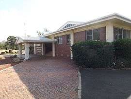 Ma Ma Creek Community Centre, 2014 | |||||||||||||||
| Population | 403 (2011 census)[1] | ||||||||||||||
| Postcode(s) | 4347 | ||||||||||||||
| Elevation | 145 m (476 ft) | ||||||||||||||
| LGA(s) | Lockyer Valley Region | ||||||||||||||
| State electorate(s) | Lockyer | ||||||||||||||
| Federal Division(s) | Wright | ||||||||||||||
| |||||||||||||||
Ma Ma Creek is a small town in the Lockyer Valley Region, Queensland, Australia.[2] At the 2011 Australian Census the town recorded a population of 403.[1]
History
The name Ma Ma is allegedly derived from the Aboriginal mia mia meaning bark huts. However, mia mia is an Aboriginal term from Western Australia, suggesting that Ma Ma was named by European settlers.[2]
Ma Ma Creek Post Office opened on 1 May 1884 (a receiving office had been open from 1881).[3]
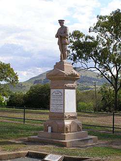
The Ma Ma Creek War Memorial commemorates three brothers: James, George and Bertie Andrews who were all killed in action in World War I. The memorial was erected in 1920 by their mother Fleurine Elsie Andrews. Although a private monument, it is used by the wider community for ANZAC Day ceremonies.[4]
Ma Ma Creek State School opened on 27 October, 1880.[5] [6] In 2016 the school catered for P - Year 6 and was a two teacher school, with multiple agegroups in each class.[7]
Heritage listings
Ma Ma Creek has a number of heritage-listed sites, including:
- Gatton-Clifton Road: Ma Ma Creek War Memorial[8]
References
- 1 2 Australian Bureau of Statistics (31 October 2012). "Ma Ma Creek (State Suburb)". 2011 Census QuickStats. Retrieved 9 August 2014.

- 1 2 "Ma Ma Creek (entry 20329)". Queensland Place Names. Queensland Government. Retrieved 13 September 2015.
- ↑ Premier Postal History. "Post Office List". Premier Postal Auctions. Retrieved 10 May 2014.
- ↑ "Ma Ma Creek War Memorial". Monument Australia. Retrieved 6 April 2014.
- ↑ "Opening and closing dates of Queensland schools (M)". education.qld.gov.au. Retrieved 2017-02-01.
- ↑ "MA MA CREEK". Queensland Times, Ipswich Herald And General Advertiser. Queensland, Australia. 30 October 1880. p. 3. Retrieved 1 February 2017 – via National Library of Australia.
- ↑ "Ma Ma Creek State School". mamacreess.eq.edu.au. Retrieved 2017-02-01.
- ↑ "Ma Ma Creek War Memorial (entry 600514)". Queensland Heritage Register. Queensland Heritage Council. Retrieved 10 July 2013.
External links
![]()
Coordinates: 27°37′43″S 152°11′25″E / 27.6287°S 152.1903°E