Groomsville, Queensland
| Groomsville Queensland | |||||||||||||||
|---|---|---|---|---|---|---|---|---|---|---|---|---|---|---|---|
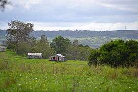 View over farmland at Groomsville looking east towards Pechey Forestry from Green Acres Road, 2015 | |||||||||||||||
 Groomsville | |||||||||||||||
| Coordinates | 27°21′S 151°57′E / 27.350°S 151.950°ECoordinates: 27°21′S 151°57′E / 27.350°S 151.950°E | ||||||||||||||
| Population | 113 (2016 census)[1] | ||||||||||||||
| Postcode(s) | 4352 | ||||||||||||||
| LGA(s) | Toowoomba Region | ||||||||||||||
| State electorate(s) | Condamine | ||||||||||||||
| Federal Division(s) | |||||||||||||||
| |||||||||||||||
Groomsville is a locality in the Toowoomba Region local government area of the Darling Downs in southern Queensland, Australia. At the 2016 Australian Census, Groomsville and surrounds recorded a population of 113.[1] The area remains undeveloped.
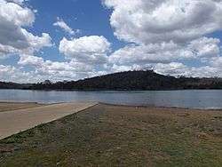
Cooby Dam, 2014
Part of the eastern and southwest boundary is marked by Cooby Creek. The creek flows into and out of Cooby Dam which occupies the southern extremities of Groomsville.
References
- 1 2 Australian Bureau of Statistics (27 June 2017). "Groomsville (State Suburb)". 2016 Census QuickStats. Retrieved 25 March 2018.

This article is issued from
Wikipedia.
The text is licensed under Creative Commons - Attribution - Sharealike.
Additional terms may apply for the media files.