Hirstglen, Queensland
| Hirstglen Queensland | |||||||||||||||
|---|---|---|---|---|---|---|---|---|---|---|---|---|---|---|---|
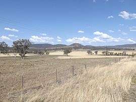 Fields along Greenmount Hirstvale Road, 2014 | |||||||||||||||
| Population | 83 (2016 census)[1] | ||||||||||||||
| Postcode(s) | 4359 | ||||||||||||||
| LGA(s) | Toowoomba Region | ||||||||||||||
| State electorate(s) | Condamine | ||||||||||||||
| Federal Division(s) | Groom | ||||||||||||||
| |||||||||||||||
Hirstglen is a locality in the Toowoomba Region local government area of the Darling Downs, Queensland, Australia. At the 2016 Australian Census Hirstglen recorded a population of 83.[1] Part of the southern boundary is marked by Kings Creek, a tributary of the Condamine River. The northern and eastern boundary roughly follows a ridge which marks the watershed of the Condamine.
References
- 1 2 Australian Bureau of Statistics (27 June 2017). "Hirstglen (State Suburb)". 2016 Census QuickStats. Retrieved 25 March 2018.

This article is issued from
Wikipedia.
The text is licensed under Creative Commons - Attribution - Sharealike.
Additional terms may apply for the media files.