Villeneuve-d'Allier
| Villeneuve-d'Allier | |
|---|---|
| Commune | |
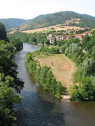 The Allier River and Villeneuve-d'Allier | |
 Villeneuve-d'Allier Location within Auvergne-Rhône-Alpes region  Villeneuve-d'Allier | |
| Coordinates: 45°11′56″N 3°23′05″E / 45.1989°N 3.3847°ECoordinates: 45°11′56″N 3°23′05″E / 45.1989°N 3.3847°E | |
| Country | France |
| Region | Auvergne-Rhône-Alpes |
| Department | Haute-Loire |
| Arrondissement | Brioude |
| Canton | Pays de Lafayette |
| Government | |
| • Mayor | Jean-Baptiste Issartel |
| Area1 | 14.31 km2 (5.53 sq mi) |
| Population (1999)2 | 306 |
| • Density | 21/km2 (55/sq mi) |
| Time zone | UTC+1 (CET) |
| • Summer (DST) | UTC+2 (CEST) |
| INSEE/Postal code | 43264 /43380 |
| Elevation |
436–902 m (1,430–2,959 ft) (avg. 456 m or 1,496 ft) |
|
1 French Land Register data, which excludes lakes, ponds, glaciers > 1 km2 (0.386 sq mi or 247 acres) and river estuaries. 2 Population without double counting: residents of multiple communes (e.g., students and military personnel) only counted once. | |
Villeneuve-d'Allier is a commune in the Haute-Loire department in south-central France.
See also
| Wikimedia Commons has media related to Villeneuve-d'Allier. |
This article is issued from
Wikipedia.
The text is licensed under Creative Commons - Attribution - Sharealike.
Additional terms may apply for the media files.