Yssingeaux
| Yssingeaux | ||
|---|---|---|
| Subprefecture and commune | ||
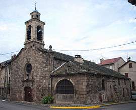 The chapel in Yssingeaux | ||
| ||
 Yssingeaux Location within Auvergne-Rhône-Alpes region  Yssingeaux | ||
| Coordinates: 45°08′37″N 4°07′28″E / 45.1436°N 4.1244°ECoordinates: 45°08′37″N 4°07′28″E / 45.1436°N 4.1244°E | ||
| Country | France | |
| Region | Auvergne-Rhône-Alpes | |
| Department | Haute-Loire | |
| Arrondissement | Yssingeaux | |
| Canton | Yssingeaux | |
| Intercommunality | Communauté de communes des Sucs | |
| Government | ||
| • Mayor (2014-2020) | Bernard Gallot | |
| Area1 | 80.57 km2 (31.11 sq mi) | |
| Population (2014)2 | 7,105 | |
| • Density | 88/km2 (230/sq mi) | |
| Time zone | UTC+1 (CET) | |
| • Summer (DST) | UTC+2 (CEST) | |
| INSEE/Postal code | 43268 /43200 | |
| Elevation |
589–1,320 m (1,932–4,331 ft) (avg. 840 m or 2,760 ft) | |
|
1 French Land Register data, which excludes lakes, ponds, glaciers > 1 km2 (0.386 sq mi or 247 acres) and river estuaries. 2 Population without double counting: residents of multiple communes (e.g., students and military personnel) only counted once. | ||

Yssingeaux (French pronunciation: [isɛ̃ʒo]; Occitan: Sinjau) is a commune and sous-préfecture in the Haute-Loire department in south-central France.
Geography
The river Lignon du Velay flows through the commune.
See also
| Wikimedia Commons has media related to Yssingeaux. |
This article is issued from
Wikipedia.
The text is licensed under Creative Commons - Attribution - Sharealike.
Additional terms may apply for the media files.