Saint-Paul-de-Tartas
| Saint-Paul-de-Tartas | |
|---|---|
| Commune | |
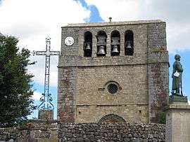 The bell tower of the church in Saint-Paul-de-Tartas | |
 Saint-Paul-de-Tartas Location within Auvergne-Rhône-Alpes region  Saint-Paul-de-Tartas | |
| Coordinates: 44°48′16″N 3°54′27″E / 44.8044°N 3.9075°ECoordinates: 44°48′16″N 3°54′27″E / 44.8044°N 3.9075°E | |
| Country | France |
| Region | Auvergne-Rhône-Alpes |
| Department | Haute-Loire |
| Arrondissement | Le Puy-en-Velay |
| Canton | Velay volcanique |
| Intercommunality | Pays de Cayres et de Pradelles |
| Government | |
| • Mayor (2008–2014) | Jean-Claude Chabalier |
| Area1 | 27.47 km2 (10.61 sq mi) |
| Population (1999)2 | 244 |
| • Density | 8.9/km2 (23/sq mi) |
| Time zone | UTC+1 (CET) |
| • Summer (DST) | UTC+2 (CEST) |
| INSEE/Postal code | 43215 /43420 |
| Elevation |
933–1,342 m (3,061–4,403 ft) (avg. 1,200 m or 3,900 ft) |
|
1 French Land Register data, which excludes lakes, ponds, glaciers > 1 km2 (0.386 sq mi or 247 acres) and river estuaries. 2 Population without double counting: residents of multiple communes (e.g., students and military personnel) only counted once. | |
Saint-Paul-de-Tartas is a commune in the Haute-Loire department in south-central France.
See also
References
| Wikimedia Commons has media related to Saint-Paul-de-Tartas. |
This article is issued from
Wikipedia.
The text is licensed under Creative Commons - Attribution - Sharealike.
Additional terms may apply for the media files.