List of secondary state highways in Virginia
  Primary and secondary State Route shields | |
| System information | |
|---|---|
| Notes | Outside cities, some towns, and two counties, every road is state-maintained. These roads are split into primary and secondary State Routes, and receive different levels of funding. Inside cities, most primary State Routes are locally maintained. |
| Highway names | |
| Interstates | Interstate X (I-X) |
| US Highways | U.S. Route X (US X) |
| State | State Route X (SR X) or Virginia Route X (VA X) |
| System links | |
This is a partial list of secondary state highways in the U.S. state of Virginia. The numbers begin with 600 and can go into five digits in populous counties such as Fairfax County. The same number can be, and often is, assigned to secondary roads in more than one county. Because of the sheer number of secondary routes, this list is not intended to be a complete list.
For information about the creation and history of Virginia's Secondary Roads System, see article Byrd Road Act.
SR 600
SR 601
SR 602
SR 603
SR 604
SR 605
SR 606
SR 607
SR 608
SR 609
SR 610
SR 611
SR 612
SR 613
SR 614
SR 615
SR 616
SR 617
SR 618
SR 619
SR 620
SR 621
SR 622
SR 623
SR 624
SR 625
SR 626
SR 627
SR 628
SR 628 (Suffolk)
State Route 628 in Suffolk was a secondary state highway. The 5.26-mile (8.47 km)[1] highway was transferred to the city on July 1, 2006, and is now simply known as Crittenden Road. Until 1947, the southwesternmost 3 miles (4.8 km) of it was primary SR 192.
SR 629
SR 630
SR 631
SR 632
SR 633
SR 634
SR 635
SR 636
SR 637
SR 638
SR 639
SR 640
SR 642
SR 642 (Lee County)
State Route 642 in Lee County extends for 8.88 miles (14.29 km)[2] in Lee County from the Powell River northeast across US 421 at Woodway to U.S. Route 58 Alternate near Dryden. The part of SR 642 east of SR 785 (old SR 66, bypassed by modern US 421) at Woodway was part of State Route 11 at the creation of the state highway system in 1918, then having various primary other numbers until it was downgraded in 1943.
SR 643
SR 643 (Fairfax County)
State Route 643 in Fairfax County is a major secondary road in the western portion of the county with a length of 10.12 miles (16.29 km). Its western terminus is SR 645 near Clifton. SR 643's eastern terminus is Fairfax County Parkway near Burke. This route is composed of four disconnected segments: Henderson Road, which runs for 6.12 miles; Old Ox Road, which runs for one block; Lee Chapel Road; and Burke Centre Parkway.
SR 643 (Tazewell County)
State Route 643 in Tazewell County is a 1.4 mile long road extending over Station Hill. Also known as Station Hill Road, it has 5 hairpin turns in its remarkably short length. The road extends from VA 624/Amonate Rd to VA 637/Dry Fork Rd.
SR 644
SR 644 (Fairfax County)
State Route 644 in Fairfax County is a secondary state highway in the southern portion of the county. It is the first main east–west road south of the Capital Beltway. It is known primarily as Old Keene Mill Road west of I-95, and Franconia Road east of I-95. Its interchange with I-95, right near the Springfield Mall, was part of the major eight-year Springfield Interchange rebuilding project that was completed in July 2007.
- Major intersections
The entire route is in Fairfax County.
| Location | mi | km | Destinations | Notes | |
|---|---|---|---|---|---|
| | Western terminus | ||||
| Five Forks | |||||
| | |||||
| Springfield | Eastbound access only via connector road | ||||
| I-395 exit 1B; westbound access via Commerce/Loisdale/Frontier exit | |||||
| I-95 exit 169B; westbound access via Commerce/Loisdale/Frontier exit | |||||
| Commerce Street / Loisdale Road / Frontier Drive – Mall | Interchange | ||||
| | |||||
| Huntington | Eastern terminus | ||||
| 1.000 mi = 1.609 km; 1.000 km = 0.621 mi | |||||
SR 645
SR 645 (Fairfax County)
SR 645 (Highland County)
State Route 645 in Highland County is a .29-mile (0.47 km) long secondary state highway in the village of McDowell. The road intersects U.S. Route 250 at its western terminus, travels .2 miles (0.32 km) to State Route 654, which it crosses, and continues for an additional .09 miles (0.14 km) to its eastern terminus with U.S. 250.[3] The section of SR 645 between its eastern terminus and SR 654 contains the Crab Run Lane Truss Bridge listed on the National Register of Historic Places. The bridge was closed in 1994 to vehicular traffic due to a lack of structural integrity.[4]
SR 650
SR 650 (Fairfax County)
State Route 650 in Fairfax County is a secondary state highway. Also known as Gallows Road and Annandale Road, it runs in a general north-south direction through the communities of Annandale and Merrifield. Its northern terminus is near Tysons Corner Center.
SR 652
SR 652 (Botetourt County)
State Route 652 in Botetourt County, also known as Mountain Pass Road, extends 6.6 miles (10.6 km) from US 11 in Troutville east to US 460 in Blue Ridge in Botetourt County.
SR 655
SR 655 (Fairfax County)
State Route 655 in Fairfax County is a secondary state highway running generally southwest to northeast from the City of Fairfax to near the Town of Vienna. Known as Jermantown Road, the road intersects with U.S. Route 50 and State Route 123 (Chain Bridge Road) in Fairfax County. Jermantown Road crosses over Interstate 66 via an overpass, although no entrance or exit to the road is available from that highway. Called Shirley Gate Rd between US 29 N (Lee Highway) and State Route 620 (Braddock Rd.)
SR 657
SR 657 (Fairfax County)
SR 659
SR 659 (Loudoun and Prince William Counties)
SR 664
SR 667
SR 667 (Wythe County)
State Route 667 in Wythe County runs 7.1 miles (11.4 km)[5] along Old Stage Road, a former main road in the corridor of present U.S. Route 11 between northeast of Rural Retreat and Wytheville. The part of SR 667 east of SR 654 (Berea Road) at the Wytheville National Fish Hatchery was primary State Route 114 until 1938.
SR 670
SR 670 (Madison County)
State Route 670 in Madison County is a secondary state highway. Also known as Old Blue Ridge Turnpike, it serves the communities of Criglersville and Syria. Its eastern terminus is an intersection with Virginia State Route 231, near Banco.[6]
SR 674 (Prince William County)
| |
|---|---|
| Location | Prince William County |
| Length | 6.08 mi[7] (9.78 km) |
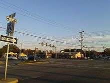
State Route 674 in Prince William County is a secondary state highway which traverses the western portion of the county. SR 674 is known by only one name, Wellington Road. It begins as a four-lane road at an intersection with Linton Hall Road SR. 619 in Gainesville. As it travels east it intersects University Boulevard, which goes over I-66 and intersects with US 29 east of the Gainesville I-66 interchange. Later, there is an intersection with SR 621, Balls Ford Road and Devlin Road in Bristow. If one follows Balls Ford Road one will end up in Manassas, whereas if one follows Devlin Road one will end up in residential portions of Bristow. After this intersection SR 674 gradually reduces to two lanes. The next major intersection is Sudley Manor Drive. To the east this road connects with SR 234 Business in Manassas. To the west it passes through the Victory Lakes subdivision before it intersects with Linton Hall Road. Almost immediately after SR 674 intersects with SR 234, the Prince William Parkway. As SR 674 continues it passes by Rixlew Lane, off of which is located the Manassas Mall. After this, it intersects with Godwin Drive at the Manassas City limits. Godwin Drive north intersects with SR 234 Business, Sudley Road, and south intersects with SR 28 and SR 234. The route continues as Wellington Road in Manassas.
Originally, SR 674 started at an intersection with US 29. As of 2007, the section between US 29 and just past Limestone Drive has been cut, the road renamed to Wellington Branch Road, and the route designation changed to SR 874.[8] Also, with progress being made in the VDOT Gainesville Interchange project, Wellington Branch Road no longer intersects with US 29, and has been cut before the intervening railroad track. The only way to access Wellington Branch Road is by turning on Limestone Drive.
The entire route is in Prince William County.
| Location | mi[7] | km | Destinations | Notes | |
|---|---|---|---|---|---|
| Gainesville | 0.00 | 0.00 | Limestone Drive | Wellington Drive continues to SR 619 | |
| Bristow | 2.02 | 3.25 | |||
| | 4.26 | 6.86 | |||
| | 5.93 | 9.54 | |||
| Manassas | 6.08 | 9.78 | Continues as Wellington Road | ||
| 1.000 mi = 1.609 km; 1.000 km = 0.621 mi | |||||
SR 681
SR 681 (James City County)
State Route 681 in James City County is a secondary state highway. Also known as Sandy Bay Road, it is a very short road, running from Ironbound Road (SR 615) to a dead end south of SR 31. The portion north of SR 31 serves as a bypass for a residential segment of SR 615.
SR 700 (Washington County)
State Route 700 in Washington County runs 31.06 miles (49.99 km)[9] in a general northeasterly direction from U.S. Route 58/U.S. Route 421 west of Bristol to State Route 645 near its junction with State Route 91 in Saltville. The southwesternmost 5.15 miles (8.29 km), ending just northeast of Benhams, was primary State Route 77 until 1942.
SR 703 (Northampton County)
State Route 703 in Northampton County is a secondary state highway. Also known as Butler's Bluff Drive, it begins at Kiptopeke Drive and loops around to Arlington Road.
SR 704 (Northampton County)
State Route 704 in Northampton County is a secondary state highway. Also known as Kiptopeke Drive, it begins at the Lankford Highway in Kiptopeke and continues into Kiptopeke State Park.
SR 711 (Chesterfield and Powhatan Counties)
State Route 711 in Chesterfield and Powhatan Counties is a secondary state highway which runs from State Route 147 west to U.S. Route 522. It was primary State Route 44 until 1952.
SR 712 (Brunswick County)
State Route 712 in Brunswick County is an old alignment of the present US 1 corridor, bypassed in 1925. It runs 12.62 miles (20.31 km)[10] from State Route 606, just south of U.S. Route 58 at Edgerton, north to US 1 at the Nottoway River. Until 1949, it was primary State Route 140.
SR 734 (Loudoun County)
SR 738 (Caroline, Hanover, and Spotsylvania Counties)
State Route 738 in Caroline, Hanover and Spotsylvania Counties, Virginia is a 38.38-mile (61.77 km)[11][12][13] secondary state highway between Richmond and Fredericksburg. It begins at State Route 646 northwest of Hanover, heading north and west to cross U.S. Route 1 at Gum Tree. From there it heads gradually west and north, mostly along an old alignment of State Route 1 (now US 1), through Coatesville, Chilesburg, and Partlow. SR 738 ends at an intersection with State Route 208 and State Route 606 at Snell; SR 208 continues northeasterly via Spotsylvania to US 1 south of Fredericksburg.
SR 738 (Fairfax County)
State Route 738 in Fairfax County is a two-lane secondary state highway beginning in McLean,VA at the intersection of SR-123/SR-309, heads northwest, intersecting with SR-193, and ends at the entry gate of Great Falls Park.
SR 744 (Lee County)
State Route 744 in Lee County extends for 3.7 miles (6.0 km)[2] from U.S. Route 58 Business east of Ewing south to the Tennessee state line. Its continuation in Tennessee is an unnumbered county road in the direction of Alanthus Hill and State Route 63. SR 744 was primary SR 62 until 1942.
SR 758 (Lee County)
State Route 758 in Lee County extends for 7.3 miles (11.7 km)[2] from U.S. Route 58 west of Jonesville south to the Tennessee state line. Its continuation in Tennessee is an unnumbered county road in the direction of State Route 63 at Mulberry Gap. SR 758 was primary SR 63 until 1946.
SR 762 (Smyth and Washington Counties)
State Route 762 in Smyth and Washington Counties runs 11.85 miles (19.07 km)[9][14] from State Route 91 at Lodi east to State Route 600 and State Route 660 at St. Clair Bottom and then north to Interstate 81 and State Route 107 in Chilhowie. Except for a realignment at St. Clair Bottom, SR 762 was primary State Route 79 until 1953. (The part west of St. Clair Bottom had been a primary state highway since 1924.)
SR 772 (Loudoun County)
SR 803 (Accomack County)
State Route 803 in Accomack County, also known as Causeway Road and Wallops Island Road, is a road that connects SR 679 (Atlantic Road) in Assawoman to the Wallops Island Flight Facility on Wallops Island.
SR 805 (Grayson County)
State Route 805 in Grayson County runs for 10.1 miles (16.3 km)[15] from US 21 south of Dry Run Gap to SR 94 at Providence. SR 805 was primary State Route 95 until 1953.
SR 5000 (James City County)
State Route 5000 in James City County is a secondary state highway. Known as Monticello Avenue, it runs for 3.7 miles (6.0 km) from VA 5 southwest of Williamsburg, Virginia to the junction of State Route 321, State Route 615, and State Route 613.[16]
See also

References
- ↑ "2005 Virginia Department of Transportation Jurisdiction Report – Daily Traffic Volume Estimates: Nansemond Maintenance Area" (PDF). (501 KiB)
- 1 2 3 "2005 Virginia Department of Transportation Jurisdiction Report – Daily Traffic Volume Estimates: Lee County" (PDF). (230 KiB)
- ↑ "Virginia Department of Transportation Jurisdiction Report – Daily Traffic Volume Estimates: Highland County" (PDF). VDOT. 2010.
- ↑ Karen Brandt (April 2009). "National Register of Historic Places Inventory/Nomination: Crab Run Lane Truss Bridge" (PDF). Virginia Department of Historic Resources.
- ↑ "2005 Virginia Department of Transportation Jurisdiction Report – Daily Traffic Volume Estimates: Wythe County" (PDF). (97.8 KiB)
- ↑ "Virginia 231 & Virginia Secondary 670". AARoads.com. Retrieved January 28, 2013.
- 1 2 VA DOT Daily Traffic Volume Estimates (Prince William) 2008 Retrieved September 27, 2009. Includes certain roads in the City of Manassas.
- ↑ VA DOT Daily Traffic Volume Estimates (Prince William) 2007 Retrieved September 28, 2009. Includes certain roads in the City of Manassas.
- 1 2 "2005 Virginia Department of Transportation Jurisdiction Report – Daily Traffic Volume Estimates: Washington County" (PDF). (356 KiB)
- ↑ "2005 Virginia Department of Transportation Jurisdiction Report – Daily Traffic Volume Estimates: Brunswick County" (PDF). (173 KiB)
- ↑ "2005 Virginia Department of Transportation Jurisdiction Report – Daily Traffic Volume Estimates: Hanover County" (PDF). (679 KiB)
- ↑ "2005 Virginia Department of Transportation Jurisdiction Report – Daily Traffic Volume Estimates: Caroline County" (PDF). (178 KiB)
- ↑ "2005 Virginia Department of Transportation Jurisdiction Report – Daily Traffic Volume Estimates: Spotsylvania County" (PDF). (588 KiB)
- ↑ "2005 Virginia Department of Transportation Jurisdiction Report – Daily Traffic Volume Estimates: Smyth County" (PDF). (201 KiB)
- ↑ "2005 Virginia Department of Transportation Jurisdiction Report – Daily Traffic Volume Estimates: Grayson County" (PDF). (229 KiB)
- ↑ "Google Maps". Google Maps. Retrieved 10 April 2018.