Evington, Virginia
| Evington, Virginia | |
|---|---|
| Unincorporated community | |
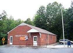 Post office in Evington | |
 Evington  Evington | |
| Coordinates: 37°14′02″N 79°17′22″W / 37.23389°N 79.28944°WCoordinates: 37°14′02″N 79°17′22″W / 37.23389°N 79.28944°W | |
| Country | United States |
| State | Virginia |
| County | Campbell |
| Elevation | 696 ft (212 m) |
| Time zone | UTC-5 (Eastern (EST)) |
| • Summer (DST) | UTC-4 (EDT) |
| ZIP code | 24550 |
| Area code(s) | 434 |
| GNIS feature ID | 1495519[1] |
Evington is an unincorporated community in Campbell County, Virginia, United States. Evington is located along Virginia State Route 24, west of U.S. Highway 29, southwest of Lynchburg.
Caryswood was listed on the National Register of Historic Places in 2010.[2]
Adjacent counties
- west-Bedford County, Virginia
- northeast-Lynchburg, Virginia
Climate
The climate in this area is characterized by hot, humid summers and generally mild to cool winters. According to the Köppen Climate Classification system, Evington has a humid subtropical climate, abbreviated "Cfa" on climate maps.[3]
See also
References
External links
| Wikimedia Commons has media related to Evington, Virginia. |
Municipalities and communities of Campbell County, Virginia, United States | ||
|---|---|---|
| Towns |  | |
| CDPs | ||
| Unincorporated communities | ||
| Footnotes | ‡This populated place also has portions in an adjacent county or counties | |
This article is issued from
Wikipedia.
The text is licensed under Creative Commons - Attribution - Sharealike.
Additional terms may apply for the media files.