Ruckersville, Virginia
| Ruckersville, Virginia | |
|---|---|
| Census-designated place | |
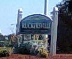 Ruckersville sign | |
 Ruckersville  Ruckersville | |
| Coordinates: 38°13′59″N 78°22′09″W / 38.23306°N 78.36917°W | |
| Country | United States |
| State | Virginia |
| County | Greene |
| Founded | 1732 |
| Area | |
| • Total | 2.78 sq mi (7.19 km2) |
| • Land | 2.75 sq mi (7.13 km2) |
| • Water | 0.02 sq mi (0.06 km2) |
| Elevation | 594 ft (181 m) |
| Population (2010) | |
| • Total | 1,141 |
| • Density | 415/sq mi (160.1/km2) |
| Time zone | UTC-5 (EST) |
| • Summer (DST) | UTC-4 (EDT) |
| ZIP code | 22968 |
| Area code(s) | 434 |
| FIPS code | 51-69360[1] |
| GNIS feature ID | 1498463[2] |
Ruckersville is a census-designated place (CDP) in Greene County, Virginia, United States, located in a rural area north of Charlottesville. The population as of the 2010 census was 1,141.[1] The community lies amidst hills, mountain views, trees, and farmland. It is located at the intersection of two major highways, north–south U.S. Route 29 and east–west U.S. Route 33. It was founded by the same family that established Ruckersville, Georgia.[3]
Geography
Ruckersville is located in southeastern Greene County. Via US 29, it is 17 miles (27 km) north of Charlottesville and 29 miles (47 km) southwest of Culpeper. Washington, D.C. is 100 miles (160 km) to the northeast via US 29. US 33 leads southeast from Ruckersville 13 miles (21 km) to Gordonsville and northwest over the Blue Ridge Mountains 38 miles (61 km) to Harrisonburg. Richmond is 80 miles (130 km) to the southeast via US 33.
According to the U.S. Census Bureau, the Ruckersville CDP has a total area of 2.8 square miles (7.2 km2), of which 0.02 square miles (0.06 km2), or 0.79%, are water.[1]
Media
Ruckersville has one media outlet, ESPN 840, a sports talk radio station. Although the station's tower location is in Earlysville, and the mailing address is Quinque, the station still considers itself a Ruckersville station.
Demographics
As of the census of 2010, there were 1,141 people, 461 households, and 316 families residing in the CDP. The population density was 414.9 people per square mile (160.1/km²). There were 512 housing units at an average density of 186.2 per square mile (71.8/km²). The racial makeup of the town was 85.5% White, 6.9% African American, 0.6% Native American, 1.1% Asian, 2.7% some other race, and 3.2% from two or more races. Hispanic or Latino of any race were 6.1% of the population.[4]
There were 461 households in the CDP, out of which 30.6% had children under the age of 18 living with them, 52.5% were headed by married couples living together, 10.8% had a female householder with no husband present, and 31.5% were non-families. 26.5% of all households were made up of individuals, and 8.2% were someone living alone who was 65 years of age or older. The average household size was 2.48, and the average family size was 2.93.[4]
In the CDP, 23.0% of the population were under the age of 18, 7.1% were from age 18 to 24, 22.8% were from 25 to 44, 28.6% were from 45 to 64, and 18.5% were 65 years of age or older. The median age was 43.5 years. For every 100 females there were 96.0 males. For every 100 females age 18 and over, there were 94.0 males.[4]
For the period 2011–15, the estimated median annual income for a household in the CDP was $53,962, and the median income for a family was $68,043. The per capita income for the CDP was $24,082.[5]
Ruckersville Parkway
In 2005, a pair of veterans of the local political scene proposed a road that would connect Ruckersville to Charlottesville, a sort of unofficial, mid-speed bypass of the crowded streets of Charlottesville. However, objections from residents and planners quashed the proposal, which had been dubbed the "Ruckersville Parkway".[6]
Notable residents
- NASCAR autoracer Philip Morris was born in Ruckersville.
References
- 1 2 3 "Geographic Identifiers: 2010 Demographic Profile Data (G001): Ruckersville CDP, Virginia". U.S. Census Bureau, American Factfinder. Retrieved March 29, 2017.
- ↑ "US Board on Geographic Names". United States Geological Survey. 2007-10-25. Retrieved 2008-01-31.
- ↑ Knight, Lucian Lamar (1917-01-01). A Standard History of Georgia and Georgians. Lewis Publishing Company.
- 1 2 3 "Profile of General Population and Housing Characteristics: 2010 Census Summary File 1 (DP-1): Ruckersville CDP, Virginia". American Factfinder. U.S. Census Bureau. Retrieved March 29, 2017.
- ↑ "Selected Economic Characteristics: 2011-2015 American Community Survey 5-Year Estimates (DP03)". American Factfinder. U.S. Census Bureau. Retrieved March 29, 2017.
- ↑ Provence, Lisa (2007-11-08). "DOA? Who killed the Ruckersville Parkway?". The Hook. Charlottesville. Retrieved 2008-02-27.
Municipalities and communities of Greene County, Virginia, United States | ||
|---|---|---|
| Town | 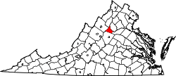 | |
| CDPs | ||
| Unincorporated communities | ||
Coordinates: 38°13′59″N 78°22′09″W / 38.23306°N 78.36917°W