Special routes of U.S. Route 1
| |
|---|---|
| Highway system | |

Several special routes of U.S. Route 1 exist, from Florida to Maine. In order from south to north, separated by type, these special routes are as follows.
- This transport-related list is incomplete; you can help by expanding it.
Alternate routes
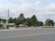
Jacksonville alternate route
| |
|---|---|
| Location | Jacksonville, Florida |
| Length | 7.563 mi[1] (12.171 km) |
U.S. Highway 1 Alternate is a alternate U.S. Route in Jacksonville, Florida, United States. It bypasses downtown to the east via the Hart Bridge, running mostly on freeways.
Like all AASHTO designated highways in Florida, US 1 Alternate always carries a FDOT designated state road number, be it signed or unsigned:
- State Road 126 from Philips Highway (US 1 / SR 5) to the south end of the Hart Expressway
- State Road 228A from the end of the Hart Expressway to the junction with the Commodore Point Expressway (SR 228 east)
- State Road 228 from the north end of the Hart Expressway to the Downtown Jacksonville exit (SR 228 west) via the Hart Bridge
- State Road 115A from the Downtown Jacksonville exit to the junction with the Martin Luther King Jr. Parkway (SR 115 south)
- State Road 115 from the junction with the Martin Luther King Jr. Parkway to the route's northern terminus at US 1/US 17 (SR 5/SR 15/SR 115 north)
- Exit list
The entire route is in Jacksonville, Duval County.
| mi[1] | km | Destinations | Notes | ||||
|---|---|---|---|---|---|---|---|
| 0.000 | 0.000 | ||||||
| 0.32 | 0.51 | I-95 exit 347 | |||||
| 1.289 | 2.074 | north end of SR 126 overlap; south end of SR 228A overlap and of freeway | |||||
| 1.49 | 2.40 | ||||||
| 2.219 | 3.571 | southbound exit and northbound entrance; north end of SR 228A overlap; south end of SR 228 overlap | |||||
| 2.53 | 4.07 | ||||||
| 2.781– 3.517 | 4.476– 5.660 | Hart Bridge over St. Johns River | |||||
| 3.626 | 5.835 | Downtown Jacksonville (SR 228 west) | northbound exit and southbound entrance; north end of SR 228 overlap; south end of SR 115A overlap | ||||
| 4.0 | 6.4 | Sports Complex (Duval Street) | |||||
| 4.59 | 7.39 | southbound exit and northbound entrance; north end of SR 115A overlap; south end of SR 115 overlap | |||||
| see MLK Parkway (mile 0.34-3.08) | |||||||
| 7.563 | 12.171 | ||||||
| 1.000 mi = 1.609 km; 1.000 km = 0.621 mi | |||||||
Alma alternate route
| |
|---|---|
| Location | Alma, Georgia |
| Length | 1.613 mi[2] (2.596 km) |
| Existed | 1980[3][4]–present |
State Route 4 Alternate (SR 4 Alt.) is a 1.613-mile-long (2.596 km) alternate route of SR 4 in Alma that travels south-to-north through the western part of the city, crossing SR 32, while the main route of US 1/US 23/SR 4 heads through the heart of downtown, past the Alma campus of Okefenokee Technical College. It is the only current special route of SR 4 that is not concurrent with a special route of US 1.
In the mid-1940s, SR 4 Spur was established on this same highway, but only on the part north of SR 32.[5][6] In 1976, SR 4 Spur was extended to the southern terminus.[7][8] In 1980, it was redesignated as SR 4 Alt.[3][4]
The entire route is in Alma, Bacon County.
| mi[2] | km | Destinations | Notes | ||
|---|---|---|---|---|---|
| 0.000 | 0.000 | Southern terminus of SR 4 Alt. | |||
| 0.587 | 0.945 | ||||
| 1.613 | 2.596 | Northern terminus of SR 4 Alt. | |||
| 1.000 mi = 1.609 km; 1.000 km = 0.621 mi | |||||
Washington alternate route
| |
|---|---|
| Location | Washington, DC–Hyattsville, MD |
| Length | 6.8 mi[9][10] (10.9 km) |
U.S. Route 1 Alternate is a alternate route forming a loop off U.S. Route 1 between Washington, D.C., and Hyattsville, Maryland.
_at_Maryland_State_Route_208_(38th_Street)_in_Colmar_Manor%2C_Prince_Georges_County%2C_Maryland.jpg)
Route description
In the District of Columbia, U.S. 1 Alternate splits from U.S. 1 at New York Avenue, following U.S. Route 50 east. U.S. 1 Alternate then turns on to Bladensburg Road, which it travels into Prince George's County, Maryland. After passing through Colmar Manor and Cottage City, the road enters Bladensburg and turns onto Baltimore Avenue toward Hyattsville, where it rejoins U.S. 1 at Rhode Island Avenue.
_at_U.S._Route_1_Alternate_(Bladensburg_Road_NE)_in_Washington%2C_D.C..jpg)
History
In the 1940s, this route was known as Bypass US 1, and was cosigned with U.S. Route 50 Alternate and Maryland Route 411.
Baltimore alternate route
| |
|---|---|
| Location | Arbutus–Baltimore, Maryland |
| Length | 3.92 mi[11][12] (6.31 km) |
U.S. Route 1 Alternate is a 3.92-mile-long (6.31 km) long alternate route forming a loop off US 1 between Arbutus and Baltimore, Maryland. US 1 Alternate serves the southwestern Baltimore County community of Halethorpe and connects US 1 with full-access interchanges with Interstate 95 and I-695.
Business loops
St. Augustine business loop
| |
|---|---|
| Location | St. Augustine, Florida |
| Length | 3.243 mi[1] (5.219 km) |
| Existed | ~1959–present |
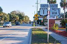
U.S. Route 1 Business in St. Augustine is a business route of U.S. Route 1. From its southern terminus at US 1 to the intersection with SR 16 it carries the hidden FDOT designation of State Road 5A. The segment from SR 16 to the northern terminus at US 1 is maintained by the City of St. Augustine, and is the only AASHTO defined road in Florida that is not under state maintenance.
US 1 Business begins at the intersection of U.S. Route 1 and King Street (County Road 214). US 1 Business travels east on King Street, with a short water crossing two blocks east of US 1. The route continues, passing the southern end of Flagler College, and then becoming a one way pair for four blocks, with King Street taking eastbound traffic and Cathedral Place, one block north, taking westbound traffic. At the intersection with State Road A1A just west of the Bridge of Lions towards Anastasia Island, US 1 Business heads north as a two way road, starting a concurrency with SR A1A, now known as North Ocean Boulevard, going through the heart of St. Augustine. At West Castillo Drive, the name changes to San Marco Avenue. At May Street, SR A1A heads east, splitting off from US 1 Business. A bit further north, it intersects with the eastern terminus of State Road 16 at Picolata Road. Six blocks to the north, US 1 Business terminates at US 1.
The entire route is in St. Augustine, St. Johns County.
| mi[1] | km | Destinations | Notes | ||
|---|---|---|---|---|---|
| 0.000 | 0.000 | south end of SR 5A and concurrency | |||
| 0.873 | 1.405 | south end of SR A1A overlap | |||
| 2.159 | 3.475 | ||||
| 2.191 | 3.526 | north end of SR A1A overlap | |||
| 2.737 | 4.405 | north end of SR 5A and concurrency; north end of state maintenance | |||
| 3.243[13] | 5.219 | ||||
1.000 mi = 1.609 km; 1.000 km = 0.621 mi
| |||||
Waycross business loop
| |
|---|---|
| Location | Waycross, Georgia |
| Length | 9.622 mi[2] (15.485 km) |
| Existed | 1996[14][15]–present |
U.S. Route 1 Business (US 1 Bus.) is a 9.622-mile-long (15.485 km) business route of US 1 partially in the city limits of Waycross. It is concurrent with US 23 Bus. and SR 4 Bus. for its entire length.
US 1 Bus./US 23 Bus./SR 4 Bus. travels northwest into the heart of Waycross, while the main route of US 1/US 23/SR 4 heads west across the southern portion of the city. US 1 Bus./US 23 Bus./SR 4 Bus. begins at an intersection with the US 1/US 23/SR 4 mainline (which also use the Memorial Drive name), as well as US 82/SR 520 (Brunswick Highway) in the southwestern part of the city. They travel to the west-northwest on Memorial Drive and cross over the city drainage canal before an intersection with US 84/SR 38 (Plant Avenue Extension). The three highways turn northeast and travel concurrent with US 84/SR 38 for approximately 1,000 feet (300 m). US 1 Bus./US 23 Bus./SR 4 Bus. then turns to the northwest, onto Ossie Davis Parkway. They curve to the north-northwest and pass Wacona Elementary School. They cross over Kettle Creek and curve to the northwest. They pass the Waycross–Ware County Airport, the Ware State Prison, and Ware County Jail. They continue to the northwest and then reach their northern terminus, a second intersection with the US 1/US 23/SR 4 mainline.
US 1 Bus./SR 4 Bus. was established in 1996, replacing the old mainline US 1/SR 4 through Waycross, via Memorial Drive, Plant Avenue, State Street, and Alma Highway.[14][15]
The entire route is in Ware County.
| Location | mi[2] | km | Destinations | Notes | |
|---|---|---|---|---|---|
| Waycross | 0.000 | 0.000 | Southern terminus of US 1 Bus./US 23 Bus./SR 4 Bus.; southern end of US 23 Bus./SR 4 Bus. concurrency | ||
| 1.212 | 1.951 | Southern end of US 84/SR 38 concurrency | |||
| 1.399 | 2.251 | Northern end of US 84/SR 38 concurrency | |||
| | 9.622 | 15.485 | Northern terminus of US 1 Bus./US 23 Bus./SR 4 Bus.; northern end of US 23 Bus./SR 4 Bus. concurrency | ||
1.000 mi = 1.609 km; 1.000 km = 0.621 mi
| |||||
Swainsboro business loop
| |
|---|---|
| Location | Swainsboro, Georgia |
| Length | 7.876 mi[2] (12.675 km) |
| Existed | 2004[16][17]–present |
U.S. Route 1 Business (US 1 Bus.) is a 7.876-mile-long (12.675 km) business route of US 1 that is partially within the city limits of Swainsboro. It is concurrent with SR 4 Bus. for its entire length. US 1 Bus./SR 4 Bus. begins at an intersection with US 1/SR 4/SR 57 (South Main Street) south of Swainsboro. It travels to the north-northeast and immediately curves to the north-northwest. Just before an intersection with both the eastern terminus of Mixon Road and the western terminus of Quick Road, the highway curves back to the north-northeast. Just after entering the city, it passes Swainsboro High School. After beginning to curve to the northwest, it skirts along the northeastern edge of Harmon Park. In downtown is an intersection with US 80/SR 26/SR 56 (Main Street). US 1 Bus./SR 4 Bus. continue to the northwest and leave the city limits of Swainsboro. It curves to the west-northwest just before reaching the northern terminus of both highways, another intersection with the US 1/SR 4 mainline.
In 2003, a western bypass of Swainsboro was proposed.[18][16] The next year, US 1/SR 4 were shifted onto this bypass. Their former path through the city was redesignated as US 1 Bus./SR 4 Bus.[16][17]
The entire route is in Emanuel County.
| Location | mi[2] | km | Destinations | Notes | |
|---|---|---|---|---|---|
| | 0.000 | 0.000 | Southern terminus of US 1 Bus./SR 4 Bus. | ||
| Swainsboro | 4.204 | 6.766 | |||
| | 7.876 | 12.675 | Northern terminus of US 1 Bus./SR 4 Bus. | ||
| 1.000 mi = 1.609 km; 1.000 km = 0.621 mi | |||||
Wadley business loop
| |
|---|---|
| Location | Wadley, Georgia |
| Length | 3.645 mi[2] (5.866 km) |
| Existed | 1966 (SR 4 Bus.);[19][20] 1967 (US 1 Bus.)[20][21]–present |
U.S. Route 1 Business (US 1 Bus.) is a 3.645-mile-long (5.866 km) business route of US 1 that is mostly within the city limits of Wadley. It is concurrent with SR 4 Bus. for its entire length. It travels north through the heart of downtown, crossing US 319/SR 78, while the main route of US 1/SR 4 heads through the east part of the city.
In 1966, SR 4 Bus. was established from US 1/SR 4 south-southeast of Wadley to US 1/SR 4 north of it.[19][20] The next year, US 1 Bus. was established on the route of SR 4 Bus.[20][21]
The entire route is in Jefferson County.
| Location | mi[2] | km | Destinations | Notes | |
|---|---|---|---|---|---|
| | 0.000 | 0.000 | Southern terminus of US 1 Bus./SR 4 Bus. | ||
| Wadley | 1.866 | 3.003 | |||
| | 3.645 | 5.866 | Northern terminus of US 1 Bus./SR 4 Bus. | ||
| 1.000 mi = 1.609 km; 1.000 km = 0.621 mi | |||||
Louisville business loop
| |
|---|---|
| Location | Louisville, Georgia |
| Length | 2.900 mi[2] (4.667 km) |
| Existed | 1966 (SR 4 Bus.);[19][20] 1967 (US 1 Bus.)[20][21]–present |
U.S. Route 1 Business (US 1 Bus.) is a 2.900-mile-long (4.667 km) business route of US 1 completely within the city limits of Louisville. It is concurrent with SR 4 Bus. for its entire length. US 1 Bus./SR 4 Bus. begins at an intersection with the US 1/SR 4 mainline (Jefferson Davis Highway) in the southeastern part of the city. This intersection is just west of the Louisville Municipal Airport. The two highways travel to the northwest on Broad Street and cross over Savannah Branch. They pass the Louisville Public Library and then intersect US 221/SR 24 (Peachtree Street). The four highways travel concurrently to the northeast. At West 9th Street, SR 24 splits off, and then the other three highways curve to the north-northeast. They pass the Jefferson Hospital and curve back to the northeast before intersecting US 1/SR 4/SR 17 in the northern part of the city. Here, US 1 Bus. and SR 4 Bus. end, while US 221 joins the mainline concurrency.
In 1966, SR 4 through the city was shifted off of US 1. Its former path became SR 4 Bus.[19][20] The next year, US 1 was shifted off of SR 4 Bus. and onto SR 4. Its former path was redesignated as US 1 Bus.[20][21]
The entire route is in Louisville, Jefferson County.
| mi[2] | km | Destinations | Notes | ||
|---|---|---|---|---|---|
| 0.000 | 0.000 | Southern terminus of US 1 Bus./SR 4 Bus. | |||
| 1.607 | 2.586 | Western end of US 221 and SR 24 concurrencies | |||
| 1.990 | 3.203 | Eastern end of SR 24 concurrency | |||
| 2.900 | 4.667 | Northern terminus of US 1 Bus./SR 4 Bus.; northern end of US 221 concurrency | |||
| 1.000 mi = 1.609 km; 1.000 km = 0.621 mi | |||||
Vass–Cameron business loop
| |
|---|---|
| Location | Vass–Cameron, North Carolina |
| Length | 9.4 mi[22] (15.1 km) |
| Existed | June 2005–present |
U.S. Route 1 Business was established in June 2005, replacing the old mainline US 1 through downtown Vass and Cameron.[23]
Sanford business loop
| |
|---|---|
| Location | Sanford, North Carolina |
| Length | 4.8 mi[24] (7.7 km) |
| Existed | 1960–present |
U.S. Route 1 Business was established in 1960, as a renumbering of US 1A through downtown Sanford, via Carthage Street and Hawkins Avenue. Between 1976-1978, US 1 Business it was rerouted onto NC 42 back to mainline US 1.[23]
Henderson business loop
| |
|---|---|
| Location | Henderson, North Carolina |
| Length | 10.6 mi[25] (17.1 km) |
| Existed | 1960–present |
U.S. Route 1 Business was established in 1960, as a renumbering of US 1A through Gill and downtown Henderson, via Raleigh Road and Garnett Street.[23]
Fredericksburg business loop
| |
|---|---|
| Location | Fredericksburg, Virginia |
_at_Kenmore_Avenue_in_Fredericksburg%2C_Virginia.jpg)
U.S. Route 1 Business in the vicinity of Fredericksburg begins at U.S. Route 1 and the east end of Virginia State Route 208 in Spotsylvania along Lafayette Boulevard, and swerves northeast towards Downtown Fredericksburg, but not before crossing an at-grade interchange with the Blue and Gray Parkway. Curving more to the east as it passes by the Fredericksburg National Cemetery, the road runs in front of Fredericksburg (VRE station) where it joins the northbound and southbound streets carrying US BUS 17, where they overlap until US BUS 1 and Princess Anne Street end at US 1 south of the bridge over the Rappahannock River. US BUS 17 continues northward to overlap US 1 before heading toward I-95/US 17.
Bel Air business loop
| |
|---|---|
| Location | Bel Air, Maryland |
| Length | 6.90 mi[26] (11.10 km) |
U.S. Route 1 Business is a 6.90-mile (11.10 km)[26] long business route of U.S. Route 1 going through the town of Bel Air, Maryland. Before this route was put into service, U.S. Route 1 went through Bel Air. It used to end at the north end of the Bel Air Bypass. In 2000, it was extended to the north end of the Hickory Bypass when it was built. The regular U.S. Route 1 was moved to the new bypass.
Penndel business loop
| |
|---|---|
| Location | Penndel, Pennsylvania |
| Existed | 1989–present |
U.S. Route 1 Business is an 8-mile (13 km)[27] long business route of U.S. Route 1 in south eastern Pennsylvania, United States. The southern terminus of the route is at US 1 in the Bensalem Township community of Oakford, west of Penndel. The northern terminus is at US 1 north of the Falls Township community of Fallsington. US 1 Business runs along the Lincoln Highway for its entire length.
When a bypass of Penndel was completed to the north of the borough in 1989, US 1 was moved from the Lincoln Highway to the expressway, allowing US 1 Business to occupy the Lincoln Highway in its place.
Major intersections
The entire route is in Bucks County.
| Location | mi | km | Destinations | Notes | |
|---|---|---|---|---|---|
| Middletown Township | Interchange, southern terminus | ||||
| Penndel | |||||
| South end of PA 413 overlap | |||||
| Middletown Township | I-295 exit 3; formerly I-95 exit 44 | ||||
| North end of PA 413 overlap | |||||
| Falls Township | Interchange, northern terminus | ||||
1.000 mi = 1.609 km; 1.000 km = 0.621 mi
| |||||
Trenton business loop
| |
|---|---|
| Location | Trenton, New Jersey |
| Length | 2.73 mi[28] (4.39 km) |
U.S. Route 1 Business is a 2.73-mile (4.39 km) business route of US 1 northeast of Trenton, New Jersey, running from an interchange with that route in Trenton to another interchange in Lawrence Township. On the border of Trenton and Lawrence Township, US 1 Business intersects northbound US 206 at the Brunswick Circle.[28] The route is also signed through Trenton on what was once designated US 1 Alternate, which continued over the Lower Trenton Bridge to Morrisville, Pennsylvania. The Pennsylvania portion of US 1 Alternate is now State Route 2060 and the southernmost part of Pennsylvania Route 32.[29][30]
Damariscotta–Newcastle business loop
| |
|---|---|
| Location | Damariscotta–Newcastle, Maine |
| Length | 3.3 mi[31] (5.3 km) |
| Existed | 1970–present |
U.S. Route 1 Business was established in 1970, which goes through downtown Newcastle and Damariscotta, via Main Street. US-1 Business begins as an offshoot of US-1 southwest of Newcastle, and proceeds into the town, where it meets the southern terminus of State Route 215. The route then turns to the east, crossing the Damariscotta River into Damariscotta. US-1 Business intersects the northern end of State Route 129 and State Route 130, which end overlapped. The route continues east through Damariscotta, before turning northeast and merging with its parent.
Bypasses
Portsmouth-Kittery bypass
| |
|---|---|
| Location | Portsmouth, New Hampshire and Kittery, Maine |
| Existed | by 1956[32][33][34]–present |
U.S. Route 1 Bypass is a 4.3-mile (6.9 km)[35] long bypass of U.S. Route 1 in Portsmouth, New Hampshire and Kittery, Maine. Most of its north section, northeast of the Portsmouth Circle where it meets the Blue Star Turnpike and Spaulding Turnpike, is built to rudimentary freeway standards, with no cross traffic but driveway access. The southern portion is similarly constructed, although there are two four-way intersections with traffic lights just south of the circle and a third at its south end, just before intersecting with US 1.
The southern terminus is at US 1 in Portsmouth. The northern terminus is at US 1 in Kittery. Between its termini, US 1 Bypass intersects Interstate 95, U.S. Route 4, New Hampshire Route 16, and the Spaulding Turnpike in Portsmouth, as well as State Route 103 in Kittery.
The bypass crosses the Piscataqua River on the 1940 Sarah Mildred Long Bridge, a lift bridge maintained by the Maine-New Hampshire Interstate Bridge Authority.
2.748 miles (4.422 km) of the route are in New Hampshire;[36] 1.6 miles (2.6 km) are in Maine.
Truck routes
Aiken truck route
| |
|---|---|
| Location | Aiken, South Carolina |
| Length | 5.6 mi[37] (9.0 km) |
| Existed | 2000–present |
U.S. Route 1 Truck was established in 2000, requiring tractor-trailers to avoid downtown Aiken, via Robert M. Bell Parkway. It is cosigned with SC 118 and other various truck routes.
Cheraw truck route
| |
|---|---|
| Location | Cheraw, South Carolina |
| Length | 3.2 mi[38] (5.1 km) |
| Existed | 2002–present |
U.S. Route 1 Truck was established in 2002, requiring tractor-trailers to avoid downtown Cheraw, via Cash Road, 2nd Street, and Front Street. It is cosigned with US 52 Truck.
West Grove alternate truck route
| |
|---|---|
| Location | West Grove, Pennsylvania |
U.S. Route 1 Alternate Truck (US 1 Alt. Truck) is a southbound truck route around a weight-restricted bridge that carries the southbound lanes of the US 1 freeway over Guernsey Road in West Grove, Pennsylvania, on which trucks over 36 tons and combination loads over 40 tons are prohibited. The route follows PA 841, Evergreen Street, Baltimore Pike, and PA 796.[39][40]
Philadelphia alternate truck route
| |
|---|---|
| Location | Philadelphia, Pennsylvania |
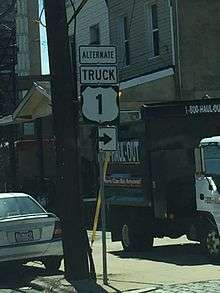
U.S. Route 1 Alternate Truck (US 1 Alt. Truck) is a truck route around a weight-restricted bridge on US 1 over SEPTA's Cynwyd Line in Philadelphia, Pennsylvania, on which trucks over 36 tons and combination loads over 40 tons are prohibited. The route follows US 30 on Lancaster Avenue and Girard Avenue, Belmont Avenue, and a one-way pair along Belmont Avenue northbound and Conshohocken Avenue southbound.[39][41]
Jersey City truck route
| |
|---|---|
| Location | Jersey City, New Jersey |
| Length | 4.11 mi[42] (6.61 km) |
| Existed | 1953–present |
U.S. Route 1/9 Truck is a 4.11-mile (6.61 km) truck route of US 1/9 in northern New Jersey between Newark and Jersey City that bypasses the Pulaski Skyway, from which trucks are banned.[42][43] The route heads east across the Passaic River into Kearny before crossing the Hackensack River into Jersey City, where the truck route turns north at the Route 440 intersection. It intersects Route 7 before turning east and ending at the Tonnele Circle with US 1/9 and Route 139.[42] Prior to 1953, US 1/9 Truck was designated as Route 25T, designating a truck bypass of Route 25, which formerly followed US 1/9 on the Pulaski Skyway.[44][45]
Former alternate routes
Former Jacksonville alternate route
| |
|---|---|
| Location | Jacksonville, Florida |
| Length | 1.3 mi (2.1 km) |
| Existed | 1958–1960 |
Not to be confused with the current U.S. Highway 1 Alternate, another U.S. Highway 1 Alternate existed as a special U.S. Route in Jacksonville, Florida between 1958 and 1960. It bypassed US 1/90 to the west via the Acosta Bridge, over the St. Johns River, and shared a brief concurrency with a former segment of former US 17 between Roosevelt Avenue and Bay Street, then ran straight north along Broad Street toward US 1/23. Today this segment is simply part of State Road 13.
Southern Pines alternate route
| |
|---|---|
| Location | Southern Pines, North Carolina |
| Existed | 1957–1962 |
U.S. Route 1 Alternate (US 1A) was established around 1957, replacing the old mainline US 1 through Southern Pines, via May Street. It was decommissioned by 1962.[46]
Sanford alternate route
| |
|---|---|
| Location | Sanford, North Carolina |
| Length | 6.5 mi[47] (10.5 km) |
| Existed | 1957–1960 |
U.S. Route 1 Alternate (US 1A) was established around 1957, replacing the old mainline US 1 through downtown Sanford, via Carthage Street and Hawkins Avenue. It was renumbered in 1960 as US 1 Business.[46]
Cary–Raleigh alternate route
| |
|---|---|
| Location | Cary–Raleigh, North Carolina |
| Existed | 1933–1935 |
U.S. Route 1 Alternate (US 1A) may have appeared in 1933 as a second route between Cary and Raleigh; it was cosigned with US 70 on Western Boulevard. Maps cease showing the route by 1936.[46]
Raleigh alternate route 1
| |
|---|---|
| Location | Raleigh, North Carolina |
| Existed | 1946–1948 |
The first U.S. Route 1 Alternate (US 1A) in Raleigh, was established in 1946 as new routing along Louisburg Road (cosigned with NC 59), then along new road (today's Capital Boulevard) back to Wake Forest Road. In 1948, US 1 and US 1A switched routes.[46]
Raleigh alternate route 2
| |
|---|---|
| Location | Raleigh, North Carolina |
| Existed | 1948–1957 |
The second U.S. Route 1 Alternate (US 1A) in Raleigh, was established in 1948 as a route switch with mainline US 1 onto Wake Forest Boulevard. It was decommissioned by 1957.[46]
Henderson alternate route
| |
|---|---|
| Location | Henderson, North Carolina |
| Length | 10.6 mi[25] (17.1 km) |
| Existed | 1957–1960 |
U.S. Route 1 Alternate (US 1A) was established around 1957, replacing the old mainline US 1 through Gill and downtown Henderson, via Raleigh Road and Garnett Street. It was renumbered in 1960 as US 1 Business.[46]
Former business loops and spurs
Florida City–Homestead business loop
| |
|---|---|
| Location | Florida City–Homestead, Florida |
| Existed | mid-1960s–1968 |
U.S. Route 1 Business was a business route of US 1 in South Dade County that was a part of US 1's original route through Florida City, Florida and Homestead, Florida. It was formed in the mid-1960s, when US 1's routing was shifted east, bypassing the central parts of the towns. It ran concurrently with State Road 997 southernmost segment. It was deleted in 1968, and much of the route is under SR 997.
Raleigh business loop
| |
|---|---|
| Location | Raleigh, North Carolina |
| Length | 7.0 mi[48] (11 km) |
| Existed | 1963–1975 |
U.S. Route 1 Business was established in 1963, replacing the old US 1 through downtown Raleigh, via Hillsborough Street, McDowell/Dawson Streets, Downtown Boulevard and North Boulevard (today's Capital Boulevard). It was decommissioned in 1975.[23]
Jersey City business spur
| |
|---|---|
| Location | Jersey City, New Jersey |
| Length | 2.77 mi[49][50] (4.46 km) |
| Existed | 1953–by 1990s |
U.S. Route 1/9 Business was a 2.77-mile (4.46 km)[49][50] long former business route of US 1/9 in Jersey City that ran between US 1/9 at the Tonnele Circle and the Holland Tunnel across the Hudson River to New York City. The route was created in 1953, replacing what had been a part of Route 25.[44][45] The business route was renumbered to Route 139 by the 1990s.[51][52]
Former bypasses
Philadelphia bypass
| |
|---|---|
| Location | Swarthmore-Philadelphia, Pennsylvania |
U.S. Route 1 Bypass (US 1 Byp.) was a bypass of a segment of US 1 from Swarthmore to Philadelphia in Pennsylvania. US 1 Byp. began at US 1 (Baltimore Pike) north of Swarthmore, heading north concurrent with PA 320. The route split from PA 320 by turning northeast onto State Road. US 1 Byp. continued northeast along Township Line Road, becoming concurrent with US 13 Byp. and intersecting PA 3 in Llanerch. The two routes continued northeast and became City Avenue, forming the border between Montgomery County to the northwest and Philadelphia to the southeast. Along City Avenue, the bypass route intersected US 30 Byp. (Haverford Road/Avenue), US 30, and PA 23 (Conshohocken State Road/Conshohocken Avenue). Upon crossing the Schuylkill River, the bypass routes intersected US 309 (Lincoln Drive) and US 422 Alt. (Ridge Avenue) and continued east along East River Drive. US 1 Byp./US 13 Byp. continued northeast along Hunting Park Avenue, intersecting US 309 Truck (Germantown Avenue) before ending at US 1/US 13/US 611 (Broad Street). US 1/US 13 continued northeast at this point on Roosevelt Boulevard.[53] US 1 Byp. was first designated by 1940 to run from Swarthmore to Northeast Philadelphia, continuing past Broad Street along Roosevelt Boulevard.[54] By 1950, the Roosevelt Boulevard became mainline US 1.[53] US 1 Byp. was decommissioned by 1960, having been replaced with mainline US 1 along State Road, Township Line Road, City Avenue, and Hunting Park Avenue.[55]
- Major intersections
| County | Location | mi | km | Destinations | Notes |
|---|---|---|---|---|---|
| Delaware | Springfield Township | Southern terminus, south end of PA 320 overlap | |||
| Northern terminus of PA 420 | |||||
| North end of PA 320 overlap | |||||
| Upper Darby | South end of US 13 Byp. overlap | ||||
| Montgomery–Philadelphia county line | Lower Merion Township–Philadelphia line | ||||
| Philadelphia | Philadelphia | Southern terminus of US 309, eastern terminus of US 422 Alt. | |||
| Southern terminus of US 309 Truck | |||||
| Northern terminus, north end of US 13 Byp. overlap | |||||
| 1.000 mi = 1.609 km; 1.000 km = 0.621 mi | |||||
Former spur routes
Alma spur route
| |
|---|---|
| Location | Alma, Georgia |
| Existed | 1946[5][6]–1980[3][4] |
State Route 4 Spur (SR 4 Spur) was a spur route of SR 4 that existed in the Alma area. It was established between the beginning of 1945 and the end of 1946, from SR 32 just west of the city to US 1/US 23/SR 4 north of it.[5][6] In 1953, a local road was established from US 1/US 23/SR 4 south of Alma to SR 4 Spur/SR 32 just west of the city.[56][57] In 1976, SR 4 Spur was extended around the southwestern and southern edges of the city.[7][8] In 1980, it was redesignated as SR 4 Alt.[3][4]
See also
References
- 1 2 3 4 FDOT straight line diagrams Archived March 6, 2014, at the Wayback Machine., accessed March 2014
- 1 2 3 4 5 6 7 8 9 10 "County GIS Base map shapefiles/geodatabases (varies by county)". Georgia Department of Transportation. Retrieved December 19, 2012.
- 1 2 3 4 Georgia Department of Transportation (1980). Official Highway and Transportation Map (PDF) (Map) (1980–1981 ed.). Scale not given. Atlanta: Georgia Department of Transportation. Retrieved April 16, 2017.
- 1 2 3 4 Georgia Department of Transportation (1981). Official Highway and Transportation Map (PDF) (Map) (1981–1982 ed.). Scale not given. Atlanta: Georgia Department of Transportation. Retrieved April 16, 2017.
- 1 2 3 State Highway Department of Georgia (January 1, 1945). System of State Roads (PDF) (Map). Scale not given. Atlanta: State Highway Department of Georgia. OCLC 5673161. Retrieved April 16, 2017.
- 1 2 3 State Highway Department of Georgia (1946). System of State Roads (PDF) (Map). Scale not given. Atlanta: State Highway Department of Georgia. OCLC 5673161. Retrieved April 16, 2017. (Corrected to November 7, 1946.)
- 1 2 Georgia Department of Transportation (January 1976). Official Highway Map (PDF) (Map) (1976–1977 ed.). Scale not given. Atlanta: Georgia Department of Transportation. Retrieved April 16, 2017.
- 1 2 Georgia Department of Transportation (January 1977). Official Highway Map (PDF) (Map) (1977–1978 ed.). Scale not given. Atlanta: Georgia Department of Transportation. Retrieved April 16, 2017.
- ↑ Google (January 2, 2014). "US 1 Alternate in the District of Columbia" (Map). Google Maps. Google. Retrieved January 2, 2014.
- ↑ Google (January 2, 2014). "US 1 Alternate in Maryland" (Map). Google Maps. Google. Retrieved January 2, 2014.
- ↑ Highway Information Services Division (December 31, 2015). Highway Location Reference. Maryland State Highway Administration. Retrieved January 6, 2017.
- Baltimore County (PDF)
- ↑ Highway Information Services Division (December 31, 2005). Highway Location Reference. Maryland State Highway Administration. Retrieved January 6, 2017.
- Baltimore City (PDF)
- ↑ FDOT GIS data, accessed January 2014
- 1 2 Georgia Department of Transportation (1996). Official Highway and Transportation Map (PDF) (Map) (1996–1997 ed.). Scale not given. Atlanta: Georgia Department of Transportation. Retrieved April 16, 2017.
- 1 2 Georgia Department of Transportation (1997). Official Highway and Transportation Map (PDF) (Map) (1997–1998 ed.). Scale not given. Atlanta: Georgia Department of Transportation. Retrieved April 16, 2017.
- 1 2 3 Georgia Department of Transportation (2004). Official Highway and Transportation Map (PDF) (Map) (2004–2005 ed.). Scale not given. Atlanta: Georgia Department of Transportation. Retrieved April 16, 2017.
- 1 2 Georgia Department of Transportation (2005). Official Highway and Transportation Map (PDF) (Map) (2005–2006 ed.). Scale not given. Atlanta: Georgia Department of Transportation. Retrieved April 16, 2017.
- ↑ Georgia Department of Transportation (2003). Official Highway and Transportation Map (PDF) (Map) (2003–2004 ed.). Scale not given. Atlanta: Georgia Department of Transportation. Retrieved April 16, 2017.
- 1 2 3 4 State Highway Department of Georgia (January 1966). Official Highway Map (PDF) (Map). Scale not given. Atlanta: State Highway Department of Georgia. Retrieved April 16, 2017.
- 1 2 3 4 5 6 7 8 State Highway Department of Georgia (January 1967). Official Highway Map (PDF) (Map). Scale not given. Atlanta: State Highway Department of Georgia. Retrieved April 16, 2017.
- 1 2 3 4 State Highway Department of Georgia (January 1968). Official Highway Map (PDF) (Map). Scale not given. Atlanta: State Highway Department of Georgia. Retrieved April 16, 2017.
- ↑ Google (March 4, 2011). "US 1 Bus - Vass-Cameron" (Map). Google Maps. Google. Retrieved March 4, 2011.
- 1 2 3 4 "NCRoads.com: U.S. 1 Business". Archived from the original on November 25, 2010. Retrieved March 4, 2011.
- ↑ Google (March 4, 2011). "US 1 Bus - Sanford" (Map). Google Maps. Google. Retrieved March 4, 2011.
- 1 2 Google (March 4, 2011). "US 1 Bus - Henderson" (Map). Google Maps. Google. Retrieved March 4, 2011.
- 1 2 Highway Information Services Division (December 31, 2014). Highway Location Reference. Maryland State Highway Administration. Retrieved March 3, 2016.
- Prince George's County (PDF)
- Baltimore County (PDF)
- Harford County (PDF)
- ↑ Pennsylvania Highways - Auxiliary Routes of US 1
- 1 2 "U.S. Route 1 Business straight line diagram" (PDF). New Jersey Department of Transportation. Retrieved January 18, 2010.
- ↑ Google (January 18, 2010). "overview map of U.S. Route 1 Business through Trenton" (Map). Google Maps. Google. Retrieved January 18, 2010.
- ↑ Map of New Jersey (Map). Cartography by H.M. Gousha. Chevron Oil Company. 1969.
- ↑ Google (March 4, 2011). "US 1 Bus - Damariscotta" (Map). Google Maps. Google. Retrieved March 4, 2011.
- ↑ 1956 Dover USGS quadrangle
- ↑ 1956 York USGS quadrangle
- ↑ Note: 1941 Dover USGS quadrangle shows US 1 on the bypass
- ↑ Mapquest Driving Directions
- ↑ GRANIT Archived August 3, 2013, at the Wayback Machine. GIS data - NH Public Roads
- ↑ Google (March 4, 2011). "US 1 Truck - Aiken" (Map). Google Maps. Google. Retrieved March 4, 2011.
- ↑ Google (March 4, 2011). "US 1 Truck - Cheraw" (Map). Google Maps. Google. Retrieved March 4, 2011.
- 1 2 "Risk-Based Bridge Postings - State and Local Bridges" (PDF). Pennsylvania Department of Transportation. October 8, 2013. Retrieved December 18, 2014.
- ↑ Google (February 10, 2016). "overview of U.S. Route 1 Alternate Truck West Grove" (Map). Google Maps. Google. Retrieved February 10, 2016.
- ↑ Google (December 18, 2014). "overview of U.S. Route 1 Alternate Truck Philadelphia" (Map). Google Maps. Google. Retrieved December 18, 2014.
- 1 2 3 "U.S. Route 1-9 Truck straight line diagram" (PDF). New Jersey Department of Transportation. Retrieved April 12, 2007.
- ↑ "Traffic Regulations: Route 1 and 9, The Pulaski Skyway". New Jersey Department of Transportation. Retrieved August 6, 2009.
- 1 2 1953 renumbering
- 1 2 "New Road Signs Ready in New Jersey". The New York Times. December 16, 1952. Archived from the original on July 21, 2011. Retrieved July 20, 2009.
- 1 2 3 4 5 6 "NCRoads.com: U.S. 1-A". Archived from the original on November 25, 2010. Retrieved March 4, 2011.
- ↑ Google (March 4, 2011). "Former US 1A - Sanford" (Map). Google Maps. Google. Retrieved March 4, 2011.
- ↑ Google (March 4, 2011). "Former US 1 Bus - Raleigh" (Map). Google Maps. Google. Retrieved March 4, 2011.
- 1 2 "Route 139 lower roadway straight line diagram" (PDF). New Jersey Department of Transportation. Retrieved September 1, 2009.
- 1 2 "Interstate 78 straight line diagram" (PDF). New Jersey Department of Transportation. Retrieved September 1, 2009.
- ↑ State Farm Road Atlas (Map). Cartography by Rand McNally. State Farm Insurance. 1983.
- ↑ United States-Canada-Mexico Road Atlas (Map). Rand McNally. 1996.
- 1 2 Official Road Map of Pennsylvania (back) (PDF) (Map). Pennsylvania Department of Highways. 1950. Retrieved January 16, 2014.
- ↑ Official Road Map of Pennsylvania (back) (PDF) (Map). Pennsylvania Department of Highways. 1940. Retrieved January 1, 2014.
- ↑ Official Map of Pennsylvania (back) (PDF) (Map). Pennsylvania Department of Highways. 1960. Retrieved January 16, 2014.
- ↑ State Highway Department of Georgia (January 1, 1953). System of State Roads (PDF) (Map). Scale not given. Atlanta: State Highway Department of Georgia. Retrieved April 16, 2017. (Corrected to January 1, 1953.)
- ↑ State Highway Department of Georgia (1953). State Highway System and Other Principal Connection Roads (PDF) (Map). Scale not given. Atlanta: State Highway Department of Georgia. OCLC 5673161. Retrieved April 16, 2017. (Corrected to September 1, 1953.)
External links
