Special routes of U.S. Route 17
| |
|---|---|
| Highway system | |

A total of at least twenty-three special routes of U.S. Route 17 have existed.
- This transport-related list is incomplete; you can help by expanding it.
Florida
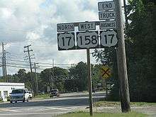
Kissimmee truck route
| |
|---|---|
| Location | Kissimmee, Florida |
US 17-92 Truck is an alternate route for US 17-92 in northern Kissimmee, Florida, following John Young Parkway and the Osceola Parkway (CR 522) instead of Vine Street (US 192) and Orange Blossom Trail. It was signed in about 2011 when the single-point urban interchange at John Young and Osceola Parkways was completed.
Until 1999, a truck bypass was signed around Downtown Kissimmee. It began where US 17-92 formerly turned from John Young Parkway onto West Emmett Street, and continued north in a straight line along John Young Parkway to US 192, where it turned east until it returned to US 17-92 at North Main Street (Orange Blossom Trail). The route existed from sometime during the 1980s until 1999, when US 17-92 itself was rerouted to bypass downtown Kissimmee.
Maitland truck route
| |
|---|---|
| Location | Winter Park-Maitland, Florida |
US 17-92 Truck is designated to divert overheight truck traffic away from a low railroad bridge that carries the SunRail rail line over US 17-92 in southern Maitland. The route follows State Road 423 (Lee Road), Interstate 4, and State Road 414 (Maitland Boulevard) in Winter Park, Florida and Maitland. It formerly used Wymore Road and Lake Avenue (CR 438A) instead of I-4 and SR 414.
Georgia
This section shows the special routes for Georgia State Route 25, the partner route for U.S. Route 17 in Georgia.
Woodbine spur route
| |
|---|---|
| Location | Woodbine, Georgia |
| Length | 2.79 mi[1] (4.49 km) |
| Existed | 1977[2][3]–present |
State Route 25 Spur (SR 25 Spur) is a 2.79-mile-long (4.49 km) spur route of SR 25 that exists almost entirely within the city limits of Woodbine. It begins at an interchange with Interstate 95 (I-95) just southeast of the city. It travels to the west-northwest, curves to the northwest, and has a gradual curve to the west-southwest. There, it meets its northern terminus, an intersection with US 17/SR 25 (Bedell Avenue).
In 1977, it was established on its current path.[2][3]
The entire route is in Camden County.
| Location | mi[1] | km | Destinations | Notes | |
|---|---|---|---|---|---|
| | 0.00 | 0.00 | Southern terminus; I-95 exit 14 | ||
| Woodbine | 2.79 | 4.49 | Northern terminus | ||
| 1.000 mi = 1.609 km; 1.000 km = 0.621 mi | |||||
Brunswick connector route
| |
|---|---|
| Location | Brunswick, Georgia |
| Length | 1.08 mi[1] (1.74 km) |
| Existed | 1965[4][5]–present |
State Route 25 Connector (SR 25 Conn.) is a 1.08-mile-long (1.74 km) connector route of SR 25 that exists entirely within the city limits of Brunswick. It begins at an intersection with US 17/SR 25 (Glynn Avenue). It travels west-southwest on Gloucester Street, concurrent with US 25. They skirt along the northern edge of Howard Coffin Park. They travel through the Old Town Brunswick Historic District At Newcastle Street, they turn right and travel to the north-northwest for one block. At F Street, they turn left and travel to the west-southwest for two blocks. At an intersection with US 341/SR 27 (Bay Street), SR 25 Conn. ends, and US 25 turns right onto US 341/SR 27.
Between June 1963 and the beginning of 1966, SR 25 Conn. was established on its current path.[4][5]
The entire route is in Brunswick, Glynn County.
| mi[1] | km | Destinations | Notes | ||
|---|---|---|---|---|---|
| 0.00 | 0.00 | Southern terminus of US 25 and SR 25 Conn.; south end of US 25 concurrency | |||
| 1.08 | 1.74 | Northern terminus; north end of US 25 concurrency | |||
1.000 mi = 1.609 km; 1.000 km = 0.621 mi
| |||||
Brunswick east spur route
| |
|---|---|
| Location | Brunswick–St. Simons Island, Georgia |
| Length | 4.13 mi[1] (6.65 km) |
| Existed | 2004[6][7]–present |
State Route 25 Spur (SR 25 Spur) is a 4.13-mile-long (6.65 km) spur route of SR 25 that exists in Brunswick and St. Simons Island. It is known as F.J. Torras Causeway for its entire length. It begins at an intersection with US 17/SR 25 (Glynn Avenue) in the eastern part of Brunswick. It travels to the east-northeast and crosses over Fancy Bluff Creek. It curves to the northeast and crosses over the Back River, leaving Brunswick. The spur crosses over the Little River and curves to the east-southeast. They cross over the Mackay River and the Intracoastal Waterway. While traveling over Lanier Island, it curves to the southeast. It crosses over the Frederica River and then enters St. Simons Island. Almost immediately, it reaches its eastern terminus, a non-circular traffic circle with Kings Way, Demere Road, and Sea Island Road.
Between September 1953 and June 1954, an unnumbered road was established on its current path.[8][9] About 50 years later, SR 25 Spur was designated on this road.[6][7]
The entire route is in Glynn County.
| Location | mi[1] | km | Destinations | Notes | |
|---|---|---|---|---|---|
| Brunswick | 0.00 | 0.00 | Western terminus | ||
| St. Simons Island | 4.13 | 6.65 | Kings Way, Demere Road, and Sea Island Road | Eastern terminus; non-circular traffic circle | |
| 1.000 mi = 1.609 km; 1.000 km = 0.621 mi | |||||
Brunswick spur route
| |
|---|---|
| Location | Brunswick, Georgia |
| Length | 7.5 mi[1] (12.1 km) |
| Existed | 1974[10][11]–present |
State Route 25 Spur (SR 25 Spur) is a 7.5-mile-long (12.1 km) spur route of SR 25 that partially exists in the northern part of Brunswick. It is known as Golden Isles Parkway for its entire length. It begins at an intersection with US 17/SR 25 (Darien Highway). There is no access from SR 25 Spur to US 17/SR 25 north. The highway travels to the north-northwest. At Altama Avenue, the spur route leaves the city limits of Brunswick. It skirts along the eastern edge of the city limits of Dock Junction for the rest of its length. It passes by the Glynn Place Mall to the mall's west. It has an interchange with Interstate 95 (I-95). Here, SR 25 Spur ends and Golden Isles Parkway continues to the north-northwest.
In 1971, SR 25 Spur was proposed on its current path.[12][13] In 1974, it was completed.[10][11]
The entire route is in Glynn County.
| Location | mi | km | Destinations | Notes | |
|---|---|---|---|---|---|
| Brunswick | No access from SR 25 Spur to US 17/SR 25 north | ||||
| Dock Junction | I-95 exit 38 | ||||
| 1.000 mi = 1.609 km; 1.000 km = 0.621 mi | |||||
Savannah connector route
| |
|---|---|
| Location | Savannah, Georgia |
| Length | 3.11 mi[1] (5.01 km) |
| Existed | 1991[14][15]–present |
State Route 25 Connector (SR 25 Conn.) is a 3.11-mile-long (5.01 km) connector route of SR 25 that exists entirely in the city limits of Savannah. It begins at a partial interchange with I-516/US 80/SR 21/SR 25/SR 26. There is no access from SR 25 Conn. to I-516 west/SR 21 north/SR 25 north/SR 26 west. US 80 west/SR 25 Conn./SR 26 west north travel northwest on Augusta Avenue. They turn right onto West Lathrop Avenue and travel to the north-northeast for one block. At Bay Street, US 80/SR 26 travels to the west-northwest, and SR 25 Conn. travels to the east-southeast. It has another partial interchange with I-516/SR 21/SR 25, with no access from SR 25 Conn. north to I-516/SR 21/SR 26 or from I-516/SR 21/SR 25 to SR 25 Conn. south. The connector route skirts along the northern edge of Bartow Park. It crosses over some railroad tracks of Norfolk Southern Railway. It travels under the Talmadge Memorial Bridge, carrying US 17/SR 404 Spur and then crosses over the Springfield Canal. At Martin Luther King, Jr. Boulevard, it turns right and travels to the south-southwest. It passes by the Ships of the Sea Maritime Museum and then turns right onto Oglethorpe Avenue. It travels to the west-northwest and passes the Chatham Area Transit bus station. At West Boundary Street, it curves to the northwest. It has a second crossing over the Springfield Canal. A short distance later, the highway has a partial interchange with US 17 north/SR 404 Spur north (Talmadge Memorial Bridge). There is no access from SR 25 Conn. to US 17/SR 404 Spur south or from US 17/SR 404 Spur north to SR 25 Conn. At this interchange, the connector reaches its northern terminus.
The 1938 GDOT map, which was the first one that had an inset map of Savannah, indicated that US 17/US 80/SR 25/SR 21/SR 26 traveled on Bay Street, from what is now Martin Luther King Jr. Boulevard to Lathrop Avenue.[16][17] In 1978, SR 21 was shifted off of Bay Street, and onto what would eventually become I-516.[2][3] In 1985, the path of US 17/US 80/SR 25/SR 26 was shifted southwestward, off of Bay Street and West Broad Street, and onto I-516/SR 21 north of the Ogeechee Road interchange. The path of US 17 Alt./SR 25 Alt. was shifted northward, off of Stiles Avenue, Gwinnett Street, and Boundary Street, and onto Bay Street, West Broad Street, York Street, and the Talmadge Memorial Bridge.[18][19] In 1988, York Street was renamed as a western extension of Oglethorpe Avenue.[20][21] In 1991, the path of US 17 Alt./SR 25 Alt. was shifted southeastward, off of Bay Street, West Broad Street, and Oglethorpe Avenue, and onto the proposed path of SR 404 Spur and the Talmadge Memorial Bridge. The former path was redesignated as SR 25 Conn.[14][15] Nearly 25 years later, West Lathrop Avenue was extended south-southwest, to Augusta Avenue. US 80 and SR 25 Conn. were extended onto both avenues to I-516/SR 21/SR 25.[22][23]
The entire route is in Savannah, Chatham County.
| mi | km | Destinations | Notes | ||
|---|---|---|---|---|---|
| Southern terminus; south end of US 80/SR 26 concurrency; no access from SR 25 Conn. to I-516 west/SR 21 north/SR 25 north/SR 26 west I-516 exit 7A | |||||
| North end of US 80/SR 26 concurrency | |||||
| No access from SR 25 Conn. north to I-516/SR 21/SR 26 or from I-516/SR 21/SR 25 to SR 25 Conn. south | |||||
| Northern terminus; no access from SR 25 Conn. to US 17/SR 404 Spur south or from US 17/SR 404 Spur north to SR 25 Conn.; interchange | |||||
1.000 mi = 1.609 km; 1.000 km = 0.621 mi
| |||||
South Carolina
South Carolina alternate route
| |
|---|---|
| Location | Near Pocotaligo to Georgetown, South Carolina |
| Length | 123.4 mi (198.6 km) |
| Existed | 1952–present |
U.S. Route 17 Alternate is an alternate route of U.S. Route 17 in South Carolina that runs between Pocotaligo and Georgetown. It is 123.4 miles (198.6 km) long and has been four-laned in various segments since 1970.
Myrtle Beach business loop
| |
|---|---|
| Location | Myrtle Beach, South Carolina |
| Length | 22.8 mi[24] (36.7 km) |
| Existed | 1967–present |
U.S. Route 17 Business, also known as Kings Highway, was established by 1967 when mainline US 17 was bypassed west of Murrells Inlet. In 1981, it was extended north to near Briarcliffe Acres, after mainline US 17 was placed on a new highway bypass route. The 22.8-mile (36.7 km) business loop connects: Murrells Inlet, Garden City, Surfside Beach, and Myrtle Beach. The road is also a major route during the Bi-Lo Marathon weekend; miles 2-6 and also 19-21 run through this highway during the marathon.
North Carolina
Shallotte business loop
| |
|---|---|
| Location | Shallotte, North Carolina |
| Length | 3.79 mi[25] (6.10 km) |
| Existed | 1991–present |
U.S. Route 17 Business (US 17 Bus) was established in 1991 after the completion of the Shallotte Bypass. The business loop is 3.8-mile (6.1 km) in length and has the street name Main Street for its entire length. The middle segment is also concurrent with NC 130, which splits from Business US 17 in the north to travel to Whiteville and splits in the south to travel to Holden Beach.[26]
The entire route is in Shallotte, Brunswick County.
| mi[25] | km | Destinations | Notes | ||
|---|---|---|---|---|---|
| 0.0 | 0.0 | ||||
| 1.7 | 2.7 | West end of NC 130 overlap | |||
| 2.8 | 4.5 | East end of NC 130 and west end of NC 130 Bus overlap | |||
| 3.1 | 5.0 | East end of NC 130 Bus overlap | |||
| 3.8 | 6.1 | ||||
1.000 mi = 1.609 km; 1.000 km = 0.621 mi
| |||||
Bolivia business loop
| |
|---|---|
| Location | Bolivia, North Carolina |
| Length | 7.5 mi[27] (12.1 km) |
| Existed | 1992–present |
U.S. Route 17 Business (US 17 Bus) was established in 1992 after the completion of the Bolivia Bypass. The business route follows the old alignment of US 17 through Bolivia, the small county seat of Brunswick County. This 7.5-mile (12.1 km) route is also called the Old Ocean Highway and passes through the center of Bolivia near its northern terminus.[28]
The entire route is in Brunswick County.
| Location | mi[27] | km | Destinations | Notes | |
|---|---|---|---|---|---|
| | 0.0 | 0.0 | Superstreet intersection, u-turn for US 17 south | ||
| | 5.8 | 9.3 | South end of NC 906 overlap | ||
| | 5.9 | 9.5 | North end of NC 906 overlap | ||
| Bolivia | 7.5 | 12.1 | |||
1.000 mi = 1.609 km; 1.000 km = 0.621 mi
| |||||
Wilmington business loop
| |
|---|---|
| Location | Wilmington, North Carolina |
| Length | 8.1 mi[29] (13.0 km) |
| Existed | 1971–present |
U.S. Route 17 Business (US 17 Bus) is a 13.0-mile (20.9 km) business route through Wilmington. US 17 Bus was established in 1971, two years after US 17 was realigned onto new routing; it traversed 1.8 miles (2.9 km) along 3rd and Market Streets, between Dawson/Wooster and 16th/17th Streets. Market Street was part of the original alignment, but goes south instead of north along 3rd Street to meetup with US 17.[30][31] In 1979, AASHTO officially recognized US 17 Bus.[32]
In 2005, AASHTO approved the US 17 Bus extension upon completion of and realignment of US 17 along the Wilmington bypass. On June 30, 2006, when the Wilmington bypass opened, US 17 Bus replaced segments of US 17: North along Market Street, between 16th/17th Streets and near Futch Creek Road, and south crossing the Cape Fear Memorial Bridge to Eagle Island.[33][34] In May 2015, AASHTO approved a request to reroute US 17 back through Wilmington, following US 76 along Oleander Drive and Military Cutoff Road; the new alignment reduces the length of existing US 17 Bus to along 3rd Street and Market Street.[35] In May 2017, US 17 Bus was officially reduced as approved by AASHTO.[36]
US 17 Bus shares brief concurrency with US 76 and US 421, while crossing over the Cape Fear River. It is also part of the Cape Fear Historic Byway, which features scenic urban areas, colonial-era streets, the USS North Carolina battleship and the city parks.
- Major intersections
The entire route is in Wilmington, New Hanover County.
| mi[29] | km | Destinations | Notes | ||
|---|---|---|---|---|---|
| 0.0 | 0.0 | ||||
| 0.8 | 1.3 | North 3rd Street | |||
| 1.8 | 2.9 | 16th Street/17th Street | |||
| 5.1 | 8.2 | To UNC Wilmington | |||
| 5.6 | 9.0 | ||||
| 8.1 | 13.0 | ||||
| 1.000 mi = 1.609 km; 1.000 km = 0.621 mi | |||||
Jacksonville business loop
| |
|---|---|
| Location | Jacksonville, North Carolina |
| Length | 4.5 mi[37] (7.2 km) |
| Existed | 2006–present |
U.S. Route 17 Business (US 17 Bus) was established in 2006 after the completion of the Jacksonville Bypass, which rerouted US 17/NC 24 south and east around Jacksonville. The old alignment along Wilmington Highway and Marine Boulevard became US 17 Bus, with a short 1.4-mile (2.3 km) overlap with NC 24 Bus.[38]
The entire route is in Jacksonville, Onslow County.
| mi[37] | km | Destinations | Notes | ||
|---|---|---|---|---|---|
| 0.0 | 0.0 | ||||
| 0.4 | 0.64 | Southbound access to US 17 northbound | |||
| 1.1 | 1.8 | West end of NC 24 Bus overlap | |||
| 2.5 | 4.0 | East end of NC 24 Bus overlap | |||
| 4.5 | 7.2 | ||||
1.000 mi = 1.609 km; 1.000 km = 0.621 mi
| |||||
New Bern business loop
| |
|---|---|
| Location | New Bern, North Carolina |
| Length | 10.5 mi[39] (16.9 km) |
| Existed | 2000–present |
U.S. Route 17 Business (US 17 Bus) was established in 2000 as a renumbering of mainline US 17 through downtown New Bern, via Martin Luther King Jr. Boulevard, Neuse Boulevard, Broad Street, and Front Street. In 2011, the business loop was extended south as mainline US 17 was placed on new freeway west of New Bern.[40][41]
| County | Location | mi[39] | km | Destinations | Notes |
|---|---|---|---|---|---|
| Jones | | 0.0 | 0.0 | ||
| Craven | New Bern | 6.7 | 10.8 | ||
| 8.0 | 12.9 | West end of NC 55 overlap | |||
| 8.4 | 13.5 | East end of NC 55 overlap | |||
| 10.5 | 16.9 | ||||
1.000 mi = 1.609 km; 1.000 km = 0.621 mi
| |||||
Vanceboro business loop
| |
|---|---|
| Location | Vanceboro, North Carolina |
| Length | 4.1 mi[42] (6.6 km) |
| Existed | 1961–present |
U.S. Route 17 Business (US 17 Bus) was established in 1961 when US 17 was rerouted, on bypass route, east of Vanceboro. US 17 Bus travels along Main Street, sharing 2.1 miles (3.4 km) of it with NC 43, since 1987.[43]
The entire route is in Vanceboro, Craven County.
| mi[42] | km | Destinations | Notes | ||
|---|---|---|---|---|---|
| 0.0 | 0.0 | South end of NC 43 overlap | |||
| 2.1 | 3.4 | North end of NC 43 overlap | |||
| 4.1 | 6.6 | ||||
1.000 mi = 1.609 km; 1.000 km = 0.621 mi
| |||||
Chocowinity–Washington business loop
| |
|---|---|
| Location | Chocowinity–Washington, NC |
| Length | 6.0 mi[44] (9.7 km) |
| Existed | 2011–present |
U.S. Route 17 Business (US 17 Bus) was established in 2011 when US 17 was rerouted, onto new freeway grade highway, bypassing east of Chocowinity and west of Washington. US 17 Bus follows the old alignment of US 17 through Chocowinity and along Bridge Street/Carolina Avenue in Washington.[45]
The entire route is in Beaufort County.
| Location | mi[44] | km | Destinations | Notes | |
|---|---|---|---|---|---|
| | 0.0 | 0.0 | Superstreet intersection, u-turn for US 17 north | ||
| Chocowinity | 0.9 | 1.4 | |||
| Washington | 4.3 | 6.9 | Southern terminus of NC 32 | ||
| 4.4 | 7.1 | ||||
| 6.0 | 9.7 | Superstreet intersection, u-turn for US 17 south | |||
| 1.000 mi = 1.609 km; 1.000 km = 0.621 mi | |||||
Williamston business loop
| |
|---|---|
| Location | Williamston, North Carolina |
| Length | 3.6 mi[46] (5.8 km) |
| Existed | 1960–present |

U.S. Route 17 Business (US 17 Bus) was established in 1960 as a renumbering of US 17A, which traversed through downtown Williamston, via Washington Street and Main Street. Between 1969-1977, US 17 Bus is split in the downtown area, northbound on Haughton Street and southbound on Elm Street. In 2003, US 17 Bus was extended 1.61 miles (2.59 km) that was formally US 17 when the new Williamston bypass was established.[47]
The entire route is in Williamston, Martin County.
| mi[46] | km | Destinations | Notes | ||
|---|---|---|---|---|---|
| 0.0 | 0.0 | ||||
| 1.6 | 2.6 | South end of NC 125 overlap | |||
| 2.6 | 4.2 | North end of NC 125 overlap | |||
| 3.6 | 5.8 | ||||
1.000 mi = 1.609 km; 1.000 km = 0.621 mi
| |||||
Windsor bypass
| |
|---|---|
| Location | Windsor, North Carolina |
| Length | 8.7 mi[48] (14.0 km) |
| Existed | 2009–present |
U.S. Route 17 Bypass (US 17 By-Pass) was established in 2009 and is 8.7 miles (14.0 km) long. Beginning at the US 13/US 17 split, located southeast of Windsor, US 17 Bypass follows the preexisting expressway grade of US 13. At exit 215, US 13 splits and continues north, while US 17 Bypass continues on freeway grade highway till it re-merges with US 17, near mile marker 221.[49]
The entire route is in Bertie County.
| Location | mi[48] | km | Exit | Destinations | Notes | |
|---|---|---|---|---|---|---|
| Windsor | 213.4 | 343.4 | South end of US 13 overlap; at-grade intersection | |||
| 214.0 | 344.4 | At-grade intersection | ||||
| 214.7 | 345.5 | 215 | North end of US 13 overlap | |||
| | 218.6 | 351.8 | 218 | Wakelon Road | ||
| | 221.2 | 356.0 | At-grade intersection | |||
1.000 mi = 1.609 km; 1.000 km = 0.621 mi
| ||||||
Edenton business loop
| |
|---|---|
| Location | Edenton, North Carolina |
| Length | 6.7 mi[50] (10.8 km) |
| Existed | 1977–present |
U.S. Route 17 Business (US 17 Bus) was established in 1977 as a renumbering of mainline US 17 through Edenton, via Queen Street and Broad Street. In 1996 it was rerouted along Virginia Road to Broad Street and removed routing through the downtown area and along Queen Street, becoming SR 1204. However, in 2012, NCDOT reversed course and reverted the business loop back to its original routing; thanks in part of not completing the formal route change package and distributing it (i.e. updating the TEAAS and road signs in the area). NC 32 shares a concurrency along Broad Street, in the downtown area.[51][52][53]
The entire route is in Chowan County.
| Location | mi[50] | km | Destinations | Notes | |
|---|---|---|---|---|---|
| | 0.0 | 0.0 | |||
| Edenton | 3.6 | 5.8 | South end of NC 32 overlap | ||
| 4.2 | 6.8 | North end of NC 32 overlap | |||
| | 6.7 | 10.8 | |||
1.000 mi = 1.609 km; 1.000 km = 0.621 mi
| |||||
Hertford–Winfall business loop
| |
|---|---|
| Location | Hertford–Winfall, NC |
| Length | 3.8 mi[54] (6.1 km) |
| Existed | 1966–present |
U.S. Route 17 Business (US 17 Bus) was established in 1966 as a renumbering of mainline US 17 through Hertford (via Edenton Road Street, Dobbs Street and Church Street) and Winfall (via Creek Drive). NC 37 shares a .9-mile (1.4 km) concurrency from Winfall Boulevard to the Business loop's northern terminus.
The entire route is in Perquimans County.
| Location | mi[54] | km | Destinations | Notes | |
|---|---|---|---|---|---|
| Hertford | 0.0 | 0.0 | |||
| Winfall | 2.9 | 4.7 | North end of NC 37 overlap | ||
| 3.8 | 6.1 | South end of NC 37 overlap | |||
1.000 mi = 1.609 km; 1.000 km = 0.621 mi
| |||||
Elizabeth City bypass
| |
|---|---|
| Location | Elizabeth City, North Carolina |
| Length | 9.3 mi[55] (15.0 km) |
| Existed | 1999–present |
U.S. Route 17 Bypass (US 17 By-Pass) was established in 2004 and is a 9.3-mile (15.0 km) controlled-access highway bypass west of Elizabeth City. Unlike typical bypasses, a separate mainline US 17 continues along original 1953 bypass route (Hughes Boulevard), while a business route goes through downtown Elizabeth City.[56]
The entire route is in Pasquotank County.
| Location | mi[55] | km | Exit | Destinations | Notes | |
|---|---|---|---|---|---|---|
| | 255.0 | 410.4 | 255 | Northbound entrance and southbound exit | ||
| | 256.1 | 412.2 | 256 | Foreman Bundy Road | Northbound entrance and southbound exit | |
| Elizabeth City | 258.2 | 415.5 | 258 | |||
| | 264.3 | 425.3 | 264 | |||
| 1.000 mi = 1.609 km; 1.000 km = 0.621 mi | ||||||
Elizabeth City business loop
| |
|---|---|
| Location | Elizabeth City, North Carolina |
| Length | 2.8 mi[57] (4.5 km) |
| Existed | 1960–present |
U.S. Route 17 Business (US 17 Bus) was established in 1960 as a renumbering of US 17A through downtown Elizabeth City, via Ehringhaus Street and Road Street. The business loop has remained unchanged since its establishment.
The entire route is in Elizabeth City, Pasquotank County.
| mi[57] | km | Destinations | Notes | ||
|---|---|---|---|---|---|
| 0.0 | 0.0 | No outlet to US 17 south | |||
| 0.4 | 0.64 | ||||
| 2.1 | 3.4 | ||||
| 2.8 | 4.5 | ||||
| 1.000 mi = 1.609 km; 1.000 km = 0.621 mi | |||||
Elizabeth City business truck route
| |
|---|---|
| Location | Elizabeth City, North Carolina |
U.S. Route 17 Business Truck is a unique truck route specifically for the US 17 Business loop in Elizabeth City. Following US 158 west from the Camden Causeway and north along (mainline) US 17 to the junction with Business US 17. The bypassed segment of US 17 Business not only has a weight limit precluding most trucks over two axles, but also passes through historic residential areas.
South Mills business loop
| |
|---|---|
| Location | South Mills, North Carolina |
| Length | 2.8 mi[58] (4.5 km) |
| Existed | 1984–present |
U.S. Route 17 Business (US 17 Bus) was established in September, 1984 as a renumbering of mainline US 17 through South Mills, via Main Street. It is the northernmost US 17 Business in North Carolina. West of South Mills, it joins with NC 343 and continues north, rejoining with US 17.[59]
The entire route is in Camden County.
| Location | mi[58] | km | Destinations | Notes | |
|---|---|---|---|---|---|
| South Mills | 0.0 | 0.0 | |||
| 1.2 | 1.9 | South end of NC 343 overlap | |||
| | 2.8 | 4.5 | North end of NC 343 overlap | ||
1.000 mi = 1.609 km; 1.000 km = 0.621 mi
| |||||
Virginia
Chesapeake business loop
| |
|---|---|
| Location | Chesapeake, Virginia |
_at_Virginia_State_Route_165_(Moses_Grandy_Trail)_in_Chesapeake%2C_Virginia.jpg)
An old alignment of US Route 17 along the Dismal Swamp Canal carries the US Route 17 Business designation north from the Dominion Boulevard intersection to Deep Creek, where US 17 Business crosses the canal on a small drawbridge, before proceeding north to rejoin US Route 17 at Interstate 64 (Exit 296).
Gloucester Courthouse business loop
| |
|---|---|
| Location | Gloucester, Virginia |
_at_Virginia_State_Route_3_and_Virginia_State_Route_14_(John_Clayton_Memorial_Highway)_in_Gloucester_Courthouse%2C_Gloucester_County%2C_Virginia.jpg)
US Route 17 Business through Gloucester Courthouse consists of a 2.5-mile (4.0 km) loop, Main Street, that travels through the historic courthouse district, intersecting State Routes 3 and 14. VA 14 multiplexes with US 17 Business on the northern leg back to US 17. Main Street is likely a former alignment of US Route 17, due to several US 17 shields on it that lack a Business banner.
Saluda business loop
| |
|---|---|
| Location | Saluda, Virginia |
_at_U.S._Route_17_(Tidewater_Trail)_in_Saluda%2C_Middlesex_County%2C_Virginia.jpg)
U.S. Route 17 Business in Saluda branches off of mainline US 17 (Tidewater Trail) to the northeast at Gloucester Road along with a concurrency with Virginia State Route 33. One block after the wye Virginia Secondary Route 618 joins the two routes from the intersection of Lovers Retreat Lane. At the intersection of General Puller Highway VA 33 turns right SSR 618 continues north onto Oakes Landing Road and BUS US 17 turns left. This segment also contains the name "School Street," and runs west until reaching mainline US 17 once again.
Fredericksburg business loop
| |
|---|---|
| Location | Fredericksburg, Virginia |
_just_north_of_Virginia_State_Route_3_(Blue_and_Gray_Parkway)_in_Fredericksburg%2C_Virginia.jpg)
U.S. Business Route 17 through the vicinity of Fredericksburg, begins at the intersection of US 17 and Virginia State Route 2 southeast of Fredericksburg, where they both become Tidewater Trail. From there the road passes by Fredericksburg Country Club, Shannon Airport and the Fredericksburg Agricultural Fairgrounds. Within the city limits, Tidewater Trail becomes Dixon Street and crosses under the Blue and Gray Parkway interchange, then curves right before splitting onto southbound Princess Anne Street and northbound Caroline Street. Both streets cross under the Fredericksburg (VRE station), where US BUS 1 joins US BUS 17 along the same parallel one-way streets, until they reach Herndon Street and become a two-way street again at Princess Anne Street. US Bus 1 & 17 continues to run northwest until they reach US 1 where US BUS 1 terminates, but US BUS 17 joins and cross the Rappahannock River, and enters Falmouth. US BUS 17 leaves US 1 at the west end of Virginia State Route 218 where it runs northwest onto Warrenton Road before finally terminating at the north end of the I-95/US 17 multiplex at Exit 133-B.
Warrenton business loop
| |
|---|---|
| Location | Warrenton, Virginia |
_at_Roebling_Street_in_Warrenton%2C_Fauquier_County%2C_Virginia.jpg)
U.S. Business Route 17 in Warrenton, Virginia is also multiplexed with U.S. Business Route 15 and U.S. Business Route 29, at least at the southern end. After James Madison Highway becomes Shirley Avenue, US Bus 15 leaves this concurrency at Falmouth Street. U.S. Route 211 joins the two Business routes as US BUS Route 211 runs east along Waterloo Street and US 211-BUS 17/29 become Broadview Avenue. As the triplex curves right, and intersects Roebling Street, it becomes Lee Highway, and US Bus 17 makes a left turn onto Broadview Avenue, a name it will keep until the intersection of Foxcroft Road and becomes James Madison Highway before terminating at the interchange with mainline US Route 17.
Marshall business loop
| |
|---|---|
| Location | Marshall, Virginia |
_at_Rectortown_Road_(Virginia_State_Secondary_Route_710)_and_Winchester_Road_in_Marshall%2C_Fauquier_County%2C_Virginia.jpg)
U.S. Business Route 17 through the vicinity of Marshall, Virginia runs northeast from Exit 27 on Interstate 66, partially along Virginia State Route 55 (Free State Road, West Main Street), then turns southeast onto Winchester Road as it reunites with US 17 at Exit 28 on I-66.
Former Routes
Jacksonville alternate route
| |
|---|---|
| Location | Jacksonville, Florida |
| Length | 1.1 mi (1.8 km) |
The Roosevelt Expressway is a spur of Interstate 10 (SR 8) west of downtown Jacksonville, Florida, United States, built partially to freeway standards. It runs northeast from an intersection with Roosevelt Boulevard (U.S. Highway 17/SR 15), running parallel with the nearby McDuff Avenue (State Road 129), to a partial interchange with I-10.
The road is designated as a spur of State Road 15,[60] and was formerly numbered State Road 15A.[61] It has also been - and may still be - an unsigned U.S. Highway 17 Alternate,[61] which originally continued east on I-10 and north on Interstate 95 to return to US 17 north of the Trout River.
Roosevelt Expressway is the bypass built as a spur of Interstate 10, which converted US 17 into a limited access Expressway north of Blanding Boulevard (SR 21), bypassing the Post Street/College Street route that Roosevelt Boulevard that goes through the Riverside-Avondale historic district, passing by McDuff Avenue (SR 129) to Interstate 10 eastbound. The expressway is accessible southbound via I-10 west as a left exit (exit 361).[62]
The current design was preferred over the proposed River Oaks Freeway, which would have decimated the Avondale district. The partial interchanges with Blanding and I-10 reflect the nature of the original need of a bypass system. Intended to stimulate commerce and encourage connectivity to Jacksonville's downtown to and from the suburbs and Orange Park, while streamlining commutes and lessening the impact such travel was to potentially have on Jacksonville's oldest areas in the southwest side of town by removing high volume and chaotic redevelopment from the streets of Avondale and Lakeside Park, the area east of the Roosevelt Expressway is now protected in the form of a zoning overlay largely allowed by the basic design of this alternate route. Roosevelt Expressway has been signed in the last number of years as Roosevelt Boulevard, even though it's still in the JTA books as Expressway. It is part of the Blue Star Memorial Highway, and named for President Franklin D. Roosevelt.
In early 2006, the Florida Department of Transportation applied to the American Association of State Highway and Transportation Officials to reroute US 17 via the Roosevelt Expressway, I-10, I-95 and U.S. Highway 23. If this is accepted, US 17 Alternate will be eliminated. As of March 2007, it appears that US 17 has been rerouted. US 17 goes north on the Roosevelt Expressway, to east Interstate 10 (SR 8), north Interstate 95, and east on Union Street (US 23) until Main Street and picking back up on its original course.[63]
Brunswick spur route (1949–1960)
| |
|---|---|
| Location | Brunswick, Georgia |
| Existed | 1949[64][65]–1960[66][67] |
State Route 25 Spur (SR 25 Spur) was a spur route of SR 25 that mostly existed in Brunswick. Between February 1948 and April 1949, it was established from SR 50 south-southeast of the city to US 17/SR 25 east of it.[64][65] Between July 1957 and June 1960, the path of US 17/SR 25 in the Brunswick metropolitan area was shifted southeastward; them and an eastern extended US 84 replaced the path of SR 25 Spur.[66][67]
The entire route was in Glynn County.
| Location | mi | km | Destinations | Notes | |
|---|---|---|---|---|---|
| | Southern terminus | ||||
| Brunswick | Northern terminus | ||||
| 1.000 mi = 1.609 km; 1.000 km = 0.621 mi | |||||
Darien spur route
| |
|---|---|
| Location | Darien, Georgia |
| Existed | 1946[68][69]–2002[70][71] |
State Route 25 Spur (SR 25 Spur) was a spur route of SR 25 that partially existed in Darien. Between January 1945 and November 1946, it was established from US 17/SR 25 in Darien to Fort King George, east of the city.[68][69] In 2002, this spur route was decommissioned.[70][71]
The entire route was in McIntosh County.
| Location | mi | km | Destinations | Notes | |
|---|---|---|---|---|---|
| Darien | Western terminus | ||||
| | Fort King George | Eastern terminus | |||
| 1.000 mi = 1.609 km; 1.000 km = 0.621 mi | |||||
Savannah spur route (1948–1969)
| |
|---|---|
| Location | Savannah, Georgia |
| Existed | 1948[69][64]–1969[72][73] |
State Route 25 Spur (SR 25 Spur) was a spur route of SR 25 that existed in Savannah. Between November 1946 and February 1948, it was established from US 17/SR 25 on the western edge of the city to US 17/US 80/SR 25/SR 26 in the main part of it.[69][64] Between April 1949 and August 1950, it was then indicated to have started at US 17/SR 25 (Ogeechee Road), traveled east-southeast on 52nd Street, turned left on Whatley Avenue and traveled to the northeast, curved to the north-northeast onto Montgomery Street and traveled north-northeast to its northern terminus.[65][74] By the beginning of 1952, US 17 Alt. was established on the path of SR 25 Spur from US 17/SR 25 east-southeast on Mills B. Lane Boulevard, northeast on Whatley Avenue, and north-northeast on Montgomery Street, as previously.[74][75] In 1953, the path of US 17 Alt. on SR 25 Spur was redesignated as the northbound lanes of US 17.[76][8] In 1969, the path of SR 25 Spur, on US 17 north, was redesignated as SR 26 Conn.[72][73]
The entire route was in Savannah, Chatham County.
| mi | km | Destinations | Notes | ||
|---|---|---|---|---|---|
| Southern terminus; south end of US 17 concurrency; interchange | |||||
| Northern terminus; north end of US 17 concurrency | |||||
1.000 mi = 1.609 km; 1.000 km = 0.621 mi
| |||||
Savannah spur route (1966–1986)
| |
|---|---|
| Location | Savannah, Georgia |
| Existed | 1966[5][77]–1986[19][78] |
State Route 25 Spur (SR 25 Spur) was a spur route of SR 25 that existed in the northern part of Savannah. In 1966, it was established on West Lathrope Avenue from US 17/US 80/SR 25/SR 26 (Bay Street) northeast to the Georgia Ports Authority.[5][77] In 1986, it was decommissioned.[19][78]
The entire route was in Savannah, Chatham County.
| mi | km | Destinations | Notes | ||
|---|---|---|---|---|---|
| Southern terminus | |||||
| Georgia Ports Authority | Northern terminus | ||||
| 1.000 mi = 1.609 km; 1.000 km = 0.621 mi | |||||
Savannah alternate route
| |
|---|---|
| Location | Savannah, Georgia |
| Existed | 1951[74][75]–1953[76][8] |
U.S. Route 17 Alternate (US 17 Alt.) was an alternate route of US 17 that existed entirely within the city limits of Savannah. The roadway that would eventually become US 17 Alt. was established between November 1946 and February 1948 as SR 25 Spur, from US 17/SR 25 on the western edge of the city to US 17/US 80/SR 25/SR 26 in the main part.[69][64] Between April 1949 and August 1950, it was then indicated to have started at US 17/SR 25 (Ogeechee Road), traveled east-southeast on 52nd Street, turned left on Whatley Avenue and traveled to the northeast, curved to the north-northeast onto Montgomery Street and traveled north-northeast to its northern terminus.[65][74] By the beginning of 1952, US 17 Alt. was established on the path of SR 25 Spur from US 17/SR 25 east-southeast on Mills B. Lane Boulevard, northeast on Whatley Avenue, and north-northeast on Montgomery Street, as previously.[74][75] In 1953, the path of US 17 Alt. on SR 25 Spur was redesignated as the northbound lanes of US 17.[76][8]
The entire route was in Savannah, Chatham County.
| mi | km | Destinations | Notes | ||
|---|---|---|---|---|---|
| Southern terminus; south end of SR 25 Spur concurrency | |||||
| Northern terminus; north end of SR 25 Spur concurrency | |||||
1.000 mi = 1.609 km; 1.000 km = 0.621 mi
| |||||
Georgia–South Carolina alternate route
| |
|---|---|
| Location | Savannah, Georgia–near Limehouse, South Carolina |
| Existed | 1955[9][79]–1995[14][15] |
U.S. Route 17 Alternate (US 17 Alt.) was an alternate route of US 17 that existed in Savannah, Georgia and the southern part of South Carolina. It was concurrent with State Route 25 Alternate (SR 25 Alt.) for its entire length in Georgia. Between June 1954 and June 1955, US 17 Alt. and SR 25 Alt. were established from an intersection with the southbound lanes of US 17/SR 25 (Ogeechee Road), north-northeast on Stiles Avenue, right onto Gwinnett Street to the east-southeast, and left onto Boundary Street to the north-northeast. The highways reached the South Carolina state line, where SR 25 Alt. reached its northern terminus. US 17 Alt. crossed over the Savannah River on a toll bridge. It curved to the northwest and reached its northern terminus, another intersection with US 17.[9][79] In 1985, US 17 Alt./SR 25 Alt. was rerouted to begin at an interchange with I-516/US 17/US 80/SR 21/SR 25/SR 26. It traveled east-southeast on Bay Street, turned right onto West Broad Street and traveled to the south-southwest, turned right onto York Street and traveled to the west-northwest, and turned right onto Boundary Street to continue as before.[18][19] In 1991, the path of US 17 Alt./SR 25 Alt. was redesignated as SR 25 Conn.[14][15]
This table shows the 1985-1991 intersections.
| State | County | Location | mi | km | Destinations | Notes |
|---|---|---|---|---|---|---|
| Georgia | Chatham | Savannah | Southern terminus of US 17 Alt. and SR 25 Alt.; south end of SR 25 Alt. concurrency | |||
| Future SR 404 Spur south | ||||||
| Savannah River | Georgia–South Carolina state line; northern terminus of SR 25 Alt.; north end of SR 25 Alt. concurrency | |||||
| South Carolina | Jasper | | Northern terminus | |||
1.000 mi = 1.609 km; 1.000 km = 0.621 mi
| ||||||
Mount Pleasant business loop
| |
|---|---|
| Location | Mount Pleasant, South Carolina |
| Existed | 1967–1992 |
U.S. Route 17 Business in Mount Pleasant, South Carolina ran in an overlap with Bus US 701 along part of SC 703 and all of BS-526 from 1967 to 1992.
U.S. Route 17-1
| |
|---|---|
| Location | Wilmington, NC–Petersburg, VA |
| Length | 236.3 mi[80][81] (380.3 km) |
| Existed | 1926–1932 |
U.S. Route 17-1 (US 17-1) was an original US highway, established in 1926; in North Carolina it was overlapped completely on NC 40. It starts, in Wilmington, on 5th Street at Market Street (US 17/NC 20, where it goes north to Nixon Street, then east to McRae Street and proceeds north on Castle Haynes Road. At Wallace, it follows today's NC 11 to Kenansville, then west, via today NC 24 Bus/NC 50, to Warsaw. Continuing north, it goes through Faison, Mount Olive, and through Goldsboro on George Street. Continuing north through Wilson, via Goldsboro Street and Herring Avenue, it connects Elm City, Rocky Mount, Battleboro, Halifax, and finally Weldon, via Washington Avenue and Sycamore Avenue. Entering Virginia, it connects through Emporia before reaching Petersburg, via Sycamore Street, ending at Washington Street (US 1).
In 1932, the entire route was renumbered, with most of the Wilmington-Wilson route to US 117 and all of Wilson-Petersburg route to US 301. Today, the entire route is paralleled with I-40 and I-95.
Wilmington truck route
| |
|---|---|
| Location | Wilmington, North Carolina |
| Existed | 1980–2005 |
This route used the one way pairs of Dawson and Wooster (from 16th St & 17th St to Oleander Drive. Continuing East/North it then used Oleander Drive and Military Cutoff Road before rejoining then mainline US-17 at Market Street. Mainline US-17 at the time used the Cape Fear Memorial Bridge, then split with Dawson and Wooster Streets until reaching 16th and 17th Streets. Mainline US-17 then used 16th and 17th back to Market Street. Once Mainline US-17 was moved to I-140 in 2005; the Truck route through Wilmington was deleted.
Williamston alternate route
| |
|---|---|
| Location | Williamston, North Carolina |
| Existed | 1954–1960 |
Windsor alternate route
| |
|---|---|
| Location | Windsor, North Carolina |
| Existed | 1954–1960 |
Elizabeth City alternate route
| |
|---|---|
| Location | Elizabeth City, North Carolina |
| Existed | 1953–1960 |
References
- 1 2 3 4 5 6 7 8 Geographic Transportation Reporting Analysis and Query System (GeoTRAQS) (Map). Georgia Department of Transportation. Archived from the original on December 27, 2012. Retrieved May 11, 2012.
- 1 2 3 Georgia Department of Transportation (January 1977). Official Highway Map (PDF) (Map) (1977–1978 ed.). Scale not given. Atlanta: Georgia Department of Transportation. Retrieved June 27, 2017.
- 1 2 3 Georgia Department of Transportation (January 1977). Official Highway Map (PDF) (Map) (1977–1978 ed.). Scale not given. Atlanta: Georgia Department of Transportation. Retrieved June 27, 2017.
- 1 2 State Highway Department of Georgia (1963). State Highway System and Other Principal Connection Roads (PDF) (Map). Scale not given. Atlanta: State Highway Department of Georgia. OCLC 5673161. Retrieved June 26, 2017. (Corrected to June 1, 1963.)
- 1 2 3 4 State Highway Department of Georgia (January 1966). Official Highway Map (PDF) (Map). Scale not given. Atlanta: State Highway Department of Georgia. Retrieved June 26, 2017.
- 1 2 Georgia Department of Transportation (2004). Official Highway and Transportation Map (PDF) (Map) (2004–2005 ed.). Scale not given. Atlanta: Georgia Department of Transportation. Retrieved June 27, 2017.
- 1 2 Georgia Department of Transportation (2005). Official Highway and Transportation Map (PDF) (Map) (2005–2006 ed.). Scale not given. Atlanta: Georgia Department of Transportation. Retrieved June 27, 2017.
- 1 2 3 4 State Highway Department of Georgia (1953). State Highway System and Other Principal Connection Roads (PDF) (Map). Scale not given. Atlanta: State Highway Department of Georgia. OCLC 5673161. Retrieved June 26, 2017. (Corrected to September 1, 1953.)
- 1 2 3 State Highway Department of Georgia (1954). State Highway System and Other Principal Connection Roads (PDF) (Map). Scale not given. Atlanta: State Highway Department of Georgia. OCLC 5673161. Retrieved June 26, 2017. (Corrected to June 1, 1954.)
- 1 2 Georgia Department of Transportation (January 1974). Official Highway Map (PDF) (Map) (1974–1975 ed.). Scale not given. Atlanta: Georgia Department of Transportation. Retrieved June 27, 2017.
- 1 2 Georgia Department of Transportation (January 1975). Official Highway Map (PDF) (Map) (1975–1976 ed.). Scale not given. Atlanta: Georgia Department of Transportation. Retrieved June 27, 2017.
- ↑ State Highway Department of Georgia (January 1971). Official Highway Map (PDF) (Map). Scale not given. Atlanta: State Highway Department of Georgia. Retrieved June 27, 2017.
- ↑ State Highway Department of Georgia (January 1972). Official Highway Map (PDF) (Map). Scale not given. Atlanta: State Highway Department of Georgia. Retrieved June 27, 2017.
- 1 2 3 4 Georgia Department of Transportation (1991). Official Highway and Transportation Map (PDF) (Map) (1991–1992 ed.). Scale not given. Atlanta: Georgia Department of Transportation. Retrieved June 28, 2017.
- 1 2 3 4 Georgia Department of Transportation (1992). Official Highway and Transportation Map (PDF) (Map) (1992–1993 ed.). Scale not given. Atlanta: Georgia Department of Transportation. Retrieved June 28, 2017.
- ↑ State Highway Department of Georgia (October 1, 1937). System of State Roads (PDF) (Map). Scale not given. Atlanta: State Highway Department of Georgia. Retrieved June 26, 2017.
- ↑ Georgia State Highway Board (January 1, 1938). System of State Roads (PDF) (Map). Scale not given. Atlanta: State Highway Department of Georgia. OCLC 5673161. Retrieved June 26, 2017.
- 1 2 Georgia Department of Transportation (1984). Official Highway and Transportation Map (PDF) (Map) (1984–1985 ed.). Scale not given. Atlanta: Georgia Department of Transportation. Retrieved June 27, 2017.
- 1 2 3 4 Georgia Department of Transportation (1986). Official Highway and Transportation Map (PDF) (Map) (1986–1987 ed.). Scale not given. Atlanta: Georgia Department of Transportation. Retrieved June 27, 2017.
- ↑ Georgia Department of Transportation (1988). Official Highway and Transportation Map (PDF) (Map) (1988–1989 ed.). Scale not given. Atlanta: Georgia Department of Transportation. Retrieved June 27, 2017.
- ↑ Georgia Department of Transportation (1989). Official Highway and Transportation Map (PDF) (Map) (1989–1990 ed.). Scale not given. Atlanta: Georgia Department of Transportation. Retrieved June 27, 2017.
- ↑ Georgia Department of Transportation (2013). Official Highway and Transportation Map (PDF) (Map) (2013–2014 ed.). Scale not given. Atlanta: Georgia Department of Transportation. Retrieved June 28, 2017.
- ↑ Georgia Department of Transportation (2015). Official Highway and Transportation Map (PDF) (Map) (2015–2016 ed.). Scale not given. Atlanta: Georgia Department of Transportation. Retrieved June 28, 2017.
- ↑ Google (March 2, 2013). "US 17 Business - Myrtle Beach, South Carolina" (Map). Google Maps. Google. Retrieved March 2, 2013.
- 1 2 Google (May 22, 2014). "US 17 Business - Shallotte, North Carolina" (Map). Google Maps. Google. Retrieved May 22, 2014.
- ↑ "Route Change (1991-07-16)" (PDF). North Carolina Department of Transportation. July 16, 1991. Retrieved May 22, 2014.
- 1 2 Google (May 22, 2014). "US 17 Business - Bolivia, North Carolina" (Map). Google Maps. Google. Retrieved May 22, 2014.
- ↑ "Route Change (1992-08-21)" (PDF). North Carolina Department of Transportation. August 21, 1992. Retrieved May 22, 2014.
- 1 2 Google (June 24, 2017). "US 17 Business - Wilmington, North Carolina" (Map). Google Maps. Google. Retrieved June 24, 2017.
- ↑ "US Route Changes (1969-09-11)" (PDF). North Carolina Department of Transportation. September 11, 1969. Retrieved February 17, 2015.
- ↑ "US Route Changes (1971-08-05)" (PDF). North Carolina Department of Transportation. August 5, 1971. Retrieved February 17, 2015.
- ↑ Special Committee on U.S. Route Numbering (June 25, 1979). "Route Numbering Committee Agenda Showing Action Taken by the Executive Committee" (PDF) (Report). Washington, DC: American Association of State Highway and Transportation Officials. p. 3. Retrieved February 17, 2015 – via Wikimedia Commons.
- ↑ Special Committee on U.S. Route Numbering (May 6, 2005). "Report of the Special Committee on U.S. Route Numbering" (PDF) (Report). Washington, DC: American Association of State Highway and Transportation Officials. p. 3. Archived (PDF) from the original on October 16, 2017. Retrieved February 17, 2015.
- ↑ "Route Changes (2006-07-14)" (PDF). North Carolina Department of Transportation. July 14, 2006. Retrieved February 17, 2015.
- ↑ Special Committee on U.S. Route Numbering (May 14, 2015). "Special Committee on U.S. Route Numbering Spring 2015 Report to the Standing Committee on Highways" (PDF) (Report). Washington, DC: American Association of State Highway and Transportation Officials. p. 4. Retrieved June 24, 2017.
- ↑ "Route Changes (2017-05-17)" (PDF). North Carolina Department of Transportation. May 17, 2017. Retrieved June 24, 2017.
- 1 2 Google (May 21, 2014). "US 17 Business - Jacksonville, North Carolina" (Map). Google Maps. Google. Retrieved May 21, 2014.
- ↑ "Route Change (2006-11-01)" (PDF). North Carolina Department of Transportation. November 1, 2006. Retrieved May 21, 2014.
- 1 2 Google (March 2, 2013). "US 17 Business - New Bern, North Carolina" (Map). Google Maps. Google. Retrieved March 2, 2013.
- ↑ "US 17 Route Change (2000-05-26)" (PDF). North Carolina Department of Transportation. May 26, 2000. Retrieved March 2, 2013.
- ↑ "US 17 Route Change (2011-07-19)" (PDF). North Carolina Department of Transportation. May 26, 2000. Retrieved March 2, 2013.
- 1 2 Google (May 21, 2014). "US 17 Business - Vanceboro, North Carolina" (Map). Google Maps. Google. Retrieved May 21, 2014.
- ↑ "Route Change (1987-08-06)" (PDF). North Carolina Department of Transportation. August 6, 1987. Retrieved May 21, 2014.
- 1 2 Google (May 21, 2014). "US 17 Business - Chocowinity-Washington, North Carolina" (Map). Google Maps. Google. Retrieved May 21, 2014.
- ↑ "Route Change (2011-02-24)" (PDF). North Carolina Department of Transportation. February 24, 2011. Retrieved May 21, 2014.
- 1 2 Google (May 21, 2014). "US 17 Business - Williamston, North Carolina" (Map). Google Maps. Google. Retrieved May 21, 2014.
- ↑ "Route Change (2003-09-15)" (PDF). North Carolina Department of Transportation. September 15, 2003. Retrieved May 21, 2014.
- 1 2 Google (May 20, 2014). "US 17 Bypass - Windsor, North Carolina" (Map). Google Maps. Google. Retrieved May 20, 2014.
- ↑ "Route Change (2009-05-19)" (PDF). North Carolina Department of Transportation. May 19, 2009. Retrieved May 20, 2014.
- 1 2 Google (May 22, 2014). "US 17 Business - Edenton, North Carolina" (Map). Google Maps. Google. Retrieved May 22, 2014.
- ↑ "Route Change (1977-08-01)" (PDF). North Carolina Department of Transportation. August 1, 1977. Retrieved May 22, 2014.
- ↑ "Route Change (1996-09-16)" (PDF). North Carolina Department of Transportation. December 16, 1996. Retrieved May 22, 2014.
- ↑ "Route Change (2012-05-17)" (PDF). North Carolina Department of Transportation. May 17, 2012. Retrieved May 22, 2014.
- 1 2 Google (May 22, 2014). "US 17 Business - Hertford, North Carolina" (Map). Google Maps. Google. Retrieved May 22, 2014.
- 1 2 Google (March 2, 2013). "US 17 Bypass - Elizabeth City, North Carolina" (Map). Google Maps. Google. Retrieved March 2, 2013.
- ↑ "Route Change (1999-06-25)" (PDF). North Carolina Department of Transportation. June 25, 1999. Retrieved May 21, 2014.
- 1 2 Google (May 22, 2014). "US 17 Business - Elizabeth City, North Carolina" (Map). Google Maps. Google. Retrieved May 22, 2014.
- 1 2 Google (March 2, 2013). "US 17 Business - South Mills, North Carolina" (Map). Google Maps. Google. Retrieved March 2, 2013.
- ↑ "Route Change (1984-09-28)" (PDF). North Carolina Department of Transportation. September 28, 1984. Retrieved May 22, 2014.
- ↑ FDOT GIS data Archived September 17, 2008, at the Wayback Machine.
- 1 2 Florida Department of Transportation, General Highway Map, Duval County, Florida, May 1973, reprinted January 1980
- ↑ Google (2010-07-17). "overview map of Roosevelt Expressway" (Map). Google Maps. Google. Retrieved 2010-07-17.
- ↑ American Association of State Highway and Transportation Officials - An Application from the State Highway or Transportation Department of Florida for the Relocation of a U.S. Route 17.
- 1 2 3 4 5 State Highway Department of Georgia (1948). System of State Roads (PDF) (Map). Scale not given. Atlanta: State Highway Department of Georgia. OCLC 5673161. Retrieved June 26, 2017. (Corrected to February 28, 1948.)
- 1 2 3 4 State Highway Department of Georgia (1949). System of State Roads (PDF) (Map). Scale not given. Atlanta: State Highway Department of Georgia. OCLC 5673161. Retrieved June 26, 2017. (Corrected to April 1, 1949.)
- 1 2 State Highway Department of Georgia (1957). State Highway System and Other Principal Connection Roads (PDF) (Map). Scale not given. Atlanta: State Highway Department of Georgia. OCLC 5673161. Retrieved June 26, 2017. (Corrected to July 1, 1957.)
- 1 2 State Highway Department of Georgia (1960). State Highway System and Other Principal Connection Roads (PDF) (Map) (1960–1961 ed.). Scale not given. Atlanta: State Highway Department of Georgia. OCLC 5673161. Retrieved June 26, 2017. (Corrected to June 1, 1960.)
- 1 2 State Highway Department of Georgia (January 1, 1945). System of State Roads (PDF) (Map). Scale not given. Atlanta: State Highway Department of Georgia. OCLC 5673161. Retrieved June 26, 2017.
- 1 2 3 4 5 State Highway Department of Georgia (1946). System of State Roads (PDF) (Map). Scale not given. Atlanta: State Highway Department of Georgia. OCLC 5673161. Retrieved June 26, 2017. (Corrected to November 7, 1946.)
- 1 2 Georgia Department of Transportation (2002). Official Highway and Transportation Map (PDF) (Map) (2002–2003 ed.). Scale not given. Atlanta: Georgia Department of Transportation. Retrieved June 28, 2017.
- 1 2 Georgia Department of Transportation (2003). Official Highway and Transportation Map (PDF) (Map) (2003–2004 ed.). Scale not given. Atlanta: Georgia Department of Transportation. Retrieved June 28, 2017.
- 1 2 State Highway Department of Georgia (January 1969). Official Highway Map (PDF) (Map). Scale not given. Atlanta: State Highway Department of Georgia. Retrieved June 26, 2017.
- 1 2 State Highway Department of Georgia (January 1970). Official Highway Map (PDF) (Map). Scale not given. Atlanta: State Highway Department of Georgia. Retrieved June 27, 2017.
- 1 2 3 4 5 State Highway Department of Georgia (1950). System of State Roads (PDF) (Map). Scale not given. Atlanta: State Highway Department of Georgia. OCLC 5673161. Retrieved June 26, 2017. (Corrected to August 1, 1950.)
- 1 2 3 State Highway Department of Georgia (1952). System of State Roads (PDF) (Map). Scale not given. Atlanta: State Highway Department of Georgia. OCLC 5673161. Retrieved June 26, 2017. (Corrected to January 1, 1952.)
- 1 2 3 State Highway Department of Georgia (January 1, 1953). System of State Roads (PDF) (Map). Scale not given. Atlanta: State Highway Department of Georgia. Retrieved June 26, 2017. (Corrected to January 1, 1953.)
- 1 2 State Highway Department of Georgia (January 1967). Official Highway Map (PDF) (Map). Scale not given. Atlanta: State Highway Department of Georgia. Retrieved June 26, 2017.
- 1 2 Georgia Department of Transportation (1987). Official Highway and Transportation Map (PDF) (Map) (1987–1988 ed.). Scale not given. Atlanta: Georgia Department of Transportation. Retrieved June 27, 2017.
- 1 2 State Highway Department of Georgia (1955). State Highway System and Other Principal Connection Roads (PDF) (Map). Scale not given. Atlanta: State Highway Department of Georgia. OCLC 5673161. Retrieved June 26, 2017. (Corrected to June 1, 1955.)
- ↑ Google (July 14, 2013). "U.S. Route 17-1 in North Carolina" (Map). Google Maps. Google. Retrieved July 14, 2013.
- ↑ Google (July 14, 2013). "U.S. Route 17-1 in Virginia" (Map). Google Maps. Google. Retrieved July 14, 2013.
External links
