Shire of Toodyay
| Shire of Toodyay Western Australia | |||||||||||||||
|---|---|---|---|---|---|---|---|---|---|---|---|---|---|---|---|
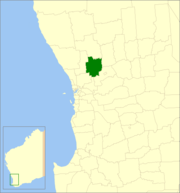 Location in Western Australia | |||||||||||||||
| Population | 4,686 (2013 est)[1] | ||||||||||||||
| • Density | 2.7666/km2 (7.1654/sq mi) | ||||||||||||||
| Established | 1871 | ||||||||||||||
| Area | 1,693.8 km2 (654.0 sq mi) | ||||||||||||||
| Shire President | Brian Rayner | ||||||||||||||
| Council seat | Toodyay | ||||||||||||||
| Region | Wheatbelt | ||||||||||||||
| State electorate(s) | Moore | ||||||||||||||
| Federal Division(s) | Pearce | ||||||||||||||
|
| |||||||||||||||
| Website | Shire of Toodyay | ||||||||||||||
| |||||||||||||||
The Shire of Toodyay is a local government area in the Wheatbelt region of Western Australia, beyond the north-eastern limits of the Perth metropolitan area. The Shire covers an area of 1,694 square kilometres (654 sq mi), and its seat of government is the town of Toodyay.
History
In 1871, the Toodyay Road District was gazetted, and in 1877, the Municipality of Newcastle followed. The latter was abolished and merged in 1912, and on 1 July 1961, Toodyay became a shire under the Local Government Act 1960.[2]
Wards
The Shire has been divided into 4 wards, since the Toodyay Road board meeting in June 1904.[3]
- North Ward (2 councillors)
- Central Ward (2 councillors)
- West Ward (3 councillors)
- East Ward (2 councillors)
Towns and localities
- Toodyay
- Bailup
- Bejoording
- Coondle
- Culham
- Dewars Pool
- Dumbarton
- Hoddys Well
- Julimar
- Moondyne
- Morangup
- Nardie
- Nunile
- Wattening
- West Toodyay
Presidents
Population
| Year | Population |
|---|---|
| 1911 | 1,480 |
| 1921 | 1,545 |
| 1933 | 1,462 |
| 1947 | 1,237 |
| 1954 | 1,525 |
| 1961 | 1,369 |
| 1966 | 1,388 |
| 1971 | 1,725 |
| 1976 | 1,138 |
| 1981 | 1,450 |
| 1986 | 1,831 |
| 1991 | 2,451 |
| 1996 | 3,186 |
| 2001 | 3,744 |
| 2006 | 4,112 |
| 2011 | 4,387 |
See also

Toodyaypedia plates ready for installation in Toodyay
- List of heritage places in Shire of Toodyay
- Wikipedia:WikiTown/Toodyaypedia
References
- ↑ "3218.0 Regional Population Growth, Australia. Table 5. Estimated Resident Population, Local Government Areas, Western Australia". 3 April 2014. Retrieved 11 September 2014.
- ↑ WA Electoral Commission, Municipality Boundary Amendments Register (release 3.0), 31 May 2007.
- ↑ "Newcastle". Western Mail (Perth, WA : 1885 - 1954). Perth, WA: National Library of Australia. 4 June 1904. p. 18. Retrieved 4 March 2014.
External links
This article is issued from
Wikipedia.
The text is licensed under Creative Commons - Attribution - Sharealike.
Additional terms may apply for the media files.