Upson County, Georgia
| Upson County, Georgia | |
|---|---|
.JPG) Upson County Courthouse (Built 1908), Thomaston | |
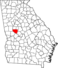 Location in the U.S. state of Georgia | |
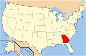 Georgia's location in the U.S. | |
| Founded | December 15, 1824 |
| Named for | Stephen Upson |
| Seat | Thomaston |
| Largest city | Thomaston |
| Area | |
| • Total | 328 sq mi (850 km2) |
| • Land | 323 sq mi (837 km2) |
| • Water | 4.1 sq mi (11 km2), 1.3% |
| Population | |
| • (2010) | 27,153 |
| • Density | 84/sq mi (32/km2) |
| Congressional district | 3rd |
| Time zone | Eastern: UTC−5/−4 |
| Website |
www |
Upson County is a county located in the west central Piedmont portion of the U.S. state of Georgia. As of the 2010 census, the population was 27,153.[1] The county seat is Thomaston.[2] The county was created on December 15, 1824.
Upson County comprises the Thomaston, GA Micropolitan Statistical Area, which is also included in the Atlanta-Athens-Clarke County-Sandy Springs, GA Combined Statistical Area.
History
Upson County, in west central Georgia, was established by an act of the state legislature on December 15, 1824. By the Treaty of Indian Springs (1821) between the United States and the Creek Indians, the federal government acquired the land that extended from the Ocmulgee River to the Flint River through middle Georgia. Upson County was created from Pike and Crawford counties.
Many settlers were drawn to the area by the lottery system, which gave them a chance to acquire homesteads from these newly available lands. The state's fifty-ninth county was named in honor of the noted Georgia lawyer Stephen Upson (1784/5-1824) four months after his death. It is the birthplace of John Brown Gordon, a major general in the Confederate army and a governor of Georgia in the 1880s, and Eugene C. Gordon, a Confederate major in the Alabama Cavalry, who later developed Decatur, Alabama.
In March 1825 the justices of the inferior court bought land lot 217 in the Tenth District to build the courthouse and the jail. Thomaston, the county seat, developed around this site. Incorporated June 11, 1825, the town was named for General Jett Thomas, a hero of the War of 1812 (1812–15).
The majority of the settlers to Upson County came from the eastern counties of Georgia, between the Oconee River and Augusta. Some were wealthy planters who already owned many slaves. Developing plantations on the rich soil of the eastern section of Upson County, around the town of The Rock and along the Flint River, they primarily grew cotton as a commodity crop. Other settlers came from North Carolina and South Carolina. The first cotton mill in Upson County, the Waymanville or Franklin Factory, was built on Tobler Creek in 1833. In 1835 a group of New Englanders arrived to manufacture textiles.
The Old Alabama Stagecoach Road, a well-traveled stagecoach and wagon-freight line between Augusta and Columbus, ran from the northeastern section of Upson County, crossing the Flint River at Double Bridges over Auchumpkee Covered Bridge in the southwest. Double Bridges was the site where two bridges spanned either side of Owen's Island in the middle of the Flint River.
A brief Civil War (1861–65) cavalry skirmish took place there. On April 18, 1865, Union raiders began three days of devastation in Upson County. Union Major General James Harrison Wilson's cavalry was headed toward Macon; its task was to destroy the agricultural and industrial facilities in the South. Fifty men of the First Battalion Georgia Cavalry Reserves stood to defend the bridges. The defenders fired a few scattered shots at the larger Union forces before fleeing. Union soldiers pillaged and burned homes, and destroyed several factories, including the Waymanville cotton mill.
After the war, mills continued to be important to the county's economy. Industrialization increased in the late 19th century. Thomaston Mills was a major employer in the county from its beginning in 1899 until 2001, before the company moved out of the country to Mexico. Martha Mills, a manufacturer of tire cord fabric, began operation in 1927 and ceased operations in 2006 (Martha Mills was bought by B. F. Goodrich in 1929, and later WesTek in 2008).
In the 1920s the peach industry thrived in Upson County, but production of peaches all but vanished in the county with the onset of the Great Depression in the 1930s. Orchard laborers found work in the mills. Peach orchards were cut down to make room for timber stands.

In 1930 publication of a history of the county, History of Upson County, Georgia, was sponsored by the Daughters of the American Revolution. It was coauthored by Evelyn Hanna, a well-known author of romantic fiction.
Upson County is home to Southern Crescent Technical College-Flint River Campus.
Several natural and historic sites draw tourism to the area. Sprewell Bluff is a 200-acre (0.81 km2) area of climbing river bluffs formed by the Flint River as it cuts through Oak Mountain. A three-mile (5 km) trail winds along the bank. The Sprewell Bluff State Park offers 1,372 acres (5.55 km2) for fishing, hiking, picnicking, horseshoes, and volleyball.
Auchumpkee Covered Bridge, located in the southeastern part of the county, is an exact replica of the 1892 bridge that was destroyed in the floods that swept through the state in 1994. Federal disaster-relief money paid for covered-bridge craftsman Arnold M. Graton to reconstruct the bridge.
Geography
According to the U.S. Census Bureau, the county has a total area of 328 square miles (850 km2), of which 323 square miles (840 km2) is land and 4.1 square miles (11 km2) (1.3%) is water.[3] Upson County boasts the lowest average summer humidity in the state.
The vast majority of Upson County is located in the Upper Flint River sub-basin of the ACF River Basin (Apalachicola-Chattahoochee-Flint River Basin), with just a tiny northeastern corner of the county, north of Yatesville, located in the Upper Ocmulgee River sub-basin of the Altamaha River basin.[4]
Major highways
Adjacent counties
- Lamar County - north
- Pike County - north
- Monroe County - northeast
- Crawford County - southeast
- Taylor County - south
- Talbot County - southwest
- Meriwether County - northwest
Demographics
| Historical population | |||
|---|---|---|---|
| Census | Pop. | %± | |
| 1830 | 7,013 | — | |
| 1840 | 9,408 | 34.2% | |
| 1850 | 9,424 | 0.2% | |
| 1860 | 9,910 | 5.2% | |
| 1870 | 9,430 | −4.8% | |
| 1880 | 12,400 | 31.5% | |
| 1890 | 12,188 | −1.7% | |
| 1900 | 13,670 | 12.2% | |
| 1910 | 12,757 | −6.7% | |
| 1920 | 14,786 | 15.9% | |
| 1930 | 19,509 | 31.9% | |
| 1940 | 25,064 | 28.5% | |
| 1950 | 25,078 | 0.1% | |
| 1960 | 23,800 | −5.1% | |
| 1970 | 23,505 | −1.2% | |
| 1980 | 25,998 | 10.6% | |
| 1990 | 26,300 | 1.2% | |
| 2000 | 27,597 | 4.9% | |
| 2010 | 27,153 | −1.6% | |
| Est. 2016 | 26,335 | [5] | −3.0% |
| U.S. Decennial Census[6] 1790-1960[7] 1900-1990[8] 1990-2000[9] 2010-2013[1] | |||
2000 census
As of the census[10] of 2000, there were 27,597 people, 10,722 households, and 7,687 families residing in the county. The population density was 85 people per square mile (33/km²). There were 11,616 housing units at an average density of 36 per square mile (14/km²). The racial makeup of the county was 70.58% White, 27.95% Black or African American, 0.25% Native American, 0.38% Asian, 0.02% Pacific Islander, 0.30% from other races, and 0.53% from two or more races. 1.18% of the population were Hispanic or Latino of any race.
There were 10,722 households out of which 31.70% had children under the age of 18 living with them, 50.70% were married couples living together, 16.90% had a female householder with no husband present, and 28.30% were non-families. 25.20% of all households were made up of individuals and 11.60% had someone living alone who was 65 years of age or older. The average household size was 2.53 and the average family size was 3.01.
In the county, the population was spread out with 25.50% under the age of 18, 8.30% from 18 to 24, 27.80% from 25 to 44, 23.50% from 45 to 64, and 14.90% who were 65 years of age or older. The median age was 37 years. For every 100 females there were 90.40 males. For every 100 females age 18 and over, there were 85.30 males.
The median income for a household in the county was $31,201, and the median income for a family was $37,418. Males had a median income of $30,484 versus $20,520 for females. The per capita income for the county was $17,053. About 11.20% of families and 14.70% of the population were below the poverty line, including 21.70% of those under age 18 and 11.70% of those age 65 or over.
2010 census
As of the 2010 United States Census, there were 27,153 people, 10,716 households, and 7,382 families residing in the county.[11] The population density was 84.0 inhabitants per square mile (32.4/km2). There were 12,161 housing units at an average density of 37.6 per square mile (14.5/km2).[12] The racial makeup of the county was 68.8% white, 28.0% black or African American, 0.5% Asian, 0.3% American Indian, 1.2% from other races, and 1.2% from two or more races. Those of Hispanic or Latino origin made up 2.2% of the population.[11] In terms of ancestry, 21.4% were American, 13.1% were Irish, 9.3% were English, and 6.3% were German.[13]
Of the 10,716 households, 32.8% had children under the age of 18 living with them, 45.8% were married couples living together, 17.6% had a female householder with no husband present, 31.1% were non-families, and 27.4% of all households were made up of individuals. The average household size was 2.49 and the average family size was 3.00. The median age was 40.3 years.[11]
The median income for a household in the county was $34,509 and the median income for a family was $42,737. Males had a median income of $36,870 versus $27,075 for females. The per capita income for the county was $17,398. About 16.7% of families and 20.1% of the population were below the poverty line, including 25.9% of those under age 18 and 9.9% of those age 65 or over.[14]
Communities
City
Town
Census-designated places
Other unincorporated places
Politics
| Year | Republican | Democratic | Third parties |
|---|---|---|---|
| 2016 | 66.7% 7,292 | 31.8% 3,475 | 1.5% 167 |
| 2012 | 64.1% 7,230 | 35.1% 3,959 | 0.8% 90 |
| 2008 | 63.8% 7,291 | 35.5% 4,061 | 0.7% 82 |
| 2004 | 65.7% 6,634 | 33.9% 3,424 | 0.4% 36 |
| 2000 | 60.6% 5,019 | 38.1% 3,158 | 1.3% 105 |
| 1996 | 47.1% 3,783 | 43.5% 3,491 | 9.5% 761 |
| 1992 | 45.0% 4,053 | 41.6% 3,740 | 13.4% 1208 |
| 1988 | 63.1% 4,614 | 36.4% 2,666 | 0.5% 38 |
| 1984 | 62.0% 4,803 | 38.0% 2,943 | |
| 1980 | 36.5% 2,788 | 61.7% 4,713 | 1.8% 134 |
| 1976 | 40.7% 2,897 | 59.3% 4,219 | |
| 1972 | 84.5% 4,892 | 15.5% 896 | |
| 1968 | 22.7% 1,494 | 22.5% 1480 | 54.8% 3,599 |
| 1964 | 48.6% 3,103 | 51.3% 3,275 | 0.1% 6 |
| 1960 | 23.5% 1,001 | 76.5% 3,262 | |
| 1956 | 17.2% 712 | 82.8% 3,422 | |
| 1952 | 14.5% 648 | 85.6% 3,837 | |
| 1948 | 9.8% 293 | 81.3% 2,432 | 9.0% 268 |
| 1944 | 9.3% 243 | 90.7% 2,362 | |
| 1940 | 6.6% 159 | 93.4% 2,235 | |
| 1936 | 8.6% 138 | 91.4% 1,471 | 0.1% 1 |
| 1932 | 1.2% 20 | 98.6% 1,660 | 0.2% 4 |
| 1928 | 23.5% 221 | 76.5% 721 | |
| 1924 | 6.4% 37 | 83.3% 484 | 10.3% 60 |
| 1920 | 15.1% 170 | 84.9% 957 | |
| 1916 | 25.6% 259 | 72.6% 734 | 1.8% 18 |
| 1912 | 23.4% 138 | 75.4% 445 | 1.2% 7 |
Notable people
See also
References
- 1 2 "State & County QuickFacts". United States Census Bureau. Retrieved June 26, 2014.
- ↑ "Find a County". National Association of Counties. Retrieved 2011-06-07.
- ↑ "US Gazetteer files: 2010, 2000, and 1990". United States Census Bureau. 2011-02-12. Retrieved 2011-04-23.
- ↑ "Georgia Soil and Water Conservation Commission Interactive Mapping Experience". Georgia Soil and Water Conservation Commission. Retrieved 2015-11-20.
- ↑ "Population and Housing Unit Estimates". Retrieved June 9, 2017.
- ↑ "U.S. Decennial Census". United States Census Bureau. Retrieved June 26, 2014.
- ↑ "Historical Census Browser". University of Virginia Library. Retrieved June 26, 2014.
- ↑ "Population of Counties by Decennial Census: 1900 to 1990". United States Census Bureau. Retrieved June 26, 2014.
- ↑ "Census 2000 PHC-T-4. Ranking Tables for Counties: 1990 and 2000" (PDF). United States Census Bureau. Retrieved June 26, 2014.
- ↑ "American FactFinder". United States Census Bureau. Retrieved 2008-01-31.
- 1 2 3 "DP-1 Profile of General Population and Housing Characteristics: 2010 Demographic Profile Data". United States Census Bureau. Retrieved 2015-12-30.
- ↑ "Population, Housing Units, Area, and Density: 2010 - County". United States Census Bureau. Retrieved 2015-12-30.
- ↑ "DP02 SELECTED SOCIAL CHARACTERISTICS IN THE UNITED STATES – 2006-2010 American Community Survey 5-Year Estimates". United States Census Bureau. Retrieved 2015-12-30.
- ↑ "DP03 SELECTED ECONOMIC CHARACTERISTICS – 2006-2010 American Community Survey 5-Year Estimates". United States Census Bureau. Retrieved 2015-12-30.
- ↑ Leip, David. "Dave Leip's Atlas of U.S. Presidential Elections". uselectionatlas.org. Retrieved 2018-03-22.
Places adjacent to Upson County, Georgia | ||||||||||
|---|---|---|---|---|---|---|---|---|---|---|
| ||||||||||
Municipalities and communities of Upson County, Georgia, United States | ||
|---|---|---|
| City | | |
| Town | ||
| CDPs | ||
| Unincorporated communities | ||