Fairfield, Montana
| Fairfield, Montana | |
|---|---|
| Town | |
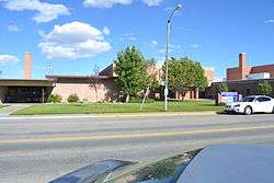 Fairfield High School | |
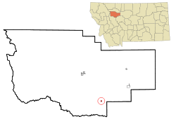 Location of Fairfield, Montana | |
| Coordinates: 47°36′55″N 111°58′51″W / 47.61528°N 111.98083°WCoordinates: 47°36′55″N 111°58′51″W / 47.61528°N 111.98083°W | |
| Country | United States |
| State | Montana |
| County | Teton |
| Area[1] | |
| • Total | 0.31 sq mi (0.80 km2) |
| • Land | 0.31 sq mi (0.80 km2) |
| • Water | 0 sq mi (0 km2) |
| Elevation | 3,983 ft (1,214 m) |
| Population (2010)[2] | |
| • Total | 708 |
| • Estimate (2016)[3] | 726 |
| • Density | 2,300/sq mi (890/km2) |
| Time zone | UTC-7 (Mountain (MST)) |
| • Summer (DST) | UTC-6 (MDT) |
| ZIP code | 59436 |
| Area code(s) | 406 |
| FIPS code | 30-25225 |
| GNIS feature ID | 0771287 |
Fairfield is a town in Teton County, Montana, United States. The population was 708 at the 2010 census. Fairfield is the self-proclaimed "Malting Barley Capital of the World" with 83,000 acres (336 km2) of irrigated cropland and 56,000 acres (227 km2) of non-irrigated cropland in production for the purpose of raising malt barley in the vicinity.
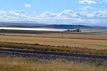
Fairfield began as a station on the Milwaukee and is between Great Falls and Choteau and near Freezeout Lake, (from Cheney's Names on the Face of Montana, Mountain Press Publishing Company) where as many as 300,000 snow geese and 10,000 tundra swans gather in March. Fairfield serves as a trading center for the farmers of Greenfield Bench. Irrigation now assures crops, but in earlier days a dry summer made the grass scarce and the name "Freeze-out Bench" was applied to the area. "Greenfield Bench" and Fairfield are now descriptive of the hay and grain fields surrounding the town. (from Cheney’s Names on the Face of Montana, Mountain Press Publishing Company)
Even though the federal government had opened this area of Montana to homesteading in 1862, not until 1909 did settlers really come into the Fairfield area when Congress liberalized this act allowing the settler 320 acres of free land instead of 160. It became apparent, however, that the small homesteads, 160 or 320 acres, made little sense in the vast and dry landscape of Montana. After the Bureau of Reclamation conducted a survey that showed a dam could be built in the Sun River Canyon and water for irrigation in Fairfield area would be feasible were many more settlers attracted to Fairfield. The Gibson Dam was completed in 1929. Today, Greenfield Irrigation District delivers water from Gibson Dam to approximately 83,000 acres surrounding this community.
Fairfield is the "Malting Barley Capital of the World", a trade center for the farming community as well as being home to Busch Agricultural Resources, 3 Rivers Telephone Cooperative and Sun River Electric Cooperative.
Geography
Fairfield is located at 47°36′55″N 111°58′51″W / 47.61528°N 111.98083°W (47.615250, -111.980859).[4]
According to the United States Census Bureau, the town has a total area of 0.31 square miles (0.80 km2), all of it land.[1]
Demographics
| Historical population | |||
|---|---|---|---|
| Census | Pop. | %± | |
| 1950 | 693 | — | |
| 1960 | 752 | 8.5% | |
| 1970 | 638 | −15.2% | |
| 1980 | 650 | 1.9% | |
| 1990 | 660 | 1.5% | |
| 2000 | 659 | −0.2% | |
| 2010 | 708 | 7.4% | |
| Est. 2016 | 726 | [3] | 2.5% |
| U.S. Decennial Census[5][6] 2015 Estimate[7] | |||
2010 census
As of the census[2] of 2010, there were 708 people, 305 households, and 204 families residing in the town. The population density was 2.8[8] inhabitants per square mile (1.1/km2). There were 339 housing units at an average density of 1,093.5 per square mile (422.2/km2). The racial makeup of the town was 95.9% White, 1.3% Native American, and 2.8% from two or more races. Hispanic or Latino of any race were 1.4% of the population.
There were 305 households of which 30.2% had children under the age of 18 living with them, 54.4% were married couples living together, 9.8% had a female householder with no husband present, 2.6% had a male householder with no wife present, and 33.1% were non-families. 30.8% of all households were made up of individuals and 15.8% had someone living alone who was 65 years of age or older. The average household size was 2.32 and the average family size was 2.91.
The median age in the town was 42.1 years. 27% of residents were under the age of 18; 3.7% were between the ages of 18 and 24; 22% were from 25 to 44; 26% were from 45 to 64; and 21.2% were 65 years of age or older. The gender makeup of the town was 46.9% male and 53.1% female.
2000 census
As of the census[9] of 2000, there were 659 people, 285 households, and 184 families residing in the town. The population density was 2,170.7 people per square mile (848.1/km²). There were 311 housing units at an average density of 1,024.4 per square mile (400.3/km²). The racial makeup of the town was 96.97% White, 0.91% Native American, 0.15% from other races, and 1.97% from two or more races. Hispanic or Latino of any race were 0.91% of the population.
There were 285 households out of which 31.2% had children under the age of 18 living with them, 53.3% were married couples living together, 8.4% had a female householder with no husband present, and 35.4% were non-families. 32.3% of all households were made up of individuals and 15.8% had someone living alone who was 65 years of age or older. The average household size was 2.31 and the average family size was 2.95.
In the town, the population was spread out with 25.6% under the age of 18, 9.4% from 18 to 24, 28.5% from 25 to 44, 18.5% from 45 to 64, and 17.9% who were 65 years of age or older. The median age was 37 years. For every 100 females there were 95.5 males. For every 100 females age 18 and over, there were 92.2 males.
The median income for a household in the town was $29,018, and the median income for a family was $34,896. Males had a median income of $28,750 versus $18,125 for females. The per capita income for the town was $15,255. About 7.7% of families and 11.3% of the population were below the poverty line, including 17.0% of those under age 18 and 7.9% of those age 65 or over.
Climate
According to the Köppen Climate Classification system, Fairfield has a semi-arid climate, abbreviated "BSk" on climate maps.[10]
References
- 1 2 "US Gazetteer files 2010". United States Census Bureau. Archived from the original on 2012-01-24. Retrieved 2012-12-18.
- 1 2 "American FactFinder". United States Census Bureau. Retrieved 2012-12-18.
- 1 2 "Population and Housing Unit Estimates". Retrieved June 9, 2017.
- ↑ "US Gazetteer files: 2010, 2000, and 1990". United States Census Bureau. 2011-02-12. Retrieved 2011-04-23.
- ↑ "Census of Population and Housing". Census.gov. Archived from the original on May 12, 2015. Retrieved June 4, 2015.
- ↑ "Census & Economic Information Center". Retrieved July 3, 2015.
- ↑ "Population Estimates". United States Census Bureau. Archived from the original on October 19, 2016. Retrieved July 22, 2016.
- ↑ http://tetoncomt.org/
- ↑ "American FactFinder". United States Census Bureau. Archived from the original on 2013-09-11. Retrieved 2008-01-31.
- ↑ Climate Summary for Fairfield, Montana
- ↑ "Fairfield, Montana Community Information". centralmontana.com. Retrieved 29 June 2012.
External links
- Fairfield Chamber of Commerce website
- Fairfield Sun Times Newspaper Website
- Visit Fairfield, MT Website
Municipalities and communities of Teton County, Montana, United States | ||
|---|---|---|
| City | 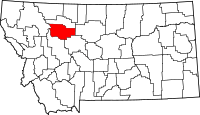 | |
| Towns | ||
| CDPs | ||
| Unincorporated communities | ||