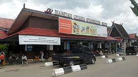
Syamsudin Noor International Airport
| Syamsudin Noor International Airport Bandar Udara Internasional Syamsudin Noor | |||||||||||
|---|---|---|---|---|---|---|---|---|---|---|---|
|
| |||||||||||
 | |||||||||||
| Summary | |||||||||||
| Airport type | Public | ||||||||||
| Owner | Government of Indonesia | ||||||||||
| Operator | PT Angkasa Pura I | ||||||||||
| Serves | Banjarmasin | ||||||||||
| Location | Banjarbaru, South Kalimantan, Indonesia | ||||||||||
| Elevation AMSL | 66 ft / 20 m | ||||||||||
| Coordinates | 03°26′32″S 114°45′45″E / 3.44222°S 114.76250°ECoordinates: 03°26′32″S 114°45′45″E / 3.44222°S 114.76250°E | ||||||||||
| Website |
syamsudinnoor-airport | ||||||||||
| Maps | |||||||||||
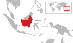 Kalimantan region in Indonesia | |||||||||||
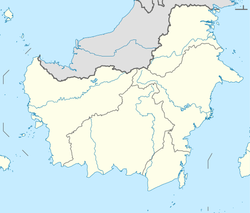 BDJ Location of airport in South Kalimantan / Indonesia  BDJ BDJ (Indonesia) | |||||||||||
| Runways | |||||||||||
| |||||||||||
| Statistics (2017) | |||||||||||
| |||||||||||
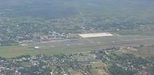
Syamsudin Noor International Airport (Indonesian: Bandar Udara Internasional Syamsudin Noor) (IATA: BDJ, ICAO: WAOO) is an airport serving Banjarmasin in South Kalimantan, Indonesia. It is located in the District of Landasan Ulin, Banjarbaru, South Kalimantan or 25 km from the center of the city of Banjarmasin, Kalimantan's largest city, and is located 10 kilometers south-west of Banjarbaru. It has an area of 257 hectares. The airport began operations in 1936 under the name Ulin Intl. In 1975 the airport was officially designated as a civilian airport and renamed to the airport Syamsudin Noor. In 2011, Syamsudin Noor Airport has a domestic terminal with an area of 9943 m² and can handle 3,013,191 passengers. One in front of the terminal is capable of handling 4 medium sized aircraft, namely Boeing 737-400 and one at the new terminal can accommodate four Boeing 767-300ER. More recently, upon the completion of the expansion in 2004, the airport had to deal with allegations of mark up. Asphalt larger Angkasa Pura halted until the airport has paid the debt to the government. Historically, Boeing 767-300ER is the first wide-body aircraft which landed at this airport in 2004. In early 2013, this airport serves 5.5 million passengers, whereas the capacity is only for 4.0 million passengers. Authority has allocated Rp2.1 trillion ($ 2.2 billion) for development and is predicted to be completed in late 2014.
In early 2013, the airport served 5.5 million passengers, while the capacity is only for 4 million. The authority has allocated Rp.2.1 trillion ($2.2 billion) to develop the airport and predicted it would be finished by the end of 2014.[5]
History
Syamsudin Noor Airport was originally named the Airports Ulin managed by the Government of Occupied Japan and is adjacent to the South of the current airport. Because it was heavily damaged by bombing by the allies, the Japanese occupation in 1944 to build a new runway parallel to the northern side of the runway being used now.
In 1948 the Dutch government (NICA) to continue the construction of the runway with a 10 cm thick stone hardening. At the time of the recognition of the sovereignty of RIS, airfield management ironwood conducted by the Local Government / Public Works Department. Furthermore, the Indonesian government in 1961, management is delegated to the Ministry of Transportation, Bureau of Civil Aviation. In 1970, Airports Ulin renamed Airports Syamsudin Noor after an Indonesian aviation hero from south kalimantan, Syamsudin Noor(id). and in 1974 enhanced the ability of its runway constructed to accommodate other aircraft Fokker-28.
From 1975 until 1977 built a new runway being used now, which is able to accommodate aircraft type DC-9 is limited.
Based on the Joint Decree of Minister of Defense and Security / Commander of the Armed Forces, Minister of Transportation and Minister of Finance with No. KEP/30/IX/1975, No. KM/598/5/Phb-75 and No.KEP.927.A/MK/8/1975, concerning set Airports Syamsudin Noor as a civilian airfield fully occupied by the Department of Transportation.
By virtue of Decree No. KM.213 / HK207 / the un-85, dated November 4, 1985 on the term airport Syamsudin Noor converted into SYAMSUDIN NOOR AIRPORT.
Based on Government Regulation No. 48 of 1992 of 12 April 1992 on the Handover Operations Management Forum Syamsudin Noor Airport to the Angkasa Pura I and officially Syamsudin Noor Airport Banjarmasin become one of the branches of Perum Angkasa Pura I. Then, based on Government Regulation No. 5 of 1993 dated January 2, 1993, the form of companies Angkasa Pura I changed from Perum Angkasa Pura I became PT. (Persero) Angkasa Pura I.
Through the development of upgrading the runway in 1994 Syamsudin Noor Airport has been able to accommodate aircraft B-737/300 at full capacity and the Year 2003 has completed development Syamsudin Noor Airport by the government of South Kalimantan to build a facility extension of Runway to accommodate planes B-767/300 ER but its capacity is limited and the construction of apron that can accommodate seven wide-body aircraft B-737 and other supporting facilities. Syamsudin Noor Airport development in order to realize the ideals of South Kalimantan society to make Pride Airport South Kalimantan have become embarkation Hajj.
Airlines and destinations
Passenger
Hajj
During the hajj season, Syamsudin Noor Airport serves pilgrims from the region for a direct flight to Jeddah with a short stopover at Batam. A hajj terminal was built to coordinate pilgrims. In 2010, it was the busiest hajj airport in Indonesia, with the greatest number of hajj travelers.
Expansion
In August 2012, about 58 hectares of 102 hectares (57%) of the land needed for an expansion had been acquired.[7]
Accidents and incidents
- On 28 August 1992, Vickers Viscount PK-IVX of Bouraq Indonesia Airlines was damaged beyond economic repair when an engine fire forced the crew to abort the take-off.[8]
References
- ↑ Airport information for WAOO at World Aero Data. Data current as of October 2006.Source: DAFIF.
- ↑ Airport information for WAOO at Great Circle Mapper. Source: DAFIF (effective October 2006).
- ↑ (in Indonesian) Airport information from Angkasa Pura I
- ↑ http://www.angkasapura1.co.id/uploads/files/10bb0090d3c9b148c2e291ad282339b7459fce5a.pdf
- ↑ "AP I Kucurkan Rp 2,1 Triliun Untuk Pengembangan Bandara Syamsudin Noor". 11 April 2013.
- ↑ https://www.instagram.com/p/BaX3kFZB6Wv/?taken-by=citilink%5Bpermanent+dead+link%5D
- ↑ "Land cleared for S. Kalimantan airport expansion". 13 August 2012.
- ↑ "Accident description". Aviation Safety Network. Retrieved 9 October 2009.
External links