Banjarbaru
| Banjarbaru | ||
|---|---|---|
| City | ||
| Other transcription(s) | ||
| • Jawi | بنجربارو | |
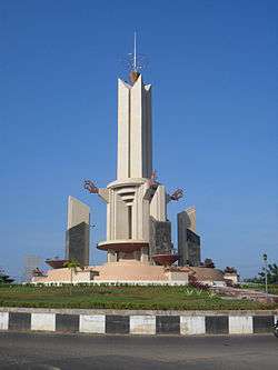 Welcome Monument | ||
| ||
| Nickname(s): "Kota bukit" = city of Hills | ||
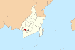 Location within South Kalimantan | ||
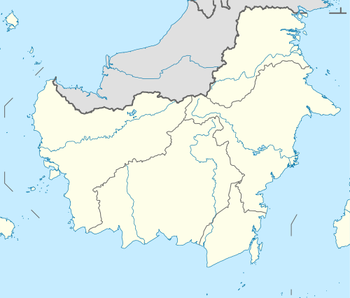 Banjarbaru Location in Kalimantan and Indonesia  Banjarbaru Banjarbaru (Indonesia) | ||
| Coordinates: 3°28′S 114°45′E / 3.467°S 114.750°ECoordinates: 3°28′S 114°45′E / 3.467°S 114.750°E | ||
| Country |
| |
| Province |
| |
| Government | ||
| • Mayor | Najmi Adhani | |
| • Vice Mayor | Darmawan Jaya Setiawan | |
| Area | ||
| • Total | 371 km2 (143 sq mi) | |
| Elevation | 23 m (75 ft) | |
| Population (2014)official estimate | ||
| • Total | 215,440 | |
| • Density | 580/km2 (1,500/sq mi) | |
| Time zone | UTC+8 (Indonesia Central Time) | |
| Area code | (+62) 511 | |
| Website | www.banjarbarukota.go.id | |
Banjarbaru is a city in the province of South Kalimantan in Indonesia. It is located 35 kilometres (22 mi) southeast of Banjarmasin. The city had a population of 199,627 as of the 2010 population census and the latest official estimate is 215,440; the town of Martapura lies immediately to the north of Banjarbaru, and in effect constitutes an extension of the city.
Orientation
Banjarbaru City is located on the major road crossing South Kalimantan. The central road Jalan Jendral Achmad Yani, splits Banjarbaru into two parts. The city is bordered by Martapura (which lies immediately adjacent) to the north, Karang Intan to the east, Gambut and Aluh-Aluh to the west and Bati–Bati (Tanah Laut District) to the south.
Geography
Banjarbaru is located at the foot of the Meratus Mountains, with 80% of the city area elevated between 0 and 25 metres (82 ft) above sea level, but also includes areas up to 500 m (1,600 ft) high. Similarly slopes vary between 0 and 8% for most of the city's territory, with some areas sloping up to 15%.
Economy
The main economic activities in order of their contribution to the Regional Bruto Product are: Commerce, restaurant and hotel (21.7%), Services (16.3%), Building (16.3%), Processing industry (15.7%) and Mining: (8.7%), while Agriculture only contributes 4.9%.[1]
Administration
Banjarbaru has an area of 371.3 km2 (143.4 sq mi), divided into five districts (kecamatan): Banjarbaru Utara (North Banjarbaru), Banjarbaru Selatan (South Banjarbaru), Cempaka, Landasan Ulin and Liang Anggang; currently these districts each cover four administrative villages (kelurahan), as set out below with their 2010 Census populations:[2]
Landasan Ulin District:
- Landasan Ulin Timur (14,178)
- Guntung Payung (6,474)
- Guntung Manggis (19,970)
- Syamsuddin Noor (10,888)
Liang Anggang District:
- Landasan Ulin Tengah (9,230)
- Landasan Ulin Utara (13,303)
- Landasan Ulin Barat (6,323)
- Landasan Ulin Selatan (5,692)
Cempaka District:
- Palam (3,101)
- Bangkal (4,217)
- Sungai Tiung (7,986)
- Cempaka (13,015)
Banjarbaru Utara District:
- Loktabat Utara (17,580)
- Mentaos (9,431)
- Komet (4,019)
- Sungai Ulin (11,775)
Banjarbaru Selatan District:
- Loktabat Selatan (8,360)
- Kemuning (8,495)
- Guntung Paikat (7,975)
- Sungai Besar (17,615)
See also
References
- ↑ Banjarbaru economic sectors 2005
- ↑ Biro Pusat Statistik, Jakarta, 2011.
External links
Regencies and cities of South Kalimantan | ||
|---|---|---|
Capital: Banjarmasin | ||
| Regencies | ||
| Cities | ||