Abdul Rachman Saleh Airport
| Abdul Rachman Saleh Airport Bandar Udara Abdul Rachman Saleh | |||||||||||||||
|---|---|---|---|---|---|---|---|---|---|---|---|---|---|---|---|
 | |||||||||||||||
| Summary | |||||||||||||||
| Airport type | Military / Public | ||||||||||||||
| Owner | Government of East Java Province | ||||||||||||||
| Serves | Malang | ||||||||||||||
| Location | Malang, East Java, Indonesia | ||||||||||||||
| Elevation AMSL | 1,726 ft / 526 m | ||||||||||||||
| Coordinates | 07°55′35″S 112°42′52″E / 7.92639°S 112.71444°ECoordinates: 07°55′35″S 112°42′52″E / 7.92639°S 112.71444°E | ||||||||||||||
| Website |
abdulrachmansaleh | ||||||||||||||
| Map | |||||||||||||||
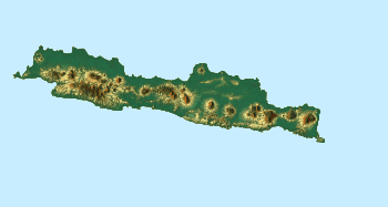
 MLG Location of airport in Java | |||||||||||||||
| Runways | |||||||||||||||
| |||||||||||||||
Abdul Rachman Saleh Airport (IATA: MLG, ICAO: WARA, formerly WIAS) is an airport serving Malang, the second largest city in East Java province of Indonesia. This airport is named after Abdoel Rachman Saleh, an Indonesian aviator and physiologist whose plane was shot down by the Dutch when landing in Maguwo Airfield (now Adisucipto International Airport), Sleman Regency, Yogyakarta during Indonesian National Revolution.
The airport was closed in October 2009 due to numerous damages found in the runway, but has opened again after some repairs were done.[3]
The new terminal was opened on 30 December 2011 replacing the old terminal that is used by the Indonesian Air Force. The new terminal is at the south end of the runway. The runway was extended into 2.300 meters in late 2012.
Airlines and destinations
The following airlines offer scheduled passenger service:
Statistics
| Rank | Destinations | Frequency (Weekly) | Airline(s) |
|---|---|---|---|
| 1 | Jakarta–Soekarno–Hatta, Jakarta | 56 | Citilink, Garuda Indonesia, Lion Air, Sriwijaya Air |
| 2 | Jakarta–Halim Perdanakusuma, Jakarta | 28 | Batik Air, Citilink |
| 3 | Bandung, West Java | 7 | Wings Air |
| 4 | Denpasar, Bali | 7 | Wings Air |
References
- ↑ Airport information for WARA at World Aero Data. Data current as of October 2006.Source: DAFIF.
- ↑ Airport information for MLG at Great Circle Mapper. Source: DAFIF (effective October 2006).
- ↑ "Archived copy". Archived from the original on 30 October 2009. Retrieved 2009-10-27.
External links