Sipocot, Camarines Sur
| Sipocot | ||
|---|---|---|
| Municipality | ||
| Municipality of Sipocot | ||
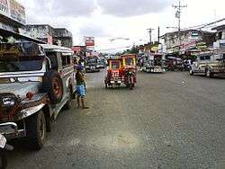 Downtown area | ||
| ||
|
Nickname(s): Egg Basket of CamSur Native Chicken Capital of CamSur. | ||
| Motto(s): "Boronyog Sipocot" | ||
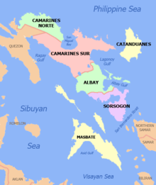
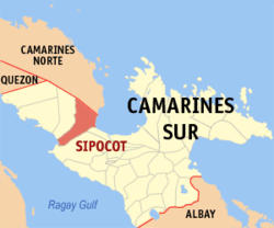 Map of Camarines Sur with Sipocot highlighted | ||
.svg.png) Sipocot Location within the Philippines | ||
| Coordinates: 13°46′N 122°59′E / 13.77°N 122.98°ECoordinates: 13°46′N 122°59′E / 13.77°N 122.98°E | ||
| Country |
| |
| Region | Bicol Region (Region V) | |
| Province | Camarines Sur | |
| District | 1st district | |
| Founded | July 3, 1801 | |
| Barangays | 46 (see Barangays) | |
| Government [1] | ||
| • Type | Sangguniang Bayan | |
| • Mayor | Rogenor R. Astor | |
| • Vice Mayor | Beth Abergos | |
| • Electorate | 33,224 voters (2016) | |
| Area [2] | ||
| • Total | 243.43 km2 (93.99 sq mi) | |
| Population (2015 census)[3] | ||
| • Total | 64,855 | |
| • Density | 270/km2 (690/sq mi) | |
| Time zone | UTC+8 (PST) | |
| ZIP code | 4408 | |
| PSGC | 051734000 | |
| IDD : area code | +63 (0)54 | |
| Climate type | Tropical rainforest climate | |
| Income class | 1st municipal income class | |
| Revenue (₱) | 153,324,480.12 (2016) [4] | |
| Poverty incidence | 33.62 (2012)[5] | |
| Native languages |
Central Bikol Tagalog | |

Sipocot, officially the Municipality of Sipocot, is a 1st class municipality in the province of Camarines Sur, Philippines. According to the 2015 census, it has a population of 64,855 people.[3]
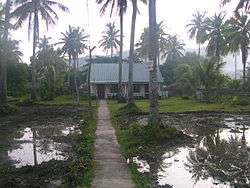
Geography
Notable hills include:
- Susong Daraga Hill & Our Lady of Lourdes Grotto located at Brgy. Impig and near CBSUA-SIPOCOT campus
- Overlooking Point, Manangle located on the left side towards Manila at the Quirino Highway.
- 100 steps, located in Brgy. Impig
Barangays
Sipocot is politically subdivided into 46 barangays:
{{columns-list|colwidth=30em|
- Aldezar
- Alteza
- Anib
- Awayan
- Azucena
- Bagong Sirang
- Binahian
- Bolo Sur
- Bolo Norte
- Bulan
- Bulawan
- Cabuyao
- Caima
- Calagbangan
- Calampinay
- Carayrayan
- Cotmo
- Gabi
- Gaongan
- Impig
- Lipilip
- Lubigan Jr.
- Lubigan Sr.
- Malaguico
- Malubago
- Manangle
- Mangga
- Mangapo
- Manlubang
- Mantila
- North Centro (Poblacion)
- North Villazar
- Sagrada Familia
- Salanda
- Salvacion
- San Isidro
- San Vicente
- Serranzana
- South Centro (Poblacion)
- South Villazar
- Taisan
- Tara
- Tible
- Tula-tula
- Vigaan
- Yabo
History
Long before it became a town in the year 1801, Sipocot originally belonged to the town of Lupi, being one of its barrios. Its conversion into a town also paved the way for the establishment of its parish in dedication of St. John the Baptist, the town's patron saint. This marked the beginning of the celebration of the town fiesta held annually every June 24.
Demographics
| Population census of Sipocot | ||
|---|---|---|
| Year | Pop. | ±% p.a. |
| 1903 | 2,925 | — |
| 1918 | 2,736 | −0.44% |
| 1939 | 7,936 | +5.20% |
| 1948 | 18,089 | +9.59% |
| 1960 | 32,650 | +5.04% |
| 1970 | 38,153 | +1.57% |
| 1975 | 39,457 | +0.68% |
| 1980 | 43,505 | +1.97% |
| 1990 | 49,501 | +1.30% |
| 1995 | 53,392 | +1.43% |
| 2000 | 56,576 | +1.25% |
| 2007 | 57,861 | +0.31% |
| 2010 | 64,042 | +3.76% |
| 2015 | 64,855 | +0.24% |
| Source: Philippine Statistics Authority[3][6][7][8] | ||
In the 2015 census, the population of Sipocot, Camarines Sur, was 64,855 people,[3] with a density of 270 inhabitants per square kilometre or 700 inhabitants per square mile.
Climate
| Climate data for Sipocot, Camarines Sur | |||||||||||||
|---|---|---|---|---|---|---|---|---|---|---|---|---|---|
| Month | Jan | Feb | Mar | Apr | May | Jun | Jul | Aug | Sep | Oct | Nov | Dec | Year |
| Average high °C (°F) | 32 (90) |
31 (88) |
35 (95) |
37 (99) |
37 (99) |
36 (97) |
35 (95) |
33 (91) |
34 (93) |
33 (91) |
31 (88) |
31 (88) |
34 (93) |
| Average low °C (°F) | 27 (81) |
27 (81) |
29 (84) |
31 (88) |
32 (90) |
31 (88) |
30 (86) |
30 (86) |
30 (86) |
29 (84) |
28 (82) |
28 (82) |
29 (85) |
| Average precipitation mm (inches) | 59.21 (2.3311) |
66.36 (2.6126) |
58.1 (2.287) |
62.92 (2.4772) |
110.94 (4.3677) |
206.81 (8.1421) |
254.59 (10.0232) |
141.12 (5.5559) |
156.51 (6.1618) |
290.68 (11.4441) |
113.40 (4.4646) |
368.1 (14.492) |
1,888.74 (74.3593) |
| Average rainy days | 22 | 23 | 19 | 22 | 25 | 28 | 31 | 27 | 25 | 28 | 27 | 31 | 308 |
| Source: World Weather Online[9] | |||||||||||||
Economy
Banks and financial institutions in Sipocot include Land Bank of the Philippines, RCPI, Rural Bank of Sipocot, Rural Bank of Pamplona, Rural Bank of Minalabac, CARD Bank, BLVING Lending Corporation, M Lhuiller, Tambunting Pawnshop, Cebuana Lhuiller, Henry Lhuiller and Sipocot. Pawnshop.
Department stores in Sipocot are Tom Eloy Convenient Store, NOVO-Fabulous, ANSON Merchandise, and Lady Anne's Boutique and Giftshoppe.
Infrastructure
Transportation and communications
- Digitel Communications, BayanTel and PLDT provide the telephone services including DSL, Broadband, and Dial-up internet services
- Using of Cellular phones is one of the important medium of communication in the area, it is being powered by Smart Communications, Sun Cellular and Globe Telecom, (it also includes the Talk N Text, Touch Mobile, etc.)
- The municipality also have this Post Office with 4408 as the Zip Code.
- The area is accessible via buses, jeepnies, tricycles, trains, skates, etc. for public transportation vehicles.
- The cable TV is also available, it is being powered by Dream Cable and Sky Cable. In the area ABS-CBN and GMA are the leading TV stations being watched.
Hospitals
- Sipocot District Hospital
- Our Lady of Salvation Hospital
Education
- Tertiary
- Felix O. Alfelor Sr. Foundation College, located at Brgy. South Centro
- Central Bicol State University of Agriculture- Sipocot (Bicol Institute of Science and Technology), located at Brgy. Impig. This college has a transition name: Central Bicol State University of Agriculture - Sipocot (2009–Present); Camarines Sur State Agricultural Colleges - Sipocot Campus (2003–2009); Bicol Institute of Science and Technology (1992–2003); Sipocot National School of Arts and Trades (1972–1992)
- Secondary
- CBSUA-Sipocot Laboratory High School(Sipocot)
- Felix O. Alfelor Sr. Foundation College - High School Dept., located at Brgy. South Centro
- Sipocot National High School, located at Brgy. Tara
- Villazar National High School, located at Brgy. North Villazar
- Sacred Heart High School, located at Brgy. Calagbangan (supervised by the Villazar National High School administration, de jure)
- Bolo Norte High School, located at Brgy. Bolo Norte (supervised by the Sipocot National High School administration, de jure)
- Anib National High School, located at Brgy. Anib
- Caima National High School High School, located at Brgy. Caima
- Elementary
- Every barangay has its own elementary schools. Schools are divided into two districts: Sipocot North District (schools in the northern part of the town) and the Sipocot South District (most of the southern part).
- Sipocot North Central School
- Sipocot South Central School
- Aldezar Elementary School
- Alteza Elementary School
- Anib Elementary School
- Awayan Elementary School
- Azucena Elementary School
- Bagong Sirang Elementary School
- Binahian Elementary School
- Bocol Elementary School
- Bolo Sur Elementary School
- Bulan Elementary School
- Bulawan Elementary School
- Cabuyao Elementary School
- Caima Elementary School
- Calagbangan Elementary School
- Calampinay Elementary School
- Carayrayan Elementary School
- Cotmo Elementary School
- Gabi Elementary School
- Gaongan Elementary School
- Lipilip Elementary School
- Lubigan Jr. Elementary School
- Lubigan Sr. Elementary School
- Malaguico Elementary School
- Manangle Elementary School
- Mangapo Elementary School
- Mangga Elementary School
- Manlubang Public School
- Mantela Elementary School
- Sagrada Elementary School
- Salvacion Elementary School
- San Isidro Public School
- San Vicente Elementary School
- Serranzana Elementary School
- Soledad R. Villafuerte Elementary School (Bolo Norte Elementary School)
- Sta. Cruz Elementary School
- Taisan Elementary School
- Tara Elementary School
- Tigman Elementary School
- Tula-Tula Elementary School
- Vigaan Elementary School
- Villazar North Elementary School
- Villazar South Elementary School
- Yabu-Salanda Elementary School
- Private Primary Institutions
- Christian Mission Service Philippines School
- Felix O. Alfelor Sr. Foundation College - Elementary School Dept. (Condemned Building)
- King Thomas Learning Academy, Inc
- Lady Amherstia Montessori School
- Nazareth Institute of Learning & Formation
- Serranz Learning Center
Sports and recreation venues
- Sipocot Municipal Amphitheater
- Governor Mariano E. Villafuerte Sr. Sports Complex (Town Plaza)
- CBSUA-BIST Gymnasium
- CBSUA-BIST Cultural Stage and Quadrangle
- CBSUA-BIST Audio Visual Room
- CBSUA-BIST Sports Ground
- Bolo Sur Cockpit Arena
- Sipocot Cockpit Arena
- Every barangay has its own Barangay Plaza for social gatherings and sport activities.
- Sipocot Municipal Hall's Field
- SNCS Covered Court, Oval and Open Ground
- SNHS Sports Complex
- Impig Viewing Point
- Susong Daraga and other mt.
- Butterfly Garden
Parishes
| Name of Parish | Parish Priest |
|---|---|
| St. John the Baptist Parish Parish (Mother Parish) | |
| Sto. Nino de Praga Parish (Calagbangan) | |
| St. Pius X Parish (North Villazar) | |
| St. Anthony de Padua Parish(Binahian) | |
| St. Therese of the child Jesus Parish (Tara) |
References
- ↑ "Municipality". Quezon City, Philippines: Department of the Interior and Local Government. Retrieved 31 May 2013.
- ↑ "Province: Camarines Sur". PSGC Interactive. Quezon City, Philippines: Philippine Statistics Authority. Retrieved 12 November 2016.
- 1 2 3 4 Census of Population (2015). "Region V (Bicol Region)". Total Population by Province, City, Municipality and Barangay. PSA. Retrieved 20 June 2016.
- ↑ "Camarines Sur : Cities and Municipalities Competitiveness Index". Makati City, Philippines: National Competitiveness Council (Philippines). Retrieved 29 October 2017.
- ↑ "PSA Releases the 2012 Municipal and City Level Poverty Estimates". Quezon City, Philippines: Philippine Statistics Authority. Archived from the original on 28 January 2017. Retrieved 28 January 2017.
- ↑ Census of Population and Housing (2010). "Region V (Bicol Region)". Total Population by Province, City, Municipality and Barangay. NSO. Retrieved 29 June 2016.
- ↑ Censuses of Population (1903–2007). "Region V (Bicol Region)". Table 1. Population Enumerated in Various Censuses by Province/Highly Urbanized City: 1903 to 2007. NSO.
- ↑ "Province of Camarines Sur". Municipality Population Data. Local Water Utilities Administration Research Division. Retrieved 17 December 2016.
- ↑ "Sipocot, Camarines Sur: Average Temperatures and Rainfall". World Weather Online. Retrieved 29 October 2017.
External links
| Wikimedia Commons has media related to Sipocot, Camarines Sur. |
- Official Site of the Diocese of Libmanan
- Philippine Standard Geographic Code
- Philippine Census Information
- Official Site of the Province of Camarines Sur
Places adjacent to Sipocot, Camarines Sur | |
|---|---|
Pili (capital) | |
| Municipalities | |
| Component city | |
| Independent component city |
|