Xinyi, Nantou
Coordinates: 23°39′44.5″N 121°00′56.6″E / 23.662361°N 121.015722°E
| Xinyi Township 信義鄉 | |
|---|---|
| Mountain indigenous township | |
 | |
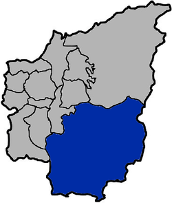 Xinyi Township in Nantou County | |
| Location | Nantou County, Taiwan |
| Area | |
| • Total | 1,422 km2 (549 sq mi) |
| Population (July 2018) | |
| • Total | 16,270 |
| • Density | 11/km2 (30/sq mi) |
Xinyi Township or Sinyi Township (Chinese: 信義鄉; pinyin: Xìnyì Xiāng) is a mountain indigenous township in Nantou County, Taiwan. It is the largest township of Nantou County. Xinyi is home to Bunun people of the Taiwanese aborigines.
Geography
It has a population total of 16,813 and an area of 1,422.42 square kilometres (549.20 sq mi).[1]
Administrative divisions
The township comprises 14 villages: Aiguo, Deli, Fengqiu, Luona, Mingde, Renhe, Shenmu, Shuanglong, Tannan, Tongfu, Tungpu, Wangmei, Xinxiang and Zijiang.
Economy
The township ranks first in Taiwan in terms of plum production, reaching an annual production of 20,000 tonnes.[2]
Infrastructures
Tourist attractions
- Mount Mabolasi
- Yushan National Park
- Batongguan Historic Trail
- Fengguidou
- Dongpu Hot Springs
- Pinglai Scenic Area
- Rainbow Falls, Lover's Valley
- Cloud Dragon Falls, Double Dragon Falls
- Fubuzhizi Precipice
- Danda Mountain Trail, Danye Mountain Trail
- Seven Colors Lake
- Papaya Pit Big Falls
- Shenmu Big Tree
- Husband Wife Tree
Transportation
References
- ↑ 信義介紹 [Introduction to Xinyi]. shini.gov.tw (in Chinese). Sinyi Township Office. Retrieved 15 February 2017.
- ↑ https://www.travelking.com.tw/eng/tourguide/nantou/specials.asp
External links
| Wikimedia Commons has media related to Xinyi Township, Nantou. |
Cities and townships of Nantou County | ||
|---|---|---|
| Cities | 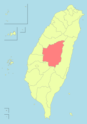 | |
| Urban townships | ||
| Rural townships | ||
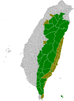
| Mountain indigenous townships | ||
| Highland aboriginal Townships and Districts |
|  | ||||||||||||||||||||||||
|---|---|---|---|---|---|---|---|---|---|---|---|---|---|---|---|---|---|---|---|---|---|---|---|---|---|---|
| Plains aboriginal Townships and County-Controlled Cities |
| |||||||||||||||||||||||||
Note: On the map, "Highland aboriginal areas" are in green, and "Plains aboriginal areas" are in tan. | ||||||||||||||||||||||||||
This article is issued from
Wikipedia.
The text is licensed under Creative Commons - Attribution - Sharealike.
Additional terms may apply for the media files.