Bessiebelle
| Bessiebelle Victoria | |
|---|---|
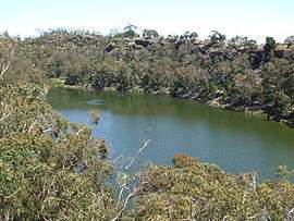 Lake Surprise to the north of Bessiebelle | |
 Bessiebelle | |
| Coordinates | 38°09′S 141°58′E / 38.150°S 141.967°ECoordinates: 38°09′S 141°58′E / 38.150°S 141.967°E |
| Population | 176 (2011 census)[1] |
| Postcode(s) | 3304 |
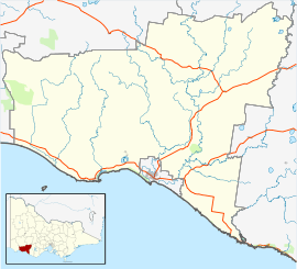
| Location |
|
| LGA(s) | Shire of Moyne |
| State electorate(s) | South-West Coast |
| Federal Division(s) | Wannon |
Bessiebelle is a locality in western Victoria, Australia. The locality is in the Shire of Moyne local government area, in what is commonly known as the Western District. Besiebelle is in the County of Normanby cadastral division, approximately 311 kilometres (193 mi) west of the state capital, Melbourne, on the Eumeralla River adjacent to the Mount Eccles National Park.
At the 2006 census the population of Bessiebelle was 195, [2] but at the 2011 census the population of Bessiebelle was 176.[1]
The locality has an active CFA Branch.
References
- 1 2 Australian Bureau of Statistics (31 October 2012). "Bessiebelle (State Suburb)". 2011 Census QuickStats. Retrieved 7 January 2017.

- ↑ Australian Bureau of Statistics (25 October 2007). "Bessiebelle (State Suburb)". 2006 Census QuickStats. Retrieved 7 January 2017.
This article is issued from
Wikipedia.
The text is licensed under Creative Commons - Attribution - Sharealike.
Additional terms may apply for the media files.