Mepunga
| Mepunga Victoria | |
|---|---|
 Uniting church at Mepunga | |
 Mepunga | |
| Coordinates | 38°26′26″S 142°42′01″E / 38.44056°S 142.70028°ECoordinates: 38°26′26″S 142°42′01″E / 38.44056°S 142.70028°E |
| Population | 47 (2016 census)[1] |
| Postcode(s) | 3265 |
| Location |
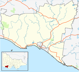
|
| LGA(s) | Shire of Moyne |
| State electorate(s) | South-West Coast |
| Federal Division(s) | Wannon |
Mepunga is a locality in south west Victoria, Australia. The locality is in the Shire of Moyne, 243 kilometres (151 mi) west of the state capital, Melbourne.
At the 2016 census, Mepunga had a population of 47.[1]
References
- 1 2 Australian Bureau of Statistics (27 June 2017). "Mepunga". 2016 Census QuickStats. Retrieved 24 July 2017.

External links
![]()
This article is issued from
Wikipedia.
The text is licensed under Creative Commons - Attribution - Sharealike.
Additional terms may apply for the media files.