City of Melton
| City of Melton Victoria | |||||||||||||||
|---|---|---|---|---|---|---|---|---|---|---|---|---|---|---|---|
 Location of Melton within Melbourne's metropolitan area. | |||||||||||||||
| Population | 135,443 (2016 census)[1] | ||||||||||||||
| • Density | 256.861/km2 (665.27/sq mi) | ||||||||||||||
| Established | 1862 | ||||||||||||||
| Area | 527.3 km2 (203.6 sq mi) | ||||||||||||||
| Mayor | Cr Bob Turner | ||||||||||||||
| Council seat | Melton | ||||||||||||||
| Region | Western Metropolitan Melbourne | ||||||||||||||
| County | Bourke | ||||||||||||||
| State electorate(s) | |||||||||||||||
| Federal Division(s) | Gorton | ||||||||||||||
 | |||||||||||||||
| Website | City of Melton | ||||||||||||||
| |||||||||||||||
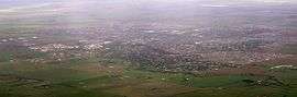
The City of Melton is a local government area in Victoria, Australia, on Melbourne's western rural–urban fringe.
It covers 527.3 square kilometres (203.6 sq mi), and at the 2016 Census, Melton had population of 135,443.[1]
It is governed by the Melton City Council. The seat of local government and administrative offices are located at Council headquarters in Melton, the settlement after which the city takes its name which lies at the western end of the LGA and is currently its largest urban area with a population of over 54,000.[2]
City of Melton has a rapid population growth rate, ranked 3rd fastest among LGAs in Victoria in 2010.[3] It was granted city status in 2012.
History

Melton was first incorporated as a district on 16 September 1862, and became a shire on 24 May 1871. Parts of the north and south ridings of the Shire of Braybrook (later City of Sunshine) were annexed to Melton as the Rockbank Riding on 24 May 1916, and this was added to in 1951. Other minor boundary adjustments with Bulla and Keilor occurred in May 1959. The Shire had a total area of 450.4 square kilometres (173.9 sq mi).[4]
In 1994, following large-scale statewide local government reform, Melton acquired the Exford district from the City of Werribee, growing to its present size.[5]
Since the early 1970s the Shire has undergone tremendous population growth and as of 2006, Melton was one of Victoria's fastest growing local government areas along with neighbouring Wyndham.
After several years of community consultation to defer applying for city status until it had reached 150,000,[6][7] the council nevertheless reversed the decision and city status was granted in September, 2012.[8] The first elected Mayor under the 'City" status was Kathy Majdlik.
Administration

Council
The City's area is divided into three wards, two of which elects three councillors, the other one electing two councillors. The councillors elect a mayor from among the council's members.
The current council, as of May 2017 is:[9]
| Ward | Party | Councillor | Notes | |
|---|---|---|---|---|
| Coburn | Independent | Bob Turner | Mayor | |
| Independent | Ken Hardy | Deputy Mayor | ||
| Independent | Sophie Ramsey | |||
| Cambridge | Independent | Steve Abboushi | ||
| Independent | Goran Kesic | |||
| Independent | Kathy Majdlik | |||
| Watts | Independent | Michelle Mendes | ||
| Independent | Lara Carli | |||
Suburbs and towns
Suburbs and towns within the boundary of the city include:
- Aintree
- Bonnie Brook
- Brookfield
- Burnside
- Burnside Heights
- Caroline Springs
- Cobblebank
- Deanside
- Diggers Rest
- Exford
- Eynesbury (Shared with the City of Wyndham)
- Fieldstone
- Fraser Rise
- Grangefields
- Harkness
- Hillside (Shared with the City of Brimbank)
- Kurunjang
- Melton
- Melton South
- Melton West
- Mount Cottrell (Shared with the City of Wyndham)
- Parwan (Shared with the Shire of Moorabool)
- Plumpton
- Ravenhall
- Rockbank
- Strathtulloh
- Taylors Hill
- Thornhill Park
- Toolern Vale
- Truganina (Shared with the City of Wyndham)
- Weir Views
Population
| Year | Population | Annual Growth (%) |
|---|---|---|
| 1954 | 1,424 | N/A |
| 1958 | 1,580[10] | 2.63 |
| 1961 | 1,804[10] | 4.52 |
| 1966 | 2,542[10] | 7.10 |
| 1971 | 5,974[10] | 18.64 |
| 1976 | 13,856[10] | 18.32 |
| 1981 | 21,300[10] | 8.98 |
| 1986 | 29,500 | 6.73 |
| 1991 | 35,695 | 3.89 |
| 1996 | 39,109 | 1.84 |
| 2001 | 51,685 | 5.73 |
| 2006 | 78,448[11] | 8.70 |
| 2011 | 109,259[11] | 7.86 |
| 2017 | 143,003 [12] |
Residential estates
Recent large housing projects include:
- Atherstone, within the new suburbs of Cobblebank and Strathtulloh. ($1.2 billion).
- Toolern.
- Eyensbury Township.
- Waterford Estate, in the suburb of Weir Views.
- Woodlea, within the new suburb of Aintree.
See also
References
- 1 2 Australian Bureau of Statistics (27 June 2017). "Melton (C)". 2016 Census QuickStats. Retrieved 8 July 2017.

- ↑ Census QuickStats (2016). "Melton (UCL) – UCL211004". Australian Bureau of Statistics. Government of Australia. Retrieved 10 December 2017.
- ↑ http://www.abs.gov.au/ausstats/abs@.nsf/Latestproducts/3218.0Main%20Features52010-11?opendocument&tabname=Summary&prodno=3218.0&issue=2010-11&num=&view=
- ↑ Victorian Municipal Directory. Brunswick: Arnall & Jackson. 1992. pp. 756–757. Accessed at State Library of Victoria, La Trobe Reading Room.
- ↑ Australian Bureau of Statistics (1 August 1995). Victorian local government amalgamations 1994-1995: Changes to the Australian Standard Geographical Classification (PDF). Commonwealth of Australia. p. 9. ISBN 0-642-23117-6. Retrieved 2007-12-16.
- ↑ "Community Engagement – Application for City status" (PDF). Moving Ahead. Shire of Melton. 2010-11-10. Retrieved 2012-05-29.
- ↑ "Welcome to the City of Melton". City of Melton. Retrieved 8 September 2012.
- ↑ Humpage, Ami; Mcaleer, Liam Status change confirmed, Melton now a City Archived 2013-01-15 at Archive.is Melton Leader. 6 Sep 12
- ↑ "Councillors - Melton City Council". www.melton.vic.gov.au.
- 1 2 3 4 5 6 1958, 1983 and 1988 Victorian Year Book
- 1 2 Australian Bureau of Statistics (25 October 2007). "Melton (S) (Local government Area)". 2006 Census QuickStats. Retrieved 2007-12-20.
- ↑ "Growth statistics". Retrieved 2017-05-25.
External links
- Melton City Council home page
- Melton City Council - Official Facebook page
- City Map from Department of Human Services, Victoria, Australia
- Public Transport Victoria local public transport map
- Link to Land Victoria interactive maps
Coordinates: 37°40′58″S 144°34′27″E / 37.6827°S 144.5741°E