Sengkang
| Sengkang | |
|---|---|
| Planning Area and HDB Town | |
| Other transcription(s) | |
| • Chinese | 盛港 |
| • Pinyin | Shèng Gǎng |
| • Malay | Sengkang |
| • Tamil | செங்காங் |
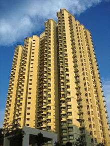
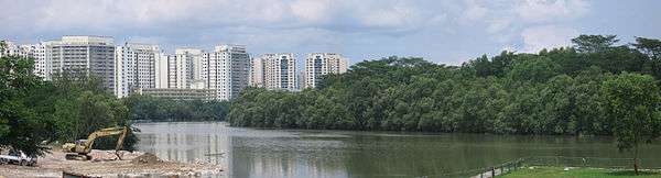  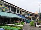 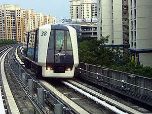    From top left to right: Panoramic view of Sungei Serangoon with Rivervale on the west bank, Compassvale, Jalan Kayu, Sengkang LRT Line, Ranggung LRT Station, Sengkang Sculpture Park, Fernvale Primary School | |
 Sengkang Location of Sengkang within Singapore | |
| Coordinates: 1°23′30″N 103°53′40″E / 1.39167°N 103.89444°E | |
| Country |
|
| Region |
|
| CDCs | |
| Government | |
| • Mayors |
Central Singapore CDC North East CDC |
| • Members of Parliament |
Ang Mo Kio GRC Pasir Ris-Punggol GRC Punggol East SMC Sengkang West SMC |
| Area[1] | |
| • Total | 10.59 km2 (4.09 sq mi) |
| • Residential | 3.97 km2 (1.53 sq mi) |
| Population (2017)[2][3] | |
| • Total | 232,100 |
| • Density | 22,000/km2 (57,000/sq mi) |
| Postal district | 19, 28 |
| Dwelling units | 59,497 |
| Projected ultimate | 92,000 |
Sengkang (Chinese: 盛港, Tamil: செங்காங்) is a planning area and residential town located in the North-East Region of Singapore. Sengkang shares boundaries with Seletar and Punggol in the north, Pasir Ris and Paya Lebar in the east, Hougang and Serangoon to the south, as well as Yishun and Ang Mo Kio to the west.
Originally a fishing village, the area is undergoing rapid development under the ambition of the Housing and Development Board (HDB) to transform it into a fully mature housing estate.[4][5]
Etymology
The name Sengkang means "prosperous harbour" in Chinese. The name comes from a road called Lorong Sengkang, off Lorong Buangkok. The area was formerly known as Kangkar (Gang Jiao 港脚) or "foot of the port" as there was once a fishing port located along Sungei Serangoon.[5][6][7]
History

Sengkang originated from the area once called Kangkar, named after the port and fishing village along Sungei Serangoon. By the mid-20th century, the area was home to several rubber, pepper, and pineapple plantations.[8] At that time, the nearest public housing estate then was the Punggol Rural Centre located along Punggol Road.[9] Sengkang was largely left alone until 1994, when an urban design team of ten from HDB began conceptualisation for a new town in Sengkang. Sengkang was carved up into seven subzones that would house a total of 95,000 public and private housing units in the long term.[4][7]
Conjured by local newspapers, Sengkang's theme became 'Town of the Seafarer', which reflects its history as a fishing village.[6][8] Two sub-themes were assigned to the four neighbourhoods (namely Rivervale, Compassvale, Anchorvale, and Fernvale) of the new town: one reflected Sengkang's marine history, while the other related to the sprawling plantations that previously covered parts of the area. The neighbourhoods were each given a name and a colour scheme to go with their respective themes. The three-storey pilotis or stilt effect was also utilised in the design of housing blocks, to resemble the stilts of fishing villages and trunks of the various plantations of bygone years.[7]
The town's first apartment blocks (known locally as flats) at Rivervale were completed in 1997.[4][10] By August 2001, about 33,700 dwelling units were completed. As of 31 March 2017, there are 65,981 HDB dwelling units in Sengkang.[5]
In October 1999, a steering committee chaired by Dr Michael Lim, then Member of Parliament for Cheng San Group Representation Constituency, was formed to look into providing sufficient amenities in Sengkang New Town. In view of feedback from residents, it completed its report on the need for facilities and services in the new town in July 2000. They coordinated with various organisations to open more void-deck precinct shops, a new shopping mall and childcare centres.[4][10][11][12][13][14]
Geography

Sengkang is a primarily residential town situated to the north of Hougang New Town in the north-eastern part of Singapore [5], under the North-East Region as defined by the Urban Redevelopment Authority (URA).
The town is bordered to the north by the Tampines Expressway (TPE), to the east by Sungei Serangoon (Serangoon River), Yio Chu Kang Road and Buangkok Drive to the south and the Central Expressway (CTE) to the west. Sungei Punggol (Punggol River) cuts through the new town, and divides the town into Sengkang East and Sengkang West. Sengkang Town Centre is located in Compassvale. A new industrial area, 'Sengkang West Industrial Area', is to be built to the west of Sengkang West Road in the near future.[8]
The construction of Sengkang West Road, which begins where Yio Chu Kang Road and Jalan Kayu intersect, started in 2011 and the first section was opened to traffic on 13 October 2013. The remaining section of the road opened on 16 May 2015. The road passes through the extended roads of Fernvale Lane, Sengkang West Avenue, Sengkang West Way in front of the Fernvale neighbourhood, cuts through the TPE across the Seletar Aerospace Flyover and links to Seletar Aerospace Park.[15] An extension of Sengkang West Way to Sengkang West Road opened on 14 May 2017.
Subzones
Sengkang New Town is divided into the following seven subzones.[16][8]
- Rivervale
- Compassvale
- Anchorvale
- Fernvale
- Sengkang Town Centre
- Sengkang West
- Lorong Halus North
Demographics
As of 2017, Sengkang has a population of 232,100, most of whom are part of the working population.[2] The most populous subzone is Rivervale with 61,400 residents, closely followed by Sengkang Town Centre with 60,800 residents. Sengkang West, however, has just ten residents, while Lorong Halus North is completely unpopulated.[2] Packed into an area of 10.59 km2 (4.09 sq mi), of which just 3.97 km2 (1.53 sq mi) are designated as residential areas, Sengkang has a population density of 22,000 people per km2 (57,000 per mi2).[1]
Notable places

Sengkang's two main rivers, Sungei Punggol and Sungei Serangoon, run through the town with a network of green connectors along their banks. They link housing precincts to neighbourhood parks such as Sengkang Riverside Park, as well as the Sengkang Swimming Complex, Sengkang Hockey Stadium and Anchorvale Community Centre. These park connectors are linked to the Coney Island Park in Punggol New Town and the existing Punggol Park in the south, to better serve the recreational needs of the residents of Sengkang. Sengkang Sculpture Park, located in Compassvale, is an elongated green space created below the LRT viaducts.[17]
Sengkang's major public transport amenities were built in tandem with the main public housing development. The main heavy rail tunnels through Sengkang and the elevated track infrastructure of the intra-town Sengkang LRT were developed as the existing public housing blocks were being built in the late 1990s.[6][10] The amenities were built in a contiguous building complex, which gives commuters direct access between Sengkang MRT/LRT Station, Sengkang Bus Interchange, Compass Heights condominium and Compass One shopping centre.[4][18][19]
Transportation
City planners plan for public transport to eventually become the preferred mode of transport. The government of Singapore uses public transport to reduce pollution caused by heavy road traffic.[20] Sengkang is part of the Urban Redevelopment Authority's focus for realising this urban planning model. As Sengkang is relatively distant from the city centre at the Central Area, an efficient, high-volume and high-speed public transport system is also preferred to using road networks, as the government is aiming to reduce the number of cars on the road.[21]
Public transport
North East Line

Sengkang Town is linked to the Central Area and MRT lines that are operated by SBST through the North East Line (NEL) at Sengkang MRT/LRT Station, located at the Town Centre. The NEL system is a fully automated heavy rail mass rapid transit system, and started operations on 20 June 2003.[22][23] It is operated by SBS Transit.
There are two Mass Rapid Transit (MRT) stations that serve Sengkang Planning Area, which are Buangkok and Sengkang.
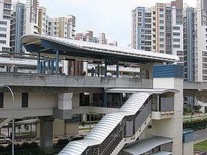
Sengkang MRT/LRT Station
The Sengkang Station, a MRT/LRT station, shares a building complex with Sengkang Bus Interchange for commuters' ease of switching across the different available modes of public transport. The MRT portion of the station began operations on 20 June 2003, along with most of the NEL;[23] the LRT portion of the station had already opened on 18 January 2003.[24]
Buangkok MRT Station
Buangkok (NE15), the other station along the NEL in Sengkang Town, serves the housing developments in Buangkok, at Compassvale, and the northern part of Hougang New Town. The station started operations on 15 January 2006.[25]
Sengkang LRT Line

The intra-town Sengkang Light Rail Transit (LRT) system is a 10.7 km light rail line that serves to link residents to the town centre. It is a fully automated system, and its rolling stock is supplied by Mitsubishi Heavy Industries. The system is operated by SBS Transit. The Sengkang LRT line forms two loops, East Loop and West Loop, that skirt the perimeter of the new town. The LRT line has 14 stations and all are in operation.[26] The line began service on 18 January 2003.[24]
Sengkang Bus Interchange

The Sengkang Bus Interchange was opened on 12 June 1998 as a terminal. At that time, developments around the area in Sengkang New Town were still actively in progress. The Sengkang Bus Interchange is located at the ground level of Compass Heights condominium, next to Compass One, which was opened on 18 January 2003,[27] and is the second air-conditioned bus interchange in Singapore, after Toa Payoh Bus Interchange.[28]
Compassvale Bus Interchange
On 24 November 2014, LTA officially announced the expansion of the Sengkang Bus Interchange to accommodate future bus services under the Bus Service Enhancement Programme (BSEP) Scheme as the current interchange does not have enough parking spaces for more services. The expansion consists of 12 additional parking bays, boarding and alighting facilities, concourse area, staff lounge and a canteen. The expansion works were completed in the third quarter of 2016.[29] The extension, named Compassvale Bus Interchange, is located opposite Compass One along Sengkang Square and it officially opened on 12 March 2017.[30]
Road network
Sengkang is connected to many parts of Singapore through its road network. The Tampines Expressway (TPE) links Sengkang Town up with Singapore's expressway network. The Kallang-Paya Lebar Expressway, which provides a direct route to the city area via TPE, was completed in late 2008.[31] New roads were built in the early 2000s to ease traffic congestion on Punggol Road. Buangkok Green and Buangkok Drive were completed in the second half of 1999. They shorten the drive from the Central Expressway near Ang Mo Kio Avenue 5 to Punggol Road.[32][33] The first part of a S$23 million project to make Sengkang town less congested was opened on 7 April 2001. The completed work involved an extension to Sengkang East Road, which runs from Compassvale Street to Tampines Expressway (TPE), and a slip road to the TPE in the direction of the Seletar and Central Expressways. The second part of the project involved the completion of the Sengkang East Road and Sengkang East Drive Flyovers.[34][35] The Sengkang East Road and Sengkang East Drive Flyovers were officially opened on 16 May 2004, making it easier for residents of Sengkang and Punggol new towns in the north-east to travel to other parts of Singapore.[36] Extensions had been made to Sengkang West Avenue and Sengkang West Way to connect to the future Sengkang West Industrial Park.
Major roads that run within the boundaries of Sengkang Planning Area include Sengkang East Drive, Sengkang East Avenue, Sengkang East Road, Sengkang East Way, Sengkang West Avenue, Sengkang West Road, Sengkang West Way and Jalan Kayu.
Sengkang Town Centre
There are four major building complexes within the Sengkang Town Centre.
Compass Heights
Compass Heights is a private condominium complex that is integrated with public transportation facilities in its surroundings.[37]
Sengkang Interchange
Sengkang Interchange, located in the centre of the town, consists of the Sengkang Bus Interchange and the Sengkang MRT/LRT station. [38]
Compass One
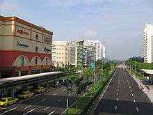
Compass One, formerly known as Compass Point is Singapore's first thematic suburban shopping centre based on the theme of learning. The Compass Point Shopping Centre was constructed at a cost of S$230 million.[39] The shopping mall started operations in August 2002.[40]
Sengkang Community Hub
Sengkang Community Hub, and its community club and neighbourhood police centre, were officially opened by Teo Chee Hean, Minister for Defence and Member of Parliament for Pasir Ris-Punggol Group Representation Constituency, on 10 December 2005.[41] Some of the facilities that it houses are the KK Women's Clinic @ Sengkang,[42] Sengkang Central Constituency Office, Sengkang Neighbourhood Police Centre, Sengkang Community Club,[43] and the Singapore Post office Sengkang branch.[44]

Amenities
Education
There are 12 primary schools [45] and six secondary schools in Sengkang New Town. Land provision has also been made for a junior college in the town to meet future educational demand in the North-East Region.[46]
Fire stations
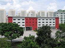
Sengkang Fire Station, which opened on 19 May 2001, is the biggest fire station in Singapore. The S$14 million fire station covers 7,000 square metres, and is used by the Singapore Civil Defense Force. Sengkang Fire Station has a capacity for 700 fire fighters and rescue personnel. It is also the first station to employ a water conservation system where water used during drills are diverted to a pump well for recycling purposes.[47]
Medical facilities
Sengkang General and Community Hospital is a 1,400 bed regional hospital serving the residents of the north-east region. The hospital was opened in August 2018. Also located in Sengkang is the SingHealth Sengkang Polyclinic.
Sports facilities
Sengkang Sports Centre [48], formerly known as Sengkang Sports and Recreation Centre, it is co-located with the People’s Association Anchorvale Community Club, and offers one of the two sheltered pools managed by Sports Singapore. Sengkang has established itself as a world class venue for hockey, with significant facility upgrades being undertaken for the inaugural Youth Olympic Games in 2010.[49]
Politics
In the current parliament, elected by the 2015 general election, there are four constituencies which contain different parts of Sengkang. Of these four constituencies, two are Group Representative Constituencies, and the other two are Single Member Constituencies. All of them are represented by the ruling People's Action Party.
Rivervale, bounded by Punggol Road and Sengkang East Drive forms the Punggol East Single Member Constituency (SMC), which was carved out of Pasir Ris-Punggol Group Representation Constituency (GRC) in the 2011 General Elections. Punggol East SMC saw the only three-cornered fight in the 2011 elections, with Michael Palmer from the People's Action Party (PAP), Desmond Lim from the Singapore Democratic Alliance (SDA), and Lee Li Lian from the Workers' Party (WP) contesting. The SMC was retained by incumbent Michael Palmer, who was also the MP when the ward was part of Pasir Ris-Punggol GRC. In December 2012, Palmer quit the PAP over an extra-marital affair, thereby vacating his seat and paving the way for a by-election that was called by the Prime Minister in January 2013. SDA's Lim and WP's Lee returned to contest the by-election, and the PAP fielded a newcomer, Dr Koh Poh Koon, who had joined the party only three weeks earlier. They were joined by a fourth competing party, the Reform Party (RP), represented by its secretary-general Kenneth Jeyaretnam. Despite this being a four-way fight, WP's Lee emerged victorious with 54.52% of valid votes cast, shocking many on both sides of the political divide, who expected it to be a close fight. PAP's Koh came in second with 43.71% of the votes, with the RP and SDA candidates losing their electoral deposits with less than 2% of the votes combined. However, Lee was unseated in the 2015 General Elections to the PAP's candidate and Deputy Speaker Charles Chong when he garnered 51.76% of the valid votes cast, while Lee getting the remaining 48.24%.[50]
Compassvale, including Buangkok, and a small portion south of Rivervale bounded by Sengkang East Avenue and Buangkok Drive come under the Pasir Ris-Punggol Group Representation Constituency. The current MP for Punggol South division of Pasir Ris-Punggol GRC, which covers a part of Hougang, Buangkok and the southern part of Rivervale, is Gan Thiam Poh. He took over from Teo Ser Luck, who is the current MP for Punggol Central division that covers Compassvale. Michael Lim, who was the MP for Punggol Central, retired from politics in 2006 and did not take part in the election that year.[51] In the 2006 General Election, Pasir Ris-Punggol GRC was expanded from five to six MPs as the population in Sengkang and Punggol new towns has grown since 2001.[52] Pasir Ris-Punggol GRC had 178,393 voters, which exceeded the limit of 170,000 for a five-MP GRC.[53]
The Anchorvale and Fernvale neighbourhoods of Sengkang Town form the Sengkang West SMC, formerly a division under the Ang Mo Kio Group Representation Constituency until the 2011 General Elections. Its Member of Parliament (MP) is Lam Pin Min. The two neighbourhoods were under the Jalan Kayu division, under Wee Siew Kim, before the 2006 General Elections.[54]
A small portion of Fernvale bounded between Jalan Kayu and Fernvale Road, is part of the Ang Mo Kio Group Representation Constituency under the Sengkang South Division. The area used to be under the Sengkang West SMC until it was carved out during GE2015. Its Member Of Parliament (MP) is Gan Thiam Poh.[55]
Before 2001, the entire Sengkang Town and Punggol New Town were part of Cheng San Group Representation Constituency.[56][57]
See also
References
- 1 2 Key Statistics | HDB Annual Report 2014/2015 (Report). Housing and Development Board. p. 10. Archived from the original on 4 March 2016. Retrieved 17 February 2018.
- 1 2 3 Singapore Residents by Planning Area/Subzone, Age Group and Sex, June 2000 - 2017 (XLS) (Report). Singapore Department of Statistics. Archived from the original (XLS) on 17 February 2018. Retrieved 17 February 2018.
- ↑ "Land Area and Dwelling Units by Town". Data Singapore. 2016. Retrieved 26 January 2018.
- 1 2 3 4 5 Tee Hun Ching (24 September 2000). "Life behind the vales". The Straits Times.
- 1 2 3 4 Housing and Development Board (4 October 2017). "Sengkang | HDB InfoWEB". Retrieved 29 December 2017.
- 1 2 3 Jose Raymond (8 February 2000). "Sengkang takes shape". The Straits Times. p. 28.
- 1 2 3 "Fancy living in an ocean park?". The Straits Times. 24 September 2000.
- 1 2 3 4 Vernon Cornelius; Aisyah Hamid (2016). "Sengkang | Infopedia". National Library Board. Retrieved 20 November 2017.
- ↑ Mapping Unit of Singapore (1985). Singapore Road Map. Punggol (Map) (3rd ed.). 1:10,000. SMU 1168. Singapore: Ministry of Defence. p. 11. Retrieved 23 February 2018.
- 1 2 3 Cindy Lim (11 April 2000). "Slow start in Sengkang". The Straits Times. p. 40.
- ↑ Natalie Soh and Kenneth Lim (18 June 1999). "Few amenities in Sengkang". The Straits Times. p. 56.
- ↑ "More amenities for Sengkang". The Straits Times. 12 June 2000. p. 34.
- ↑ "Task force became model for meeting people's needs". The Sunday Times. 19 March 2006.
- ↑ Ministry of Communications and Information (21 April 2001). "speech by Mr Lee Yock Suan". Retrieved 6 February 2018.
- ↑ Adrain Lim (26 May 2015). "new Seletar flyover and Sengkang west road improves road links". Retrieved 25 February 2018.
- ↑ "Singapore's Sengkang Planning Area". Key Location. Retrieved 2017-11-11.
- ↑ On 4 February 1997, the Urban Redevelopment Authority released the Development Guide Plan or blueprint for the long-term land use for Sengkang: Stephanie Yeo (5 February 1997). "Riverfront housing for Sengkang". The Straits Times. p. 2.
- ↑ Geraldine Yeo (20 April 1999). "Travel to be seamless in Sengkang". The Straits Times. p. 4.
- ↑ Khaw Boon Wan (26 November 2002). "The ticket to seamless travel". The Straits Times.
- ↑ "Public Transport". www.mot.gov.sg. Ministry of Transport, Singapore. 5 February 2018. Retrieved 11 February 2018.
- ↑ Land Transport Authority (21 February 2018). "Walk Cycle Ride". Retrieved 22 February 2018.
- ↑ Goh Chin Lian (21 June 2003). "It's a smooth ride on NEL – mostly". The Straits Times.
- 1 2 Leonard Lim (21 June 2003). "NEL gets off to a promising start". The Business Times.
- 1 2 "Free LRT service in Sengkang". Today. 17 January 2003. Retrieved 4 February 2018.
- ↑ Christopher Tan (31 December 2005). "Buangkok station opens on Jan 15". The Straits Times.
- ↑ Land Transport Authority. "Public Transport Projects- Sengkang LRT". Retrieved 28 January 2018.
- ↑ The opening of the Sengkang LRT Line coincided with the opening of the new Sengkang Bus Interchange on 18 January 2003: Karamjit Kaur (17 January 2003). "Free rides for LRT opening tomorrow". The Straits Times.
- ↑ "First air-conditioned bus interchange opens on Sunday". The Straits Times. 17 May 2002.
- ↑ "Expansion of Sengkang and Tampines bus interchanges". lta.gov.sg. Land Transport Authority. Archived from the original on 2016-03-04.
- ↑ Land Transport Authority (1 December 2016). "Bus Interchange to Open on 12 March 2017". Archived from the original on 2017-09-01. Retrieved 2017-05-17.
- ↑ "Coming your way – Expressway: Longest underground road". The Straits Times. 29 April 2001. p. 1.
- ↑ Karamjit Kaur (21 December 1999). "New roads cut down travel time". The Straits Times. p. 40.
- ↑ "Traffic woes in Sengkang will be a thing of the past". The Straits Times. 21 May 2001. p. H5.
- ↑ "Road extension to ease Sengkang's traffic woes". The Straits Times. 8 April 2002. p. H5.
- ↑ The one-kilometre-long Sengkang Central Road, which joins Buangkok Drive and Compassvale Drive in Sengkang Town, was opened on 15 June 2002: "New road links Hougang to Sengkang". The Straits Times. 15 June 2002.
- ↑ "New flyovers ease traffic woes of residents". The Straits Times. 17 May 2004.
- ↑ Compass Heights (2014). "Compass Heights". Retrieved 28 January 2018.
- ↑ "Sengkang Interchange". landtransportguru.net. 30 April 2013. Retrieved 3 February 2018.
- ↑ Koh Boon Pin (26 July 2000). "It's not just a mall, it's a learning centre". The Straits Times. p. 49.
- ↑ "2,000 flock to Sengkang mall job fair". The Straits Times. 8 July 2002.
- ↑ "Community Club Housed at Community Hub Provides All Encompassing Community and Commercial Services for Residents" (PDF). People's Association. 9 December 2005. Archived from the original (PDF) on 28 September 2007. Retrieved 2 August 2007.
- ↑ KK Women's and Children's Hospital. "Location and types". Archived from the original on 30 August 2005. Retrieved 30 August 2005.
- ↑ People's Association. "Archived copy". Archived from the original on 17 July 2012. Retrieved 26 October 2015.
- ↑ "singpost.com.sg". singpost.com.sg. Archived from the original on 15 November 1996. Retrieved 8 February 2013.
- ↑ Ministry of Education (6 December 2017). "Primary Schools by Planning Area in Year 2018". Retrieved 2017-12-29.
- ↑ "North East Region Set to Get More Exciting". Urban Redevelopment Authority. 24 April 2003. Archived from the original on 17 June 2003. Retrieved 29 September 2007.
- ↑ "$14m state-of-the-art facility can house 700". The Straits Times. 20 May 2001. p. 31.
- ↑ ActiveSG. "Sengkang Sports Centre". Retrieved 28 January 2018.
- ↑ Singapore Hockey (2018). "Sengkang Hockey Stadium". Retrieved 3 March 2018.
- ↑ Royston Sim (11 September 2015). "Charles Chong wins Punggol east SMC". Retrieved 8 February 2017.
- ↑ Tee Hun Ching (17 April 2006). "Michael Lim is last of 24 PAP MPs to announce exit". The Straits Times.
- ↑ Leslie Koh (4 March 2006). "Oversized GRC to take on 6th MP". The Straits Times.
- ↑ Chua Mui Hoong (4 March 2006). "Few major changes to electoral boundaries". The Straits Times.
- ↑ Various authors (20 May 2006). "The road ahead". The Straits Times. p. S8.
- ↑ Ang Mo Kio Town Council (2018). "Meet the people sessions". Retrieved 22 February 2018.
- ↑ Laurel Teo (27 January 2001). "MPs, not the Elections Department, draw up wards". The Straits Times. p. H10.
- ↑ "No big changes to electoral map". The Straits Times. 11 March 2006.
Bibliography
- Victor R Savage, Brenda S A Yeoh (2003). Toponymics – A Study of Singapore Street Names. Singapore: Eastern Universities Press. ISBN 981-210-205-1.
- Tommy Koh; Timothy Auger; Jimmy Yap; Ng Wei Chian, eds. (2006). Singapore: The Encyclopedia. Singapore: Editions Didier Millet. ISBN 981-4155-63-2.
- "Transcript of Prime Minister Lee Hsien Loong's National Day Rally English Speech on 19 August 2007 at NUS University Cultural Centre". Ministry of Information, Communications and the Arts. 19 August 2007. Archived from the original on 27 September 2007. Retrieved 2 September 2007.
External links
| Wikimedia Commons has media related to Sengkang, Singapore. |
- Ang Mo Kio Town Council
- Pasir Ris-Punggol Town Council
- Central Singapore Community Development Council
- Northeast Community Development Council
- Sengkang West Portal
- Jalan Kayu Community Website
- Pasir Ris-Punggol GRC Town Portal
| |||||||||||||||||||