North-East Region, Singapore
| North-East Region | |
|---|---|
| Region | |
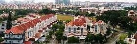 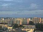 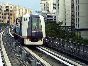 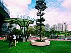 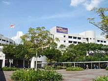 From top left to right: Terraced houses in Serangoon, HDB flats in Hougang, Sengkang LRT Line, Waterway Point, Nanyang Polytechnic | |
 | |
| Coordinates: 1°23′30″N 103°53′40″E / 1.39167°N 103.89444°E | |
| Country |
|
| Planning Areas |
|
| CDC | |
| Regional centre | Seletar |
| Largest PA | Hougang |
| Government | |
| • Mayors |
Central Singapore CDC North East CDC North West CDC South East CDC South West CDC |
| Area[1] | |
| • Total | 103.9 km2 (40.1 sq mi) |
| Population (2015)[1] | |
| • Total | 889,300 |
| • Density | 8,600/km2 (22,000/sq mi) |
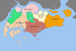
The North-East Region of Singapore is one of the five regions in the city-state. The region is the most densely populated and has the third highest population among the five, with Sengkang being its most populous town and Seletar as the regional centre. Comprising 13,810 hectares, it includes seven planning areas and is largely a residential region with 217,120 homes.[2] As its name implies, it is located in the north-eastern part of Singapore.[3]
Geography
Situated on the North-Eastern corner of Singapore Island, the region comprises a total land area of 103.9 km2 (40.1 sq mi), including the North-Eastern cluster of islands, Pulau Ubin, Pulau Tekong and Pulau Tekong Kechil. It directly borders Singapore's East Region to the east, Central Region to the south and North Region to the west.
Government
The North-East Region is governed locally by 5 different Community Development Councils, namely the Central CDC, North East CDC, North West CDC, South East CDC and South West CDC and is divided into 7 different planning areas.
Planning Areas
| Planning Area |
Area (km2') | Population | Density (/km2') |
|---|---|---|---|
| Ang Mo Kio | 13.94 | 166,820 | 11,967 |
| Hougang | 13.93 | 224,390 | 16,108 |
| North-Eastern Islands | 42.88 | 50 | 1.16 |
| Punggol | 9.34 | 146,640 | 15,000 |
| Seletar | 10.25 | 210 | 20.5 |
| Sengkang | 10.59 | 232,100 | 21,917 |
| Serangoon | 10.1 | 119,140 | 11,796 |
Economy
The region is home to the Seletar Aerospace Park, which houses several aviation manufacturing and research facilities owned by companies such as Rolls-Royce, Pratt & Whitney[4] and Singapore Technologies Aerospace, allowing the aviation industry in Singapore to expand out of Changi, which is a major aviation and commercial zone located in the East region of the country. Several industrial zones are also located within the region such as Defu Industrial Estate in Hougang and Ang Mo Kio Industrial Park in Ang Mo Kio.
Tourism
Located within the North-Eastern Islands planning area, Pulau Ubin is a popular tourist attraction with both local and foreign visitors visiting the island as it is one of the last rural areas in Singapore, with an abundance of natural flora and fauna.
Education
Residents living within the area have access to different educational facilities ranging from preschools to primary and secondary schools as these are located around the different towns in the North-East region. The area is also home to various tertiary institutions such as, Anderson Junior College, ITE College Central, Nanyang Junior College, Nanyang Polytechnic, Serangoon Junior College and a soon to be opened Singapore Institute of Technology. There are also 3 international schools, namely, the Australian International School Singapore, the French School of Singapore and the Global Indian International School Singapore.
References
- 1 2 City Population - statistics, maps and charts | SINGAPORE: Regions
- ↑ "Key Statistics FY 2014/2015". Singapore Statistics. 2015. Archived from the original on 2016-03-04.
- ↑ http://www.ura.gov.sg/DMP2008/northeast.htm
- ↑ "Pratt & Whitney opens first Singapore manufacturing facility". Channel NewsAsia. 15 February 2016. Retrieved 18 February 2016.