Sapucaia, Rio de Janeiro
| Sapucaia | |||
|---|---|---|---|
| Municipality | |||
| Município de Sapucaia | |||
| |||
 Location of Sapucaia in the state of Rio de Janeiro | |||
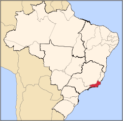
 Sapucaia Location of Sapucaia in Brazil | |||
| Coordinates: 21°59′42″S 42°54′50″W / 21.99500°S 42.91389°WCoordinates: 21°59′42″S 42°54′50″W / 21.99500°S 42.91389°W | |||
| Country |
| ||
| Region | Southeast | ||
| State |
| ||
| Government | |||
| • Prefeito | Fabrício Baião (PMDB) | ||
| Area | |||
| • Total | 540.350 km2 (208.630 sq mi) | ||
| Elevation | 221 m (725 ft) | ||
| Population (2010) | |||
| • Total | 17,504 | ||
| Time zone | UTC-3 (UTC-3) | ||
| Website | |||


Sapucaia (Portuguese pronunciation: [sapuˈkajɐ]) is a municipality located in the Brazilian state of Rio de Janeiro. Its population was 18,240 (2005) and its area is 540 km².[1] Sapucaia is also the local name for the tree Lecythis zabucajo.
References
Capital: Rio de Janeiro | |||||||||||
| Mesoregion Baixadas |
|  | |||||||||
| Mesoregion Centro Fluminense |
| ||||||||||
| Mesoregion Metropolitana do Rio de Janeiro |
| ||||||||||
| Mesoregion Noroeste Fluminense |
| ||||||||||
| Mesoregion Norte Fluminense |
| ||||||||||
| Mesoregion Sul Fluminense |
| ||||||||||
This article is issued from
Wikipedia.
The text is licensed under Creative Commons - Attribution - Sharealike.
Additional terms may apply for the media files.