Nilópolis
Coordinates: 22°48′28″S 43°24′50″W / 22.80778°S 43.41389°W
| Nilópolis | |||
|---|---|---|---|
| Municipality | |||
| Município de Nilópolis | |||
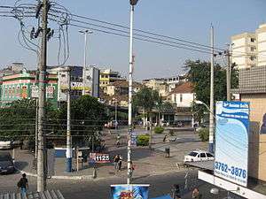 A view of the city | |||
| |||
| Motto(s): "Terra da Azul e Branca" | |||
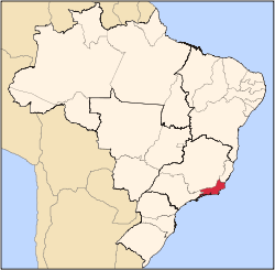
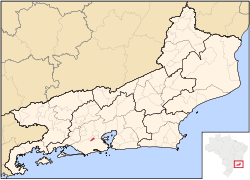 Location of Nilópolis in the State of Rio de Janeiro | |||
| Coordinates: 22°48′19″S 43°24′55.91″W / 22.80528°S 43.4155306°W | |||
| Country |
| ||
| Region | Southeast | ||
| State |
| ||
| Founded | August 21, 1947 | ||
| Government | |||
| • Mayor | Farid Abrão David (PTB) | ||
| Area | |||
| • Total | 19.157 km2 (7.397 sq mi) | ||
| [1] | |||
| Elevation | 14 m (46 ft) | ||
| Population (2012) | |||
| • Total | 157,986 | ||
| • Density | 8,200/km2 (21,000/sq mi) | ||
| [2] | |||
| Time zone | UTC-3 | ||
| Postal Code | 28000-000 | ||
| Area code(s) | +55 22 | ||
| Website | www.nilopolis.rj.gov.br | ||


Nilópolis (Portuguese pronunciation: [niˈlɔpoliʃ], [niˈlɔpɔliʃ], [niˈlɔpuliʃ]) is a municipality in Brazil, located in the Rio de Janeiro state's southwestern region, bordering São João de Meriti, Mesquita and Rio de Janeiro. It is the smallest municipality in Rio de Janeiro state, with a total area of 19.39 km². The population of 157,483 inhabitants living in an area of 9 km² and the remaining area corresponds to the Gericinó's Natural Park. Officially, the population density exceeds 8,120 inhabitants/km², but if calculated just 9 km² occupied, it becomes the most densely populated city in Brazil with more than 17.400 inhabitants/km². Currently, São João de Meriti has the highest population density, with 12,897 inhabitants/km².
The city was named after Nilo Peçanha, a President of Brazil.
Beija Flor
Nilópolis is famous for its Grêmio Recreativo Escola de Samba Beija-Flor de Nilópolis, one of the most successful and luxurious Samba schools and usually a top contender for winning the carnival parade in Rio.
References
- ↑ IBGE link to check the area of every municipality of Brazil - IBGE
- ↑ "2012 Populational Estimate" (PDF). Censo Populacional 2012. Instituto Brasileiro de Geografia e Estatística (IBGE). July 2012. Retrieved September 9, 2012.
External links
- (in Portuguese) Prefeitura de Nilópolis (Nilópolis City Hall)
- (in Portuguese) Baixada Fácil (Nilópolis history)
Capital: Rio de Janeiro | |||||||||||
| Mesoregion Baixadas |
|  | |||||||||
| Mesoregion Centro Fluminense |
| ||||||||||
| Mesoregion Metropolitana do Rio de Janeiro |
| ||||||||||
| Mesoregion Noroeste Fluminense |
| ||||||||||
| Mesoregion Norte Fluminense |
| ||||||||||
| Mesoregion Sul Fluminense |
| ||||||||||