Mesquita, Rio de Janeiro
Coordinates: 22°46′55″S 43°25′44″W / 22.78194°S 43.42889°W
| The Municipality of Mesquita | |||
|---|---|---|---|
| Municipality | |||
| |||
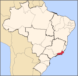
 Localization of Mesquita in Rio de Janeiro. | |||
| Coordinates: 22°48′19″S 43°24′55.91″W / 22.80528°S 43.4155306°W | |||
| Country |
| ||
| Region | Southeast | ||
| State |
| ||
| Founded | September 25, 1999 | ||
| Government | |||
| • Mayor | Jorge Lúcio Ferreira Miranda (PSDB) | ||
| Area | |||
| • Total | 39.062 km2 (15.082 sq mi) | ||
| Population | |||
| • Total | 168,403 | ||
| • Density | 4,300/km2 (11,000/sq mi) | ||
| Time zone | UTC-3 | ||
| Website | www.mesquita.rj.gov.br | ||
.svg.png)
.svg.png)
Mesquita (Portuguese pronunciation: [mesˈkitɐ], locally [mĭɕˈc̠itə], Mosque) is a municipality located in the Brazilian state of Rio de Janeiro. Its population was 182,546 (2005) and its area is 39 km2 (15 sq mi).[1]
The municipality contains part of the 4,398 hectares (10,870 acres) Mendanha State Park, created in 2013.[2]
References
- ↑ IBGE - "Archived copy". Archived from the original on 2007-01-09. Retrieved 2007-01-09.
- ↑ Parque Estadual do Mendanha (in Portuguese), INEA, retrieved 2017-01-15
Capital: Rio de Janeiro | |||||||||||
| Mesoregion Baixadas |
|  | |||||||||
| Mesoregion Centro Fluminense |
| ||||||||||
| Mesoregion Metropolitana do Rio de Janeiro |
| ||||||||||
| Mesoregion Noroeste Fluminense |
| ||||||||||
| Mesoregion Norte Fluminense |
| ||||||||||
| Mesoregion Sul Fluminense |
| ||||||||||
This article is issued from
Wikipedia.
The text is licensed under Creative Commons - Attribution - Sharealike.
Additional terms may apply for the media files.