Comendador Levy Gasparian
| Comendador Levy Gasparian | |||
|---|---|---|---|
| Municipality | |||
| Município de Comendador Levy Gasparian | |||
| |||
| Nickname(s): Levy | |||
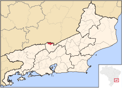 Location of Comendador Levy Gasparian in the state of Rio de Janeiro | |||
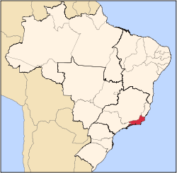
 Comendador Levy Gasparian Location of Comendador Levy Gasparian in Brazil | |||
| Coordinates: 22°01′44″S 43°12′18″W / 22.02889°S 43.20500°WCoordinates: 22°01′44″S 43°12′18″W / 22.02889°S 43.20500°W | |||
| Country |
| ||
| Region | Southeast | ||
| State |
| ||
| Government | |||
| • Prefeito | Valter Lavinas (PTB) | ||
| Area | |||
| • Total | 107.266 km2 (41.416 sq mi) | ||
| Elevation | 355 m (1,165 ft) | ||
| Population (2010) | |||
| • Total | 8,183 | ||
| Time zone | UTC-3 (UTC-3) | ||
| Website | |||


Comendador Levy Gasparian (Portuguese pronunciation: [komẽdɐˈdoʁ leˈvi ɡɐspaɾiˈɐ̃], locally [kʷmẽ̞dəˈdox leˈvʲiˑ ɡəɕpɐɾiˈɜ̃ɰ̃]) is a municipality located in the Brazilian state of Rio de Janeiro. Its population was 8,455 (2005) and its area is 107 km².[1]
References
- ↑ IBGE - "Archived copy". Archived from the original on 2008-06-11. Retrieved 2008-06-11.
Capital: Rio de Janeiro | |||||||||||
| Mesoregion Baixadas |
|  | |||||||||
| Mesoregion Centro Fluminense |
| ||||||||||
| Mesoregion Metropolitana do Rio de Janeiro |
| ||||||||||
| Mesoregion Noroeste Fluminense |
| ||||||||||
| Mesoregion Norte Fluminense |
| ||||||||||
| Mesoregion Sul Fluminense |
| ||||||||||
This article is issued from
Wikipedia.
The text is licensed under Creative Commons - Attribution - Sharealike.
Additional terms may apply for the media files.