Carmo, Rio de Janeiro
| Carmo | |||
|---|---|---|---|
| Municipality | |||
| Município de Carmo | |||
 Ilha dos Pombos hydropower plant | |||
| |||
| Nickname(s): Cidade Bela | |||
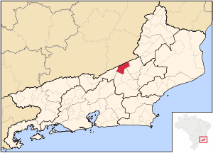 Location of Carmo in the state of Rio de Janeiro | |||
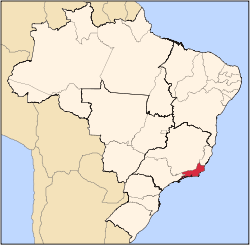
 Carmo Location of Carmo in Brazil | |||
| Coordinates: 21°56′02″S 42°36′32″W / 21.93389°S 42.60889°WCoordinates: 21°56′02″S 42°36′32″W / 21.93389°S 42.60889°W | |||
| Country |
| ||
| Region | Southeast | ||
| State |
| ||
| Government | |||
| • Prefeito | Paulo Cezar Gonçalves Ladeira (PSB) | ||
| Area | |||
| • Total | 321.187 km2 (124.011 sq mi) | ||
| Elevation | 347 m (1,138 ft) | ||
| Population (2010) | |||
| • Total | 17,439 | ||
| Time zone | UTC-3 (UTC-3) | ||
| Website | |||


Carmo (Portuguese pronunciation: [ˈkaʁmu]) is a municipality in the Brazilian state of Rio de Janeiro. Its nickname is the Cidade Bela (Beautiful City). [1]
Geography
Carmo encompasses an area of about 320 square kilometres (120 sq mi).
Its current population is estimated to be more than 17000 inhabitants, of which 72.3% live in the suburban area.
The municipality neighbors Sumidouro, Cantagalo, Duas Barras, Sapucaia, as well as bordering Além Paraíba.
Part of the city is situated in the basin of the Paquequer River, one of the last tributaries of the Paraíba do Sul that has little aquatic pollution.
References
Capital: Rio de Janeiro | |||||||||||
| Mesoregion Baixadas |
|  | |||||||||
| Mesoregion Centro Fluminense |
| ||||||||||
| Mesoregion Metropolitana do Rio de Janeiro |
| ||||||||||
| Mesoregion Noroeste Fluminense |
| ||||||||||
| Mesoregion Norte Fluminense |
| ||||||||||
| Mesoregion Sul Fluminense |
| ||||||||||
This article is issued from
Wikipedia.
The text is licensed under Creative Commons - Attribution - Sharealike.
Additional terms may apply for the media files.