Nagbukel
| Nagbukel | ||
|---|---|---|
| Municipality | ||
| Municipality of Nagbukel | ||
| ||
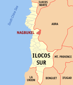 Map of Ilocos Sur with Nagbukel highlighted | ||
.svg.png) Nagbukel Location within the Philippines | ||
| Coordinates: 17°27′N 120°33′E / 17.45°N 120.55°ECoordinates: 17°27′N 120°33′E / 17.45°N 120.55°E | ||
| Country |
| |
| Region | Ilocos Region (Region I) | |
| Province | Ilocos Sur | |
| District | 2nd District | |
| Barangays | 12 (see Barangays) | |
| Government [1] | ||
| • Type | Sangguniang Bayan | |
| • Mayor | Timoteo M. Cabrera | |
| • Electorate | 3,953 voters (2016) | |
| Area [2] | ||
| • Total | 43.12 km2 (16.65 sq mi) | |
| Population (2015 census)[3] | ||
| • Total | 5,259 | |
| • Density | 120/km2 (320/sq mi) | |
| Time zone | UTC+8 (PST) | |
| ZIP code | 2725 | |
| PSGC | 012913000 | |
| IDD : area code | +63 (0)77 | |
| Climate type | Tropical monsoon climate | |
| Income class | 5th municipal income class | |
| Revenue (₱) | 37,623,073.52 (2016) | |
| Native languages |
Ilocano Tagalog | |
| Website |
www | |

Nagbukel, officially the Municipality of Nagbukel, is a 5th class municipality in the province of Ilocos Sur, Philippines. According to the 2015 census, it has a population of 5,259 people.[3]
Barangays
Nagbukel is politically subdivided into 12 barangays. [2]
- Balaweg
- Bandril
- Bantugo
- Cadacad
- Casilagan
- Casocos
- Lapting
- Mapisi
- Mission
- Poblacion East
- Poblacion West
- Taleb
Etymology
The name of the municipality was thought to have come from the round shape of one of the hills in the area. People in the area would utter, "Anian nga nagbukel" (Ilocano meaning "How round it is.").
Another origin of the municipality's name comes from three small hills in the southern part of the municipality.
Another origin of the town's name comes from the irregular distribution of the barangays of Nagbukel and nearby Narvacan. Negotiations were made in such a way that the place east of the Kayapa River become part of Nagbukel and places west of the river become part of Narvacan. The distance from north to south was equal to the distance from east to west. The resulting area is round, hence the name "Nagbukel."
Demographics
| Population census of Nagbukel | ||
|---|---|---|
| Year | Pop. | ±% p.a. |
| 1918 | 1,979 | — |
| 1939 | 2,497 | +1.11% |
| 1948 | 2,345 | −0.70% |
| 1960 | 2,874 | +1.71% |
| 1970 | 2,978 | +0.36% |
| 1975 | 3,226 | +1.62% |
| 1980 | 3,539 | +1.87% |
| 1990 | 3,806 | +0.73% |
| 1995 | 4,124 | +1.51% |
| 2000 | 4,671 | +2.71% |
| 2007 | 4,764 | +0.27% |
| 2010 | 4,938 | +1.31% |
| 2015 | 5,259 | +1.21% |
| Source: Philippine Statistics Authority[3][4][5][6] | ||
In the 2015 census, the population of Nagbukel was 5,259 people,[3] with a density of 120 inhabitants per square kilometre or 310 inhabitants per square mile.
References
- ↑ "Municipality". Quezon City, Philippines: Department of the Interior and Local Government. Retrieved 31 May 2013.
- 1 2 "Province: Ilocos Sur". PSGC Interactive. Quezon City, Philippines: Philippine Statistics Authority. Retrieved 12 November 2016.
- 1 2 3 4 Census of Population (2015). "Region I (Ilocos Region)". Total Population by Province, City, Municipality and Barangay. PSA. Retrieved 20 June 2016.
- ↑ Census of Population and Housing (2010). "Region I (Ilocos Region)". Total Population by Province, City, Municipality and Barangay. NSO. Retrieved 29 June 2016.
- ↑ Censuses of Population (1903–2007). "Region I (Ilocos Region)". Table 1. Population Enumerated in Various Censuses by Province/Highly Urbanized City: 1903 to 2007. NSO.
- ↑ "Province of Ilocos Sur". Municipality Population Data. Local Water Utilities Administration Research Division. Retrieved 17 December 2016.
External links
- Pasyalang Ilocos Sur
- Philippine Standard Geographic Code
- Philippine Census Information
- Local Governance Performance Management System
Places adjacent to Nagbukel | |
|---|---|