Saint-Victor, Ardèche
| Saint-Victor | |
|---|---|
| Commune | |
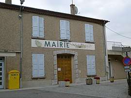 Town hall | |
 Saint-Victor Location within Auvergne-Rhône-Alpes region  Saint-Victor | |
| Coordinates: 45°06′06″N 4°40′23″E / 45.1017°N 4.6731°ECoordinates: 45°06′06″N 4°40′23″E / 45.1017°N 4.6731°E | |
| Country | France |
| Region | Auvergne-Rhône-Alpes |
| Department | Ardèche |
| Arrondissement | Tournon-sur-Rhône |
| Canton | Haut-Vivarais |
| Intercommunality | Pays de Saint-Félicien |
| Government | |
| • Mayor (2008–2014) | Daniel Jullien |
| Area1 | 31.88 km2 (12.31 sq mi) |
| Population (2008)2 | 932 |
| • Density | 29/km2 (76/sq mi) |
| Time zone | UTC+1 (CET) |
| • Summer (DST) | UTC+2 (CEST) |
| INSEE/Postal code | 07301 /07410 |
| Elevation |
240–881 m (787–2,890 ft) (avg. 620 m or 2,030 ft) |
|
1 French Land Register data, which excludes lakes, ponds, glaciers > 1 km2 (0.386 sq mi or 247 acres) and river estuaries. 2 Population without double counting: residents of multiple communes (e.g., students and military personnel) only counted once. | |
Saint-Victor is a commune in the Ardèche department in southern France.
Population
| Historical population | ||
|---|---|---|
| Year | Pop. | ±% |
| 1962 | 799 | — |
| 1968 | 917 | +14.8% |
| 1975 | 777 | −15.3% |
| 1982 | 796 | +2.4% |
| 1990 | 821 | +3.1% |
| 1999 | 828 | +0.9% |
| 2008 | 932 | +12.6% |
See also
References
| Wikimedia Commons has media related to Saint-Victor, Ardèche. |
This article is issued from
Wikipedia.
The text is licensed under Creative Commons - Attribution - Sharealike.
Additional terms may apply for the media files.