Lachapelle-sous-Aubenas
| Lachapelle-sous-Aubenas | |
|---|---|
| Commune | |
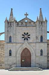 The church in Lachapelle-sous-Aubenas | |
 Lachapelle-sous-Aubenas Location within Auvergne-Rhône-Alpes region  Lachapelle-sous-Aubenas | |
| Coordinates: 44°33′54″N 4°21′53″E / 44.565°N 4.3647°ECoordinates: 44°33′54″N 4°21′53″E / 44.565°N 4.3647°E | |
| Country | France |
| Region | Auvergne-Rhône-Alpes |
| Department | Ardèche |
| Arrondissement | Largentière |
| Canton | Aubenas-2 |
| Intercommunality | Vinobre |
| Government | |
| • Mayor (2008–2014) | Roland Chambon |
| Area1 | 10.12 km2 (3.91 sq mi) |
| Population (2008)2 | 1,430 |
| • Density | 140/km2 (370/sq mi) |
| Time zone | UTC+1 (CET) |
| • Summer (DST) | UTC+2 (CEST) |
| INSEE/Postal code | 07122 /07200 |
| Elevation |
178–449 m (584–1,473 ft) (avg. 205 m or 673 ft) |
|
1 French Land Register data, which excludes lakes, ponds, glaciers > 1 km2 (0.386 sq mi or 247 acres) and river estuaries. 2 Population without double counting: residents of multiple communes (e.g., students and military personnel) only counted once. | |
Lachapelle-sous-Aubenas is a commune in the Ardèche department in southern France.
Population
| Historical population | ||
|---|---|---|
| Year | Pop. | ±% |
| 1962 | 442 | — |
| 1968 | 511 | +15.6% |
| 1975 | 631 | +23.5% |
| 1982 | 840 | +33.1% |
| 1990 | 1,107 | +31.8% |
| 1999 | 1,259 | +13.7% |
| 2008 | 1,430 | +13.6% |
See also
References
| Wikimedia Commons has media related to Lachapelle-sous-Aubenas. |
This article is issued from
Wikipedia.
The text is licensed under Creative Commons - Attribution - Sharealike.
Additional terms may apply for the media files.