Sceautres
| Sceautres | |
|---|---|
| Commune | |
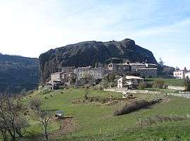 A general view of Sceautres | |
 Sceautres Location within Auvergne-Rhône-Alpes region  Sceautres | |
| Coordinates: 44°37′01″N 4°36′33″E / 44.6169°N 4.6092°ECoordinates: 44°37′01″N 4°36′33″E / 44.6169°N 4.6092°E | |
| Country | France |
| Region | Auvergne-Rhône-Alpes |
| Department | Ardèche |
| Arrondissement | Largentière |
| Canton | Berg-Helvie |
| Intercommunality | Berg et Coiron |
| Government | |
| • Mayor (2008–2014) | Laurent Turrell |
| Area1 | 14.64 km2 (5.65 sq mi) |
| Population (2008)2 | 141 |
| • Density | 9.6/km2 (25/sq mi) |
| Time zone | UTC+1 (CET) |
| • Summer (DST) | UTC+2 (CEST) |
| INSEE/Postal code | 07311 /07400 |
| Elevation |
292–703 m (958–2,306 ft) (avg. 430 m or 1,410 ft) |
|
1 French Land Register data, which excludes lakes, ponds, glaciers > 1 km2 (0.386 sq mi or 247 acres) and river estuaries. 2 Population without double counting: residents of multiple communes (e.g., students and military personnel) only counted once. | |
Sceautres is a commune in the Ardèche department in southern France.
Population
| Historical population | ||
|---|---|---|
| Year | Pop. | ±% |
| 1962 | 90 | — |
| 1968 | 125 | +38.9% |
| 1975 | 110 | −12.0% |
| 1982 | 96 | −12.7% |
| 1990 | 96 | +0.0% |
| 1999 | 104 | +8.3% |
| 2008 | 141 | +35.6% |
See also
References
| Wikimedia Commons has media related to Sceautres. |
This article is issued from
Wikipedia.
The text is licensed under Creative Commons - Attribution - Sharealike.
Additional terms may apply for the media files.