Saint-Alban-Auriolles
| Saint-Alban-Auriolles | |
|---|---|
| Commune | |
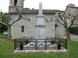 The war memorial in Auriolles | |
 Saint-Alban-Auriolles Location within Auvergne-Rhône-Alpes region  Saint-Alban-Auriolles | |
| Coordinates: 44°25′37″N 4°17′59″E / 44.4269°N 4.2997°ECoordinates: 44°25′37″N 4°17′59″E / 44.4269°N 4.2997°E | |
| Country | France |
| Region | Auvergne-Rhône-Alpes |
| Department | Ardèche |
| Arrondissement | Largentière |
| Canton | Vallon-Pont-d'Arc |
| Government | |
| • Mayor (2008–2014) | Max Thibon |
| Area1 | 17.57 km2 (6.78 sq mi) |
| Population (2008)2 | 952 |
| • Density | 54/km2 (140/sq mi) |
| Time zone | UTC+1 (CET) |
| • Summer (DST) | UTC+2 (CEST) |
| INSEE/Postal code | 07207 /07120 |
| Elevation |
92–254 m (302–833 ft) (avg. 108 m or 354 ft) |
|
1 French Land Register data, which excludes lakes, ponds, glaciers > 1 km2 (0.386 sq mi or 247 acres) and river estuaries. 2 Population without double counting: residents of multiple communes (e.g., students and military personnel) only counted once. | |
Saint-Alban-Auriolles is a commune in the Ardèche department in southern France.
Geography
Population
| Historical population | ||
|---|---|---|
| Year | Pop. | ±% |
| 1962 | 494 | — |
| 1968 | 504 | +2.0% |
| 1975 | 513 | +1.8% |
| 1982 | 542 | +5.7% |
| 1990 | 584 | +7.7% |
| 1999 | 736 | +26.0% |
| 2008 | 952 | +29.3% |
See also
References
| Wikimedia Commons has media related to Saint-Alban-Auriolles. |
This article is issued from
Wikipedia.
The text is licensed under Creative Commons - Attribution - Sharealike.
Additional terms may apply for the media files.