Arrondissement of Le Puy-en-Velay
| Le Puy-en-Velay | |
|---|---|
| Arrondissement | |
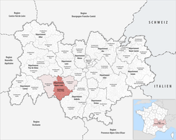 Location of the arrondissement in Auvergne-Rhône-Alpes | |
| Country | France |
| Region | Auvergne-Rhône-Alpes |
| Department | Haute-Loire |
| Communes | 102 |
| Subprefecture | Le Puy-en-Velay |
| Area¹ | |
| • Total | 1,931 km2 (746 sq mi) |
| Population (2013) | |
| • Total | 95,979 |
| • Density | 50/km2 (130/sq mi) |
| ¹ French Land Register data, which exclude lakes, ponds, and glaciers larger than 1 km² as well as the estuaries of rivers. | |
The arrondissement of Le Puy-en-Velay is an arrondissement of France in the Haute-Loire department in the Auvergne-Rhône-Alpes region. It has 102 communes. In 2007 it lost the canton of Saugues to the arrondissement of Brioude.[1]
Composition
Cantons
The cantons of the arrondissement of Le Puy-en-Velay are:
Communes
The communes of the arrondissement of Le Puy-en-Velay, and their INSEE codes, are:[2]
- Aiguilhe (43002)
- Allègre (43003)
- Alleyrac (43004)
- Alleyras (43005)
- Arlempdes (43008)
- Arsac-en-Velay (43010)
- Bains (43018)
- Barges (43019)
- Beaulieu (43021)
- Beaune-sur-Arzon (43023)
- Bellevue-la-Montagne (43026)
- Blanzac (43030)
- Blavozy (43032)
- Borne (43036)
- Le Bouchet-Saint-Nicolas (43037)
- Le Brignon (43039)
- Brives-Charensac (43041)
- Cayres (43042)
- Céaux-d'Allègre (43043)
- Ceyssac (43045)
- Chadrac (43046)
- Chadron (43047)
- Chamalières-sur-Loire (43049)
- Champclause (43053)
- La Chapelle-Bertin (43057)
- Chaspinhac (43061)
- Chaspuzac (43062)
- Chaudeyrolles (43066)
- Chomelix (43071)
- Costaros (43077)
- Coubon (43078)
- Craponne-sur-Arzon (43080)
- Cussac-sur-Loire (43084)
- Espaly-Saint-Marcel (43089)
- Les Estables (43091)
- Fay-sur-Lignon (43092)
- Fix-Saint-Geneys (43095)
- Freycenet-la-Cuche (43097)
- Freycenet-la-Tour (43098)
- Goudet (43101)
- Jullianges (43108)
- Lafarre (43109)
- Landos (43111)
- Lantriac (43113)
- Laussonne (43115)
- Lavoûte-sur-Loire (43119)
- Lissac (43122)
- Loudes (43124)
- Malrevers (43126)
- Mézères (43134)
- Le Monastier-sur-Gazeille (43135)
- Monlet (43138)
- Le Monteil (43140)
- Montusclat (43143)
- Moudeyres (43144)
- Ouides (43145)
- Le Pertuis (43150)
- Polignac (43152)
- Pradelles (43154)
- Présailles (43156)
- Le Puy-en-Velay (43157)
- Queyrières (43158)
- Rauret (43160)
- Roche-en-Régnier (43164)
- Rosières (43165)
- Saint-Arcons-de-Barges (43168)
- Saint-Christophe-sur-Dolaison (43174)
- Saint-Étienne-du-Vigan (43180)
- Saint-Étienne-Lardeyrol (43181)
- Saint-Front (43186)
- Saint-Geneys-près-Saint-Paulien (43187)
- Saint-Georges-Lagricol (43189)
- Saint-Germain-Laprade (43190)
- Saint-Haon (43192)
- Saint-Hostien (43194)
- Saint-Jean-d'Aubrigoux (43196)
- Saint-Jean-de-Nay (43197)
- Saint-Jean-Lachalm (43198)
- Saint-Julien-Chapteuil (43200)
- Saint-Julien-d'Ance (43201)
- Saint-Martin-de-Fugères (43210)
- Saint-Paul-de-Tartas (43215)
- Saint-Paulien (43216)
- Saint-Pierre-du-Champ (43217)
- Saint-Pierre-Eynac (43218)
- Saint-Privat-d'Allier (43221)
- Saint-Victor-sur-Arlanc (43228)
- Saint-Vidal (43229)
- Saint-Vincent (43230)
- Salettes (43231)
- Sanssac-l'Église (43233)
- Séneujols (43238)
- Solignac-sur-Loire (43241)
- Vals-près-le-Puy (43251)
- Varennes-Saint-Honorat (43252)
- Les Vastres (43253)
- Vazeilles-Limandre (43254)
- Vergezac (43257)
- Vernassal (43259)
- Le Vernet (43260)
- Vielprat (43263)
- Vorey (43267)
References
- ↑ INSEE, Modifications territoriales
- ↑ INSEE Communes de l'arrondissement du Puy-en-Velay
External links
This article is issued from
Wikipedia.
The text is licensed under Creative Commons - Attribution - Sharealike.
Additional terms may apply for the media files.