Readingsburgh, New Jersey
| Readingsburgh, New Jersey | |
|---|---|
| Unincorporated community | |
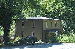 Old building in Readingsburgh | |
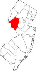
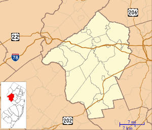 Readingsburgh, New Jersey Readingsburgh's location in Hunterdon County (Inset: Hunterdon County in New Jersey)  Readingsburgh, New Jersey Readingsburgh, New Jersey (New Jersey)  Readingsburgh, New Jersey Readingsburgh, New Jersey (the US) | |
| Coordinates: 40°40′55″N 74°52′37″W / 40.68194°N 74.87694°WCoordinates: 40°40′55″N 74°52′37″W / 40.68194°N 74.87694°W | |
| Country |
|
| State |
|
| County | Hunterdon |
| Township | Clinton |
| Elevation[1] | 97 m (318 ft) |
| Time zone | UTC-5 (Eastern (EST)) |
| • Summer (DST) | UTC-4 (EDT) |
| GNIS feature ID | 883138[1] |
|
Readingsburg Historic District | |
| NRHP reference # | 00000176[2] |
|---|---|
| Added to NRHP | March 3, 2000 |
Readingsburgh is an unincorporated community located within Clinton Township, in Hunterdon County, New Jersey, United States.[1][3][4]
The community is centered at County Route 639 at the intersection of River Road and Cokesbury Road, and is located 3.6 miles (5.8 km) northeast of Spruce Run Reservoir and 4.5 miles (7.2 km) east-southeast of Hampton.[5]
References
- 1 2 3 Feature Detail Report for: Readingsburgh, Geographic Names Information System. Accessed January 1, 2015.
- ↑ National Park Service (2009-03-13). "National Register Information System". National Register of Historic Places. National Park Service.
- ↑ Locality Search, State of New Jersey. Accessed January 1, 2015.
- ↑ Areas covering the point (-74.876944,40.681944), MapIt. Accessed January 2, 2015.
- ↑ N 40.68194 W 74.87694, ACME Mapper. Accessed January 2, 2015.
| Topics | 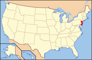 | ||
|---|---|---|---|
| Lists by county | |||
| Lists by city |
| ||
| Other lists | |||
| |||
This article is issued from
Wikipedia.
The text is licensed under Creative Commons - Attribution - Sharealike.
Additional terms may apply for the media files.