National Register of Historic Places listings in Morris County, New Jersey
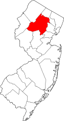
Location of Morris County in New Jersey
List of the National Register of Historic Places listings in Morris County, New Jersey
| Atlantic - Bergen - Burlington - Camden - Cape May - Cumberland - Essex - Gloucester - Hudson - Hunterdon - Mercer - Middlesex - Monmouth - Morris - Ocean - Passaic - Salem - Somerset - Sussex - Union - Warren |
This is intended to be a complete list of properties and districts listed on the National Register of Historic Places in Morris County, New Jersey. The locations of National Register properties and districts (at least for all showing latitude and longitude coordinates below) may be seen in an online map by clicking on "Map of all coordinates".[1]
- This National Park Service list is complete through NPS recent listings posted October 11, 2018.[2]
| [3] | Name on the Register[4] | Image | Date listed[5] | Location | City or town | Description |
|---|---|---|---|---|---|---|
| 1 | Acorn Hall | 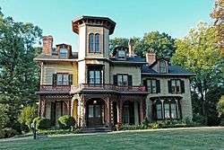 |
April 3, 1973 (#73001124) |
68 Morris Ave. 40°47′48″N 74°27′38″W / 40.796667°N 74.460556°W |
Morristown | |
| 2 | Alnwick Hall | 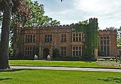 |
April 11, 1985 (#85000783) |
355 Madison Ave. 40°46′51″N 74°27′03″W / 40.780833°N 74.450833°W |
Morris Township | |
| 3 | Anthony-Corwin Farm | 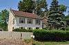 |
May 1, 1992 (#92000371) |
244 W. Mill Rd., Washington Township 40°46′14″N 74°48′19″W / 40.770556°N 74.805278°W |
Long Valley | part of the Stone Houses and Outbuildings in Washington Township Multiple Property Submission (MPS) |
| 4 | Ayres' Farm | 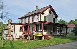 |
May 29, 1998 (#98000598) |
25 Cooper Rd. 40°52′02″N 74°30′15″W / 40.867222°N 74.504167°W |
Denville | |
| 5 | Baker Building | 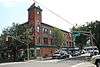 |
July 1, 1981 (#81000396) |
16 W. Blackwell St. S4703 40°53′02″N 74°33′35″W / 40.883889°N 74.559722°W |
Dover | |
| 6 | Martin Berry House | 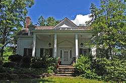 |
June 19, 1973 (#73001129) |
581 NJ 23 at Jackson Ave. 40°58′09″N 74°17′12″W / 40.969167°N 74.286667°W |
Pompton Plains | |
| 7 | Beverwyck Site |  |
May 14, 2004 (#04000430) |
Southeast of the junction of US 46 and S. Beverwyck Rd. 40°51′41″N 74°23′03″W / 40.861389°N 74.384167°W |
Parsippany-Troy Hills | |
| 8 | Blackwell Street Historic District |  |
May 21, 1982 (#82003287) |
Blackwell and Sussex Sts. 40°53′04″N 74°33′34″W / 40.884444°N 74.559444°W |
Dover | |
| 9 | Boisaubin Manor | 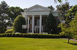 |
October 22, 1976 (#76001175) |
Southeast of Morristown on Treadwell Ave. 40°46′03″N 74°26′37″W / 40.7675°N 74.443611°W |
Morristown | |
| 10 | Boonton Historic District | 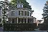 |
September 29, 1980 (#80002509) |
Main, Church, Birch, Cornelia and Cedar Sts. 40°54′25″N 74°24′42″W / 40.906944°N 74.411667°W |
Boonton | |
| 11 | Boonton Public Library | 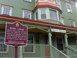 |
November 13, 1972 (#72000804) |
619 Main St. 40°54′19″N 74°24′40″W / 40.905278°N 74.411111°W |
Boonton | |
| 12 | Bottle Hill Historic District | 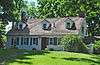 |
June 16, 2005 (#05000614) |
James Park, 1-105 Ridgedale ave. 40°45′57″N 74°24′54″W / 40.765833°N 74.415°W |
Madison | |
| 13 | David S. Bower House | November 30, 1982 (#82001045) |
427 Main St. 40°44′33″N 74°23′26″W / 40.7425°N 74.390556°W |
Chatham | Probably demolished. | |
| 14 | Bowers-Livingston-Osborn House | 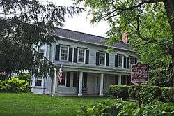 |
June 19, 1973 (#73001128) |
25 Parsippany Rd. 40°51′53″N 74°25′36″W / 40.864722°N 74.426667°W |
Parsippany | |
| 15 | Bowlsby-Degelleke House | 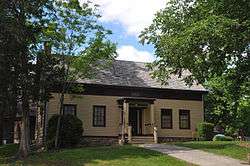 |
December 15, 1978 (#78001784) |
Northwest of Parsippany at 320 Baldwin Rd. 40°52′07″N 74°23′46″W / 40.868611°N 74.396111°W |
Parsippany | |
| 16 | Boyle/Hudspeth-Benson House | 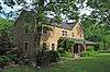 |
February 10, 1975 (#75001151) |
100 Basking Ridge Rd. 40°40′45″N 74°31′22″W / 40.679281°N 74.522722°W |
Millington | |
| 17 | Brookside | %2C_MENDHAM_TOWNSHIP%2C_MORRIS_COUNTY.jpg) |
February 16, 1996 (#96000041) |
Bounded by Tingley Rd., E. and W. Main Sts., Cold Hill Rd. and Cherry Ln., Mendham Township 40°47′34″N 74°34′04″W / 40.792778°N 74.567778°W |
Brookside | |
| 18 | Dr. Jabez Campfield House | 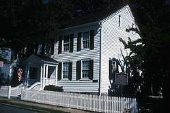 |
September 4, 2008 (#08000837) |
5 Olyphant Pl. 40°47′50″N 74°28′21″W / 40.797108°N 74.472506°W |
Morristown | |
| 19 | Lewis Carey Farmhouse | 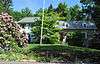 |
July 20, 1977 (#77000893) |
208 Emmans Rd. 40°51′38″N 74°40′48″W / 40.860556°N 74.68°W |
Flanders | |
| 20 | Cary Station | 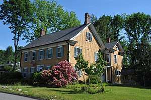 |
September 5, 1985 (#85002005) |
239 Emmans Rd. 40°51′25″N 74°41′25″W / 40.856944°N 74.690278°W |
Ledgewood | |
| 21 | Stephen Cary House | 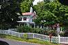 |
July 27, 1989 (#89000995) |
Mountainside Rd. 40°47′26″N 74°35′56″W / 40.790556°N 74.598889°W |
Mendham | |
| 22 | George Chamberlain House | 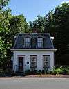 |
December 2, 2009 (#09000973) |
315 Dover-Milton Rd. 41°01′12″N 74°31′40″W / 41.020097°N 74.527797°W |
Jefferson Township | |
| 23 | Chester House Inn | 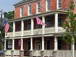 |
July 18, 1974 (#74001183) |
Main St. and Hillside Rd. 40°47′11″N 74°41′43″W / 40.786389°N 74.695278°W |
Chester | |
| 24 | The Church in the Glen | 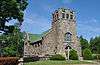 |
January 2, 2013 (#12001127) |
2 Ledgewood Ave. 40°54′05″N 74°42′18″W / 40.90143°N 74.70512°W |
Netcong | |
| 25 | Combs Hollow | 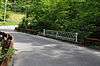 |
February 16, 1996 (#96000042) |
Junction of Combs Ave. and Combs Hollow Rd., south of Doby Rd., Randolph and Mendham Townships 40°48′33″N 74°36′55″W / 40.809167°N 74.615278°W |
Mount Freedom | |
| 26 | Community of St John Baptist | 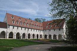 |
April 24, 2007 (#07000356) |
82 W. Main St. 40°46′26″N 74°36′54″W / 40.773814°N 74.614872°W |
Mendham | |
| 27 | Dr. Lewis Condict House |  |
April 3, 1973 (#73001125) |
51 South St. 40°47′23″N 74°28′50″W / 40.789722°N 74.480556°W |
Morristown | |
| 28 | Stephen Condit House |  |
February 15, 1974 (#74001187) |
Northeast of Parsippany on Beverwyck Rd. off U.S. 46 40°51′51″N 74°23′04″W / 40.864167°N 74.384444°W |
Parsippany | |
| 29 | Ellis Cook House |  |
May 12, 1975 (#75001149) |
174 Mount Pleasant Ave. 40°48′06″N 74°21′52″W / 40.801667°N 74.364444°W |
East Hanover | |
| 30 | Gen. Nathan Cooper Mansion | 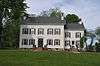 |
December 29, 1978 (#78001781) |
West of Mendham on NJ 24 40°46′45″N 74°40′04″W / 40.779167°N 74.667778°W |
Mendham | |
| 31 | Nathan Cooper Gristmill | 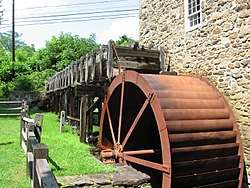 |
November 21, 1976 (#76001174) |
West of Chester at Hacklebarney Rd. and NJ 24 40°46′44″N 74°43′20″W / 40.778889°N 74.722222°W |
Chester | |
| 32 | Craft-Clausen House | 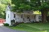 |
May 1, 1992 (#92000372) |
170 Fairmont Rd., Washington Township 40°46′06″N 74°46′07″W / 40.768333°N 74.768611°W |
Long Valley | part of the Stone Houses and Outbuildings in Washington Township MPS |
| 33 | Craftsman Farms |  |
April 10, 1989 (#85003730) |
Junction of NJ 10 and Manor Ln. 40°51′22″N 74°28′52″W / 40.856111°N 74.481111°W |
Parsippany | Home to Gustav Stickley and other artists and artisans of the Arts and Crafts Movement in the early 20th century |
| 34 | Cutler Homestead | 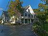 |
March 10, 1975 (#75001152) |
21 Cutler St. 40°48′28″N 74°29′04″W / 40.807778°N 74.484444°W |
Morristown | |
| 35 | Davenport-Demarest House | 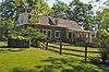 |
January 17, 1992 (#91001934) |
140 Changebridge Rd. 40°53′38″N 74°22′00″W / 40.893889°N 74.366667°W |
Montville | part of the Dutch Stone Houses in Montville MPS |
| 36 | Decker-Kincaid Homestead | 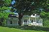 |
March 9, 2005 (#05000126) |
591 Powerville Rd. 40°57′26″N 74°24′38″W / 40.957222°N 74.410556°W |
Boonton | |
| 37 | Delaware, Lackawanna and Western Railroad Station |  |
March 11, 1980 (#80002514) |
132 Morris St. 40°47′50″N 74°28′29″W / 40.797222°N 74.474722°W |
Morristown | 1913 Renaissance Revival station in use ever since. Some scenese from Cyndi Lauper's "Time After Time" video shot here. |
| 38 | Delaware, Lackawanna and Western Railroad Station | 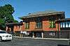 |
July 13, 1977 (#77000889) |
Myrtle Ave., Main, and Division Sts. 40°54′14″N 74°24′23″W / 40.903889°N 74.406389°W |
Boonton | |
| 39 | Delaware, Lackawanna and Western Railroad Station | 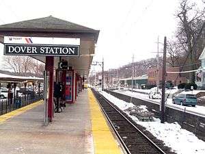 |
May 23, 1980 (#80002511) |
N. Dickerson St. 40°53′01″N 74°33′20″W / 40.883611°N 74.555556°W |
Dover | |
| 40 | James Dixon Farm | 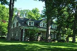 |
August 29, 1977 (#77000890) |
Northwest of Boonton on Rockaway Valley Rd. 40°55′58″N 74°26′22″W / 40.932778°N 74.439444°W |
Boonton | |
| 41 | John Dod House and Tavern |  |
August 12, 1977 (#77000895) |
11 Highland St. and 8 Chapel Hill Rd. 40°55′04″N 74°18′07″W / 40.917778°N 74.301944°W |
Lincoln Park | |
| 42 | Doremus House |  |
October 31, 1972 (#72000805) |
490 Main Rd. 40°55′11″N 74°21′16″W / 40.919722°N 74.354444°W |
Towaco | part of the Dutch Stone Houses in Montville MPS |
| 43 | Dusenberry House | 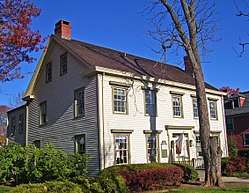 |
November 1, 1979 (#79001515) |
186 Main St 40°44′23″N 74°22′50″W / 40.739722°N 74.380556°W |
Chatham | Mid-19th century home of local pastor |
| 44 | Fairmount Historic District | 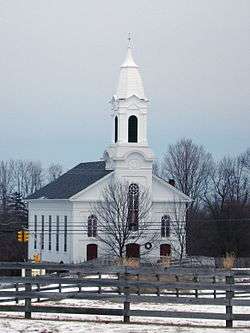 |
December 20, 1996 (#96001470) |
Roughly, NJ 517 from the Morris-Hunterdon Co. line to NJ 512 and NJ 517 from Fox Hill to Wildwood Rds. 40°43′08″N 74°46′34″W / 40.718889°N 74.776111°W |
Califon | |
| 45 | First Congregational Church | 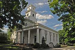 |
August 10, 1977 (#77000892) |
Hillside Rd. 40°47′14″N 74°41′48″W / 40.787222°N 74.696667°W |
Chester | |
| 46 | First Presbyterian Church of Hanover | 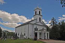 |
November 10, 1977 (#77000896) |
Mount Pleasant and Hanover Aves. 40°48′13″N 74°22′07″W / 40.803611°N 74.368611°W |
East Hanover | |
| 47 | First Reformed Church of Pompton Plains | 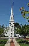 |
December 12, 2012 (#12001034) |
529 Newark-Pompton Turnpike 40°57′52″N 74°17′44″W / 40.96445°N 74.29552°W |
Pompton Plains | |
| 48 | Flock-Stephens Farmstead | 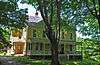 |
May 1, 1992 (#92000373) |
244 Flocktown Rd., Washington Township 40°49′16″N 74°46′47″W / 40.821111°N 74.779722°W |
Long Valley | part of the Stone Houses and Outbuildings in Washington Township MPS |
| 49 | Flocktown Schoolhouse | 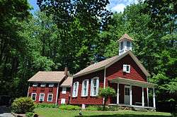 |
November 30, 1982 (#82001046) |
Flocktown and Naughright Rds. 40°48′57″N 74°47′13″W / 40.815833°N 74.786944°W |
Long Valley | |
| 50 | Samuel Ford, Jr.'s, Hammock Farm |  |
December 23, 1974 (#74001185) |
310 Columbia Turnpike 40°47′26″N 74°24′36″W / 40.790556°N 74.41°W |
Florham Park | |
| 51 | Ford-Faesch House | 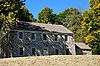 |
February 12, 1974 (#74001184) |
629 Mount Hope Road (N. of Mall) 40°55′42″N 74°32′36″W / 40.928333°N 74.543333°W |
Rockaway Township | |
| 52 | Fordville | 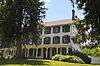 |
November 2, 1978 (#78001782) |
East of Morristown at 30 Ford Hill Rd. 40°48′18″N 74°26′05″W / 40.805°N 74.434722°W |
Morristown | |
| 53 | Fredericks House | 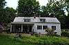 |
October 18, 1979 (#79003254) |
6 Duchess Dr. 40°58′27″N 74°22′03″W / 40.974167°N 74.3675°W |
Fayson Lakes | |
| 54 | Friends Meetinghouse | 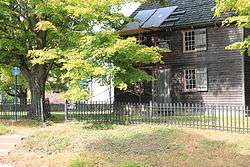 |
June 4, 1973 (#73001121) |
South of Dover at Quaker Ave. and Quaker Church Rd., near NJ 10 40°51′54″N 74°34′11″W / 40.865°N 74.569722°W |
Dover | |
| 55 | German Valley Historic District | 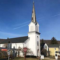 |
July 14, 1983 (#83001606) |
NJ 24, Fairmount and Fairview Roads 40°47′05″N 74°46′48″W / 40.784722°N 74.780000°W |
Long Valley | |
| 56 | Gibbons Mansion | 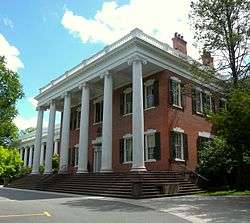 |
August 10, 1977 (#77000897) |
36 Madison Ave. 40°45′44″N 74°25′31″W / 40.762222°N 74.425278°W |
Madison | |
| 57 | William Gibbons Stable and Farm |  |
March 30, 2005 (#05000222) |
Loantaka Way 40°44′55″N 74°26′42″W / 40.748611°N 74.445°W |
Chatham Township | |
| 58 | Glanville Blacksmith Shop |  |
March 25, 1987 (#86003112) |
47 Bank St. 40°47′43″N 74°29′01″W / 40.795278°N 74.483611°W |
Morristown | part of the Morristown Multiple Resource Area (MRA) |
| 59 | Glynallen | 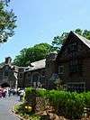 |
March 9, 1987 (#87000354) |
Canfield Rd. 40°46′26″N 74°26′48″W / 40.773889°N 74.446667°W |
Morristown | |
| 60 | Grimes Homestead |  |
April 1, 1977 (#77000900) |
45 Bloomfield Ave. 40°52′32″N 74°26′15″W / 40.875556°N 74.4375°W |
Mountain Lakes | |
| 61 | Rev. John Hancock House, Cider Mill and Cemetery |  |
August 30, 1984 (#84002761) |
45 Ridgedale Ave. 40°46′29″N 74°24′07″W / 40.774722°N 74.401944°W |
Florham Park | |
| 62 | Hanover Village Historic District |  |
September 13, 1993 (#93000901) |
Area surrounding Hanover Rd. and Mount Pleasant Ave., East Hanover Township 40°48′00″N 74°21′59″W / 40.8°N 74.366389°W |
East Hanover | |
| 63 | Hartley Farms | 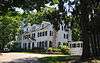 |
July 19, 1991 (#91000888) |
Junction of Spring Valley and Blue Mill Rds., Harding Township 40°45′16″N 74°27′38″W / 40.754444°N 74.460556°W |
Morristown | |
| 64 | Benjamin Howell Homestead | 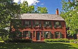 |
October 19, 1978 (#78001786) |
709 S. Beverwyck Rd. 40°50′49″N 74°23′33″W / 40.846944°N 74.3925°W |
Parsippany | |
| 65 | Illumination Gas Plant of the New Jersey State Asylum for the Insane at Morris Plains |  |
June 9, 2000 (#00000653) |
Old Dover Rd. 40°50′10″N 74°30′03″W / 40.836111°N 74.500833°W |
Parsippany | |
| 66 | Joseph Jackson House |  |
March 4, 1975 (#75001155) |
82 E. Main St. 40°53′56″N 74°30′36″W / 40.898889°N 74.51°W |
Rockaway | |
| 67 | Jenkins-Mead House |  |
March 10, 1997 (#97000106) |
14 Revere Rd. 40°47′23″N 74°28′10″W / 40.789664°N 74.469572°W |
Morristown | |
| 68 | Peter Kemble House |  |
August 26, 1980 (#80002510) |
Old Camp Rd. and Mount Kemble Ave. 40°45′30″N 74°31′27″W / 40.758333°N 74.524167°W |
Chatham | |
| 69 | King Store and Homestead |  |
April 29, 1994 (#94000393) |
211 Main St., Roxbury Township 40°52′42″N 74°39′08″W / 40.878333°N 74.652222°W |
Ledgewood | |
| 70 | Lake Hopatcong Yacht Club | 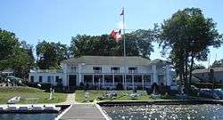 |
August 12, 1999 (#99000904) |
N. Bertrand Rd. and Willow St. 40°55′43″N 74°38′59″W / 40.928475°N 74.649722°W |
Mount Arlington | |
| 71 | Ledgewood Historic District | April 18, 2013 (#13000202) |
Main and Canal Sts., Circle Dr., and Emmans and Mountain Rds. 40°52′45″N 74°39′09″W / 40.879167°N 74.652500°W |
Ledgewood | ||
| 72 | Lindenwold | 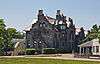 |
November 13, 1986 (#86003113) |
247 South St. 40°47′40″N 74°29′04″W / 40.794444°N 74.484444°W |
Morristown | part of the Morristown MRA |
| 73 | Little Red Schoolhouse | 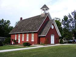 |
June 6, 1986 (#73001122) |
203 Ridgedale Ave. 40°47′17″N 74°23′26″W / 40.788056°N 74.390556°W |
Florham Park | |
| 74 | Effingham Low House | 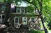 |
January 17, 1992 (#91001930) |
102 Hook Mountain Rd., Montville Township 40°52′37″N 74°20′18″W / 40.876944°N 74.338333°W |
Pine Brook | part of the Dutch Stone Houses in Montville MPS |
| 75 | Madison Civic Commercial District | 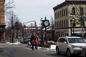 |
October 18, 1991 (#89002115) |
Roughly Main St., Waverly Pl., Lincoln Pl., Prospect St., Kings Rd., Green Ave., Wilmer St., and Green Village Rd. 40°45′29″N 74°25′00″W / 40.758056°N 74.416667°W |
Madison | Downtown core of Madison from late 19th century |
| 76 | Madison Masonic Lodge |  |
January 17, 2008 (#07001405) |
170 Main St. 40°45′25″N 74°24′31″W / 40.756944°N 74.408611°W |
Madison | |
| 77 | Madison Public Library and the James Building |  |
February 8, 1980 (#80002512) |
Main St. and Green Village Rd. 40°45′35″N 74°25′03″W / 40.759722°N 74.4175°W |
Madison | |
| 78 | Madison Station |  |
June 22, 1984 (#84002764) |
Kings Rd. 40°45′25″N 74°24′58″W / 40.756944°N 74.416111°W |
Madison | 1916 stone Gothic Revival building; part of the Operating Passenger Railroad Stations TR |
| 79 | Mendham Historic District |  |
April 18, 1985 (#85000865) |
Roughly bounded by Halstead St. and Country Ln. on W. and E. Main St., Mountain Ave., Hilltop Rd. and Prospect St.; also E. & W. Main Sts., Peacock Ln., Hampton St., Hilltop & Talmage Rds. 40°46′32″N 74°36′00″W / 40.775556°N 74.6°W |
Mendham | second address listing represents a boundary increase 11/19/14. |
| 80 | Merchiston Farm |  |
November 13, 1989 (#89001946) |
170 Longview Road 40°43′53″N 74°42′26″W / 40.731389°N 74.707222°W |
Chester Township | Home to landscape architect Martha Brookes Hutcheson, now the Bamboo Brook Outdoor Education Center |
| 81 | Methodist Episcopal Church |  |
May 2, 2008 (#08000364) |
24 Madison Ave. 40°45′48″N 74°25′22″W / 40.763333°N 74.422778°W |
Madison | |
| 82 | Methodist Episcopal Church of Hibernia |  |
July 14, 2011 (#11000448) |
419 Green Pond Rd. 40°56′44″N 74°29′40″W / 40.945556°N 74.494444°W |
Hibernia | |
| 83 | Middle Valley Historic District |  |
September 25, 1990 (#89002353) |
Along W. Mill Rd. and Middle Valley Rd. south of Beacon Rd. 40°45′29″N 74°49′01″W / 40.758056°N 74.816944°W |
Long Valley | |
| 84 | Miller-Rinehard Farmstead |  |
February 1, 2006 (#05001569) |
72 Hacklebarney Rd. 40°45′18″N 74°44′40″W / 40.755°N 74.744444°W |
Washington Township | |
| 85 | Miller-Kingsland House |  |
July 24, 1973 (#73001120) |
Vreeland Ave., 900 feet (270 m) west of Montville Township boundary 40°54′02″N 74°23′13″W / 40.900556°N 74.386944°W |
Boonton | |
| 86 | Millington Schoolhouse |  |
March 12, 2012 (#12000109) |
1802 Long Hill Rd. (Long Hill Township) 40°40′38″N 74°31′05″W / 40.677099°N 74.518023°W |
Millington | |
| 87 | Millington Station |  |
June 22, 1984 (#84002767) |
Long Hill Rd. 40°40′24″N 74°31′26″W / 40.673333°N 74.523889°W |
Millington | part of the Operating Passenger Railroad Stations TR |
| 88 | Timothy Mills House |  |
February 24, 1975 (#75001153) |
27 Mills St. 40°48′05″N 74°29′24″W / 40.801389°N 74.49°W |
Morristown | |
| 89 | Montville Schoolhouse | 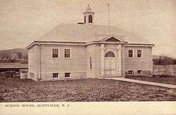 |
December 11, 2009 (#09001075) |
6 Taylortown 40°54′57″N 74°23′03″W / 40.915739°N 74.384239°W |
Montville | |
| 90 | Morris Canal | 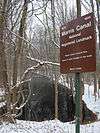 |
October 1, 1974 (#74002228) |
Irregular line beginning at Phillipsburg and ending at Jersey City 40°41′08″N 75°09′49″W / 40.685556°N 75.163611°W |
Not Applicable | |
| 91 | Morris County Courthouse | 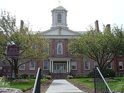 |
August 19, 1977 (#77000898) |
Washington St. between Court St. and Western Ave. 40°47′51″N 74°29′05″W / 40.7975°N 74.484722°W |
Morristown | |
| 92 | Morris Plains Station | 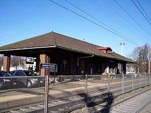 |
June 22, 1984 (#84002780) |
Speedwell Ave. 40°49′42″N 74°28′44″W / 40.828333°N 74.478889°W |
Morris Plains | part of the Operating Passenger Railroad Stations TR |
| 93 | Morristown and Erie Railroad Whippany Water Tank | 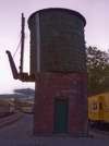 |
September 6, 2006 (#06000762) |
1 RR Plaza, NJ 10 W and Whippany Rd. 40°49′31″N 74°24′46″W / 40.825278°N 74.412778°W |
Hanover Township | |
| 94 | Morristown District | 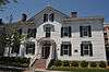 |
October 30, 1973 (#73001126) |
Roughly bounded by the cemetery, King Pl., Madison and Colles Aves., DeHart St., and N. Park Pl. • Morristown Historic District boundary increase (listed November 13, 1986, refnum 86003109): Irregularly bounded by Lackawanna, Franklin Pl., James, Ogden Pl., Doughty, Mt. Kemble, Western, and Speedwell 40°47′38″N 74°28′51″W / 40.793889°N 74.480833°W |
Morristown | |
| 95 | Morristown National Historical Park | 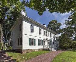 |
October 15, 1966 (#66000053) |
At junction of U.S. 202 and NJ 24 40°47′47″N 74°28′00″W / 40.796389°N 74.466667°W |
Morristown | Includes the Ford Mansion, Fort Nonsense, Jockey Hollow and New Jersey Brigade Encampment Site |
| 96 | Morristown School |  |
February 28, 1996 (#96000047) |
Junction of Whippany Rd. and Hanover Ave., Morris Township 40°48′13″N 74°26′58″W / 40.803611°N 74.449444°W |
Morristown | |
| 97 | Mott Hollow |  |
August 31, 1992 (#92001085) |
Roughly, Gristmill Rd. from Millbrook Ave. to Zandep Ln. and adjacent area along Millbrook, Randolph Township 40°51′43″N 74°33′07″W / 40.861944°N 74.551944°W |
Millbrook | |
| 98 | Mount Arlington Historic District | 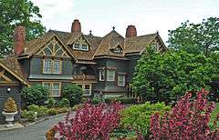 |
August 26, 1983 (#83001607) |
Howard Blvd., Edgemere and Windemere Aves. 40°55′56″N 74°37′58″W / 40.932222°N 74.632778°W |
Mount Arlington | |
| 99 | Mount Freedom Presbyterian Church | 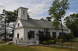 |
October 11, 1991 (#91001484) |
Junction of Sussex Turnpike and Church Rd., Randolph Township 40°49′38″N 74°34′56″W / 40.827222°N 74.582222°W |
Mount Freedom | |
| 100 | Mount Hope Miners' Church | 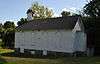 |
August 20, 2012 (#12000530) |
Mount Hope Rd. 40°55′42″N 74°32′39″W / 40.92834°N 74.544174°W |
Rockaway Township | |
| 101 | Mount Kemble Home |  |
November 13, 1986 (#86003115) |
1 Mt. Kemble Ave. 40°47′40″N 74°29′04″W / 40.794444°N 74.484444°W |
Morristown | part of the Morristown MRA |
| 102 | Mount Olive Village Historic District | 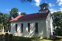 |
August 3, 2015 (#15000490) |
Mount Olive Road and Flanders-Drakestown Road 40°51′04″N 74°44′00″W / 40.851111°N 74.733333°W |
Mount Olive Township | |
| 103 | Mount Tabor Historic District |  |
March 3, 2015 (#15000051) |
Roughly bounded by Tabor & Dickerson Rds., Simpson & Ridgewood Aves. & Mount Tabor Golf Course 40°52′21″N 74°28′42″W / 40.8724°N 74.4782°W |
Parsippany-Troy Hills | |
| 104 | Mountain Lakes Historic District |  |
September 7, 2005 (#05000963) |
Roughly bounded by Pocono Rd., Denville Township line, Fanny Rd., and RR Tracks 40°53′41″N 74°26′22″W / 40.894722°N 74.439444°W |
Mountain Lakes | |
| 105 | Thomas Nast Home |  |
October 15, 1966 (#66000470) |
MacCulloch Ave. and Miller Rd. 40°47′30″N 74°28′52″W / 40.791667°N 74.481111°W |
Morristown | Home of influential political cartoonist Thomas Nast for much of his career |
| 106 | Jacob Wise (J. W.) Neighbor House | _NEIGHBOR_HOUSE%2C_LONG_VALLEY%2C_MORRIS_COUNTY.jpg) |
February 22, 1991 (#91000111) |
143 W. Mill Rd., Washington Township 40°45′45″N 74°48′53″W / 40.7625°N 74.814722°W |
Long Valley | |
| 107 | Leonard Neighbor Farmstead |  |
May 1, 1992 (#92000374) |
177 W. Mill Rd., Washington Township 40°46′15″N 74°47′24″W / 40.770833°N 74.79°W |
Long Valley | part of the Stone Houses and Outbuildings in Washington Township MPS |
| 108 | New Vernon Historic District |  |
July 8, 1982 (#82003288) |
Lee's Hill, Village, Mill Brook and Glen Alpin Rds. 40°44′36″N 74°29′57″W / 40.743333°N 74.499167°W |
Harding | |
| 109 | New York Susquehanna & Western Railroad Station |  |
January 24, 2002 (#01001492) |
Main St. 41°00′14″N 74°20′33″W / 41.003889°N 74.3425°W |
Butler | |
| 110 | Normandy Park |  |
December 6, 1996 (#96001469) |
Normandy Pkway., between Columbia Turnpike and Madison Ave., Morris Township 40°47′31″N 74°27′10″W / 40.791944°N 74.452778°W |
Morristown | |
| 111 | Oak Dell |  |
November 13, 1986 (#86003114) |
Franklin St. and Madison Ave. 40°47′20″N 74°27′37″W / 40.788889°N 74.460278°W |
Morristown | part of the Morristown MRA |
| 112 | Our Lady of Mercy Chapel | 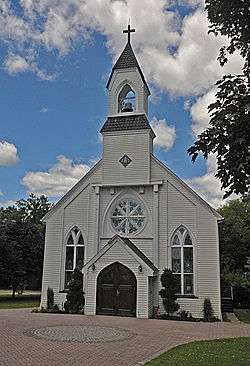 |
September 18, 1978 (#78001785) |
100 Whippany Rd. 40°49′11″N 74°25′01″W / 40.819722°N 74.416944°W |
Whippany | |
| 113 | Palace Theatre | 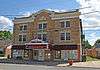 |
May 24, 1996 (#96000536) |
7 Ledgewood Ave. 40°54′02″N 74°42′17″W / 40.900556°N 74.704722°W |
Netcong | |
| 114 | Johannes Parlaman House |  |
January 17, 1992 (#91001933) |
15 Vreeland Ave. 40°54′03″N 74°22′50″W / 40.900833°N 74.380556°W |
Montville | part of the Dutch Stone Houses in Montville MPS |
| 115 | Parsonage of the Montville Reformed Dutch Church | 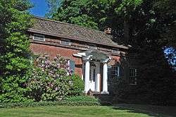 |
January 17, 1992 (#91001931) |
107 Changebridge Rd. 40°54′00″N 74°21′54″W / 40.9°N 74.365°W |
Montville | part of the Dutch Stone Houses in Montville MPS |
| 116 | Pompton Plains Railroad Station | 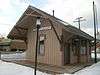 |
March 5, 2008 (#08000136) |
33 Evans Place 40°58′14″N 74°17′36″W / 40.970556°N 74.293333°W |
Pequannock | |
| 117 | Pottersville Village Historic District | 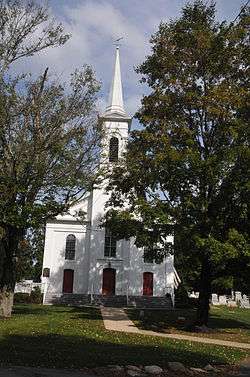 |
September 18, 1990 (#90001475) |
Properties fronting on Black River, Pottersville, McCann Mill and Hacklebarney Rds. and Fairmount Rd. E and Hill St. 40°42′52″N 74°43′21″W / 40.714444°N 74.7225°W |
Pottersville | |
| 118 | Pruddentown Historic District |  |
February 12, 2003 (#03000011) |
Mount Kemble Ave. 40°46′47″N 74°29′56″W / 40.779722°N 74.498889°W |
Morris Township | |
| 119 | Ralston Historic District |  |
February 20, 1975 (#75001150) |
1 mile (1.6 km) west of Mendham at NJ 24 and Roxiticus Rd. • Boundary increase (listed February 22, 1999, refnum 99000085): NJ 24 and Roxiticus Rd. 40°46′16″N 74°37′31″W / 40.771111°N 74.625278°W |
Mendham | |
| 120 | Rarick-Kellihan House |  |
May 1, 1992 (#92000375) |
358 Fairview Ave., Washington Township 40°48′56″N 74°45′08″W / 40.815556°N 74.752222°W |
Long Valley | part of the Stone Houses and Outbuildings in Washington Township MPS |
| 121 | Joseph W. Revere House |  |
September 20, 1973 (#73001127) |
Northwest of Morristown on Mendham Ave. • Fosterfields boundary increase (listed October 9, 1991, refnum 91000478): Junction of Mendham and Kahdena Rds., Morris Township 40°47′58″N 74°30′29″W / 40.799444°N 74.508056°W |
Morristown | |
| 122 | Silas Riggs House |  |
November 11, 1977 (#77000894) |
217 Main St. 40°52′43″N 74°39′10″W / 40.878611°N 74.652778°W |
Ledgewood | |
| 123 | Alfred T. Ringling Manor |  |
June 3, 1976 (#76001177) |
South of Oak Ridge on Berkshire Valley Rd. 41°00′33″N 74°31′00″W / 41.009167°N 74.516667°W |
Oak Ridge | |
| 124 | Rockaway Valley Methodist Church | 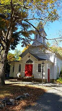 |
November 11, 1977 (#77000891) |
Northwest of Boonton 40°55′42″N 74°26′12″W / 40.928333°N 74.436667°W |
Boonton | |
| 125 | Sayre House | 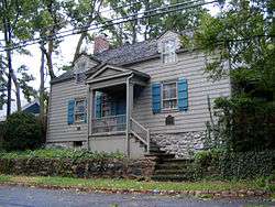 |
February 12, 1980 (#80002513) |
31 Ridgedale Ave. 40°45′44″N 74°24′58″W / 40.762222°N 74.416111°W |
Madison | |
| 126 | Schooley's Mountain Historic District | 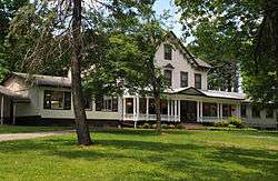 |
June 14, 1991 (#91000677) |
Roughly along Schooley's Mt. Rd., Pleasant Grove Rd. and Flocktown Rd., Washington Township 40°48′08″N 74°49′07″W / 40.802222°N 74.818611°W |
Schooley's Mountain | |
| 127 | Seward House | 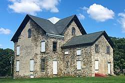 |
December 24, 2013 (#13000977) |
30 Flanders Road (Turkey Brook Park) 40°52′00″N 74°43′33″W / 40.866667°N 74.725833°W |
Mount Olive Township | Known as Seward Mansion |
| 128 | Sharpenstine Farmstead | 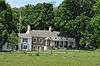 |
May 1, 1992 (#92000376) |
98 E. Mill Rd., Washington Township 40°47′08″N 74°45′47″W / 40.785556°N 74.763056°W |
Long Valley | part of the Stone Houses and Outbuildings in Washington Township MPS |
| 129 | Silver Lake Historic District | 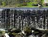 |
March 5, 1999 (#99000270) |
Roughly along Blue Mill Rd., Dickson's Mill Rd., Beuren Rd., Red Gate Rd., and James St. 40°45′08″N 74°28′22″W / 40.752222°N 74.472778°W |
Harding | |
| 130 | Slater's Mill | 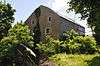 |
June 18, 1975 (#75001154) |
96 Paterson-Hamburg Turnpike 40°59′55″N 74°18′22″W / 40.998611°N 74.306111°W |
Riverdale | |
| 131 | Bridget Smith House | 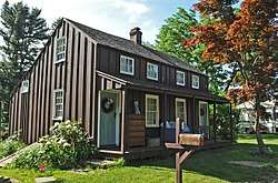 |
February 27, 1998 (#98000099) |
124 Randolph Ave. 40°52′25″N 74°35′49″W / 40.873611°N 74.596944°W |
Mine Hill Township | |
| 132 | John Smith House |  |
January 1, 1976 (#76001176) |
124 Washington Valley Road 40°48′20″N 74°31′37″W / 40.805556°N 74.526944°W |
Washington Valley | |
| 133 | Speedwell Village-The Factory |  |
September 13, 1974 (#74001186) |
333 Speedwell Ave. 40°47′50″N 74°28′51″W / 40.797222°N 74.480833°W |
Morristown | |
| 134 | Split Rock Furnace |  |
November 6, 1974 (#74001182) |
Northwest of Boonton 40°57′33″N 74°27′43″W / 40.959167°N 74.461944°W |
Rockaway Township | |
| 135 | Spring Brook House |  |
November 13, 1986 (#86003111) |
167 James St. 40°46′56″N 74°28′59″W / 40.782222°N 74.483056°W |
Morristown | part of the Morristown MRA |
| 136 | Stephens Homestead | 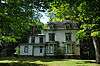 |
January 14, 2013 (#12001178) |
800 Willow Grove Rd. 40°52′10″N 74°48′37″W / 40.869319°N 74.81018°W |
Mount Olive Township | |
| 137 | Tempe Wick Road-Washington Corners Historic District | 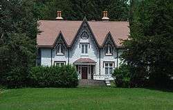 |
August 25, 2000 (#00000959) |
Corey Ln., Cemetery Rd., Tempe Wick, Kennaday, Leddell, and Jockey Hollow Rds. 40°45′56″N 74°33′30″W / 40.765556°N 74.558333°W |
Harding | |
| 138 | David Thompson House | 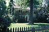 |
July 24, 1973 (#73001123) |
56 W. Main St. 40°46′26″N 74°36′45″W / 40.773889°N 74.6125°W |
Mendham | |
| 139 | Thorne and Eddy Estates | 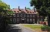 |
December 14, 1978 (#78001783) |
East of Morristown on Columbia Rd. 40°47′42″N 74°26′40″W / 40.795°N 74.444444°W |
Morristown | |
| 140 | Trimmer-Dufford Farmstead |  |
May 1, 1992 (#92000377) |
186 W. Mill Rd., Washington Township 40°46′24″N 74°47′48″W / 40.773333°N 74.796667°W |
Long Valley | part of the Stone Houses and Outbuildings in Washington Township MPS |
| 141 | Tuttle House |  |
October 5, 1977 (#77000901) |
341 NJ 10 40°49′12″N 74°24′26″W / 40.82°N 74.407222°W |
Whippany | |
| 142 | David Tuttle Cooperage |  |
June 19, 1979 (#79001516) |
83 Gristmill Rd. 40°51′35″N 74°33′21″W / 40.859722°N 74.555833°W |
Dover | |
| 143 | United States Army Steam Locomotive No. 4039 |  |
March 4, 2002 (#02000108) |
1 Railroad Plaza, 10 West and Whippany Rd. 40°49′23″N 74°24′41″W / 40.823056°N 74.411389°W |
Hanover Township | |
| 144 | James Van Duyne Farm House |  |
April 15, 1982 (#82003289) |
32 Waughaw Rd. 40°55′32″N 74°20′54″W / 40.925556°N 74.348333°W |
Towaco | |
| 145 | Martin Van Duyne House |  |
January 17, 1992 (#91001935) |
292 Main Rd. 40°54′59″N 74°22′15″W / 40.916389°N 74.370833°W |
Montville | part of the Dutch Stone Houses in Montville MPS |
| 146 | Simon Van Duyne House |  |
January 17, 1992 (#91001932) |
58 Maple Ave., Montville Township 40°51′55″N 74°20′22″W / 40.865278°N 74.339444°W |
Pine Brook | part of the Dutch Stone Houses in Montville MPS |
| 147 | Van Duyne-Jacobus House |  |
January 17, 1992 (#91001929) |
29 Changebridge Rd. 40°54′39″N 74°21′50″W / 40.910833°N 74.363889°W |
Montville | part of the Dutch Stone Houses in Montville MPS |
| 148 | Vanness – Linen House | 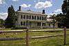 |
July 14, 2011 (#11000449) |
211 Hamburg Turnpike 41°00′03″N 74°18′54″W / 41.000833°N 74.315°W |
Riverdale | |
| 149 | Nicholas Vreeland Outkitchen | 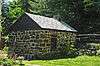 |
December 11, 2009 (#09001076) |
52 Jacksonville Rd. 40°55′59″N 74°20′33″W / 40.933161°N 74.342494°W |
Towaco | part of the Dutch Stone Houses in Montville MPS |
| 150 | Washington Valley Historic District | 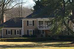 |
November 12, 1992 (#92001583) |
Roughly bounded by Schoolhouse Lane, Gaston Road, Sussex Avenue, Kahdena Road, Mendham Avenue, Tingley and Washington Valley Roads 40°48′00″N 74°31′48″W / 40.8000°N 74.5300°W |
Morris Township, Mendham Township | Includes Joseph W. Revere House, John Smith House, and Washington Valley Schoolhouse |
| 151 | Washington Valley Schoolhouse | 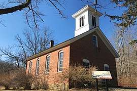 |
October 15, 1973 (#73001130) |
Washington Valley Road and Schoolhouse Lane 40°48′22″N 74°31′52″W / 40.806111°N 74.531111°W |
Washington Valley | |
| 152 | Whippany Burying Yard |  |
December 11, 2009 (#09001077) |
New Jersey Route 10 40°49′09″N 74°24′22″W / 40.819167°N 74.406111°W |
Hanover | |
| 153 | Whippany Farm |  |
September 22, 1977 (#77000899) |
53 E. Hanover Ave. 40°48′05″N 74°27′10″W / 40.801389°N 74.452778°W |
Morristown | |
| 154 | Willow Hall |  |
January 18, 2011 (#10001146) |
330 Speedwell Avenue 40°48′51″N 74°29′00″W / 40.814167°N 74.483333°W |
Morristown |
References
| Wikimedia Commons has media related to National Register of Historic Places in Morris County, New Jersey. |
- ↑ The latitude and longitude information provided in this table was derived originally from the National Register Information System, which has been found to be fairly accurate for about 99% of listings. For about 1% of NRIS original coordinates, experience has shown that one or both coordinates are typos or otherwise extremely far off; some corrections may have been made. A more subtle problem causes many locations to be off by up to 150 yards, depending on location in the country: most NRIS coordinates were derived from tracing out latitude and longitudes from USGS topographical quadrant maps created under the North American Datum of 1927, which differs from the current, highly accurate WGS84 GPS system used by most on-line maps. Chicago is about right, but NRIS longitudes in Washington are higher by about 4.5 seconds, and are lower by about 2.0 seconds in Maine. Latitudes differ by about 1.0 second in Florida. Some locations in this table may have been corrected to current GPS standards.
- ↑ "National Register of Historic Places: Weekly List Actions". National Park Service, United States Department of the Interior. Retrieved on October 11, 2018.
- ↑ Numbers represent an ordering by significant words. Various colorings, defined here, differentiate National Historic Landmarks and historic districts from other NRHP buildings, structures, sites or objects.
- ↑ National Park Service (2008-04-24). "National Register Information System". National Register of Historic Places. National Park Service.
- ↑ The eight-digit number below each date is the number assigned to each location in the National Register Information System database, which can be viewed by clicking the number.
| Topics | 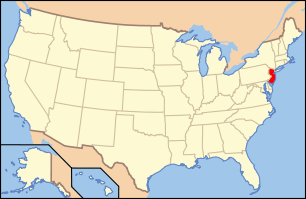 | ||
|---|---|---|---|
| Lists by county | |||
| Lists by city |
| ||
| Other lists | |||
| |||
This article is issued from
Wikipedia.
The text is licensed under Creative Commons - Attribution - Sharealike.
Additional terms may apply for the media files.