Amwell, New Jersey
| Amwell, New Jersey | |
|---|---|
| Unincorporated community | |
 | |
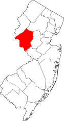
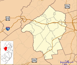 Amwell, New Jersey Location of Amwell in Hunterdon County Inset: Location of county within the state of New Jersey  Amwell, New Jersey Amwell, New Jersey (New Jersey)  Amwell, New Jersey Amwell, New Jersey (the US) | |
| Coordinates: 40°25′53″N 74°45′08″W / 40.43139°N 74.75222°WCoordinates: 40°25′53″N 74°45′08″W / 40.43139°N 74.75222°W | |
| Country |
|
| State |
|
| County | Hunterdon and Somerset |
| Township | East Amwell, Montgomery and Hillsborough |
| Elevation[1] | 453 ft (138 m) |
| GNIS feature ID | 874336[1] |
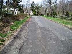
Amwell is an unincorporated community located at the tripoint of East Amwell Township in Hunterdon County and Hillsborough and Montgomery townships in Somerset County, in New Jersey, United States.[2] The community is located along Spring Hill Road near its intersection with Zion Road and is located along the top of the Sourland Mountain.
References
- 1 2 "Amwell". Geographic Names Information System. United States Geological Survey.
- ↑ Locality Search, State of New Jersey. Accessed January 30, 2015.
Municipalities and communities of Somerset County, New Jersey, United States | ||
|---|---|---|
| Boroughs | 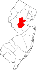 | |
| Townships | ||
| CDPs | ||
| Other unincorporated communities | ||
This article is issued from
Wikipedia.
The text is licensed under Creative Commons - Attribution - Sharealike.
Additional terms may apply for the media files.