| [3] |
Name on the Register[4] |
Image |
Date listed[5] |
Location |
City or town |
Description |
|---|
| 1 |
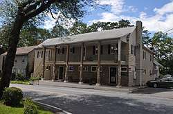
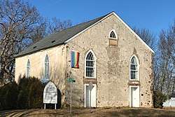
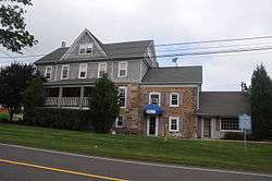
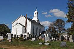
Amsterdam Historic District |
|
March 17, 1995
(#95000184) |
Roughly, area surrounding Amsterdam, Church, and Crab Apple Hill Rds., Holland Township
40°35′15″N 75°09′34″W / 40.5875°N 75.159444°W / 40.5875; -75.159444 (Amsterdam Historic District) |
Holland Township |
|
| 2 |
Annandale Historic District |
|
September 8, 1994
(#94001108) |
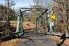
Roughly bounded by Maple Ave., Main St., Beaver Ave. and East St., Clinton Township
40°38′36″N 74°52′40″W / 40.643333°N 74.877778°W / 40.643333; -74.877778 (Annandale Historic District) |
Annandale |
|
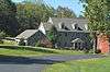
| 3 |
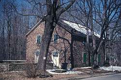
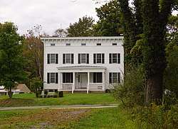
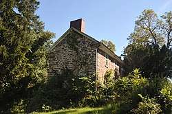
J. K. Apgar Farmhouse |
|
November 1, 1979
(#79001494) |
CR 512 and Guinea Hollow Rd.
40°42′59″N 74°49′38″W / 40.716389°N 74.827222°W / 40.716389; -74.827222 (J. K. Apgar Farmhouse) |
Califon |
|
| 4 |
Asbury Historic District |
|
March 19, 1993
(#93000132) |
Roughly, CR 643 from Maple Ave. to CR 623 and adjacent parts of Maple, CR 623 and Kitchen and School Sts.
40°41′53″N 75°00′50″W / 40.698056°N 75.013889°W / 40.698056; -75.013889 (Asbury Historic District) |
Asbury |
|
| 5 |
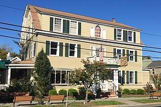
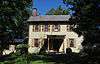
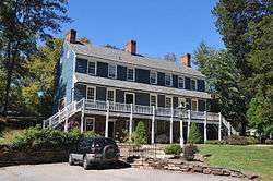
Bartles House |
|
March 14, 2007
(#06000763) |
159 Oldwick Rd.
40°39′58″N 74°45′05″W / 40.666111°N 74.751389°W / 40.666111; -74.751389 (Bartles House) |
Tewksbury Township |
|
| 6 |
Bray-Hoffman House |
|
January 25, 1973
(#73001104) |
On Bray's Hill Rd.
40°38′13″N 74°51′33″W / 40.636944°N 74.859167°W / 40.636944; -74.859167 (Bray-Hoffman House) |
Annandale |
This house has been demolished |
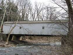
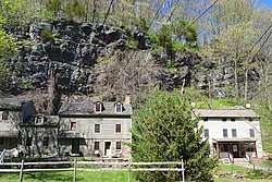
| 7 |
Califon Historic District |
|
October 14, 1976
(#76001157) |
Main and Academy Sts.
40°43′07″N 74°50′11″W / 40.718611°N 74.836389°W / 40.718611; -74.836389 (Califon Historic District) |
Califon |
|
| 8 |
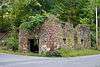
Case-Dvoor Farmstead |
|
December 11, 2009
(#09001074) |
111 Mine St.
40°30′19″N 74°52′05″W / 40.505356°N 74.867942°W / 40.505356; -74.867942 (Case-Dvoor Farmstead) |
Raritan Township |
|
| 9 |
Case Farmstead |
|
August 14, 1979
(#79001496) |
West of Pattenburg on SR 14
40°38′02″N 75°01′57″W / 40.633889°N 75.0325°W / 40.633889; -75.0325 (Case Farmstead) |
Pattenburg |
|
| 10 |
Clinton Historic District |
|
September 28, 1995
(#95001101) |
Roughly, along Center, W. Main, Main, E. Main, Halstead, Water, Leigh (Library) and Lower Center Sts.
40°38′17″N 74°54′37″W / 40.638056°N 74.910278°W / 40.638056; -74.910278 (Clinton Historic District) |
Clinton |
|
| 11 |
Clover Hill Historic District |
|
September 29, 1980
(#80002492) |
Amwell and Wertsville-Clover Hill Rds.
40°29′14″N 74°47′01″W / 40.487222°N 74.783611°W / 40.487222; -74.783611 (Clover Hill Historic District) |
Flemington |
|
| 12 |
Cokesbury Historic District |
|
July 17, 1997
(#97000802) |
Along Cokebury-Califon Rd., Rt. 639, Water St., and McCatharn Rd.
40°40′56″N 74°50′20″W / 40.682222°N 74.838889°W / 40.682222; -74.838889 (Cokesbury Historic District) |
Clinton |
|
| 13 |
Covered Bridge Historic District |
|
March 5, 1999
(#99000269) |
Roughly along CR 604, Pine Hill Rd., and Lower Creek Rd.
40°26′44″N 74°57′50″W / 40.445556°N 74.963889°W / 40.445556; -74.963889 (Covered Bridge Historic District) |
Delaware Township |
|
| 14 |
Dart's Mill Historic District |
|
April 29, 1982
(#82003279) |
Northeast of Flemington on Rt. 523
40°32′16″N 74°50′04″W / 40.537778°N 74.834444°W / 40.537778; -74.834444 (Dart's Mill Historic District) |
Readington Township |
|
| 15 |
Dawlis Mill-Spring Mill Historic District |
|
October 27, 2004
(#04001192) |
525 and 530 NJ 31
40°24′56″N 74°51′40″W / 40.415689°N 74.861006°W / 40.415689; -74.861006 (Dawlis Mill-Spring Mill Historic District) |
East Amwell |
|
| 16 |
Delaware and Raritan Canal |
|
May 11, 1973
(#73001105) |
Follows the Delaware River to Trenton, then E to New Brunswick
40°32′40″N 75°02′50″W / 40.544444°N 75.047222°W / 40.544444; -75.047222 (Delaware and Raritan Canal) |
Lambertville |
|
| 17 |
District No. 98 Schoolhouse |
|
January 12, 2005
(#04001477) |
19 S. Main St.
40°24′25″N 74°58′30″W / 40.406944°N 74.975°W / 40.406944; -74.975 (District No. 98 Schoolhouse) |
Stockton Borough |
|
| 18 |
Dunham's Mill |
|
April 15, 1982
(#82003277) |
7 Center St.
40°38′11″N 74°54′45″W / 40.636389°N 74.9125°W / 40.636389; -74.9125 (Dunham's Mill) |
Clinton |
|
| 19 |
Everittstown Historic District |
|
August 28, 1980
(#80002496) |
East of Milford at intersection of CR 513, CR 519 and Palmyra Rd.
40°33′58″N 75°01′41″W / 40.566111°N 75.028056°W / 40.566111; -75.028056 (Everittstown Historic District) |
Milford |
|
| 20 |
Charles Eversole House |
|
February 1, 2006
(#05001563) |
509 Cty Rd. 523
40°35′56″N 74°46′39″W / 40.598889°N 74.7775°W / 40.598889; -74.7775 (Charles Eversole House) |
Readington Township |
|
| 21 |
Fairmount Historic District |
|
December 20, 1996
(#96001470) |
Roughly, NJ 517 from the Morris-Hunterdon Co. line to NJ 512 and NJ 517 from Fox Hill to Wildwood Rds.
40°43′08″N 74°46′34″W / 40.718889°N 74.776111°W / 40.718889; -74.776111 (Fairmount Historic District) |
Califon |
|
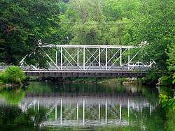
| 22 |
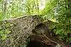
Fink-Type Truss Bridge |
|
December 24, 1974
(#74001161) |
West of Allerton off NJ 31 over South Branch of Raritan River
40°36′14″N 74°54′10″W / 40.603889°N 74.902778°W / 40.603889; -74.902778 (Fink-Type Truss Bridge) |
Clinton Township |
Demolished.[6] |
| 23 |
Flemington Historic District |
|
September 17, 1980
(#80002493) |
Roughly bounded by NJ 12, NJ 31, N. Main, Shields, and Hopewell Aves.
40°30′32″N 74°51′38″W / 40.508889°N 74.860556°W / 40.508889; -74.860556 (Flemington Historic District) |
Flemington |
|
| 24 |
Frenchtown Historic District |
|
May 19, 1994
(#94000438) |
Bounded by 12th St., Washington St., the Delaware R. and Nishisakawick Cr.
40°31′39″N 75°03′45″W / 40.5275°N 75.0625°W / 40.5275; -75.0625 (Frenchtown Historic District) |
Frenchtown |
|
| 25 |
Frog Hollow Road Bridge over minor tributary of the South Branch, Raritan River |
|
December 12, 2002
(#02001509) |
Frog Hollow Rd., approximately 1,400 feet (430 m) west of Beavers Rd.
40°43′47″N 74°49′01″W / 40.729722°N 74.816944°W / 40.729722; -74.816944 (Frog Hollow Road Bridge over minor tributary of the South Branch, Raritan River) |
Tewksbury |
|
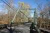
| 26 |
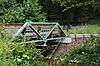
Glen Gardner Pony Pratt Truss Bridge |
|
September 22, 1977
(#77000876) |
Mill St. at Spruce Run
40°42′03″N 74°56′39″W / 40.700833°N 74.944167°W / 40.700833; -74.944167 (Glen Gardner Pony Pratt Truss Bridge) |
Glen Gardner |
|
| 27 |
Green Sergeants Covered Bridge |
|
November 19, 1974
(#74001165) |
North of Stockton off Rosemont-Sergeantsville Rd.
40°26′39″N 74°57′59″W / 40.444167°N 74.966389°W / 40.444167; -74.966389 (Green Sergeants Covered Bridge) |
Stockton |
|
| 28 |
Headquarters Historic District |
|
July 14, 2011
(#11000447) |
Rosemont-Ringoes Rd., Zentek Rd.
40°26′27″N 74°55′25″W / 40.440833°N 74.923611°W / 40.440833; -74.923611 (Headquarters Historic District) |
Sergeantsville |
Boundary increase February 8, 2016. |
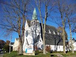
| 29 |
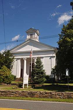
High Bridge Reformed Church |
|
November 21, 1980
(#80002494) |
Church St. and CR 513
40°40′13″N 74°53′41″W / 40.670278°N 74.894722°W / 40.670278; -74.894722 (High Bridge Reformed Church) |
High Bridge |
|
| 30 |
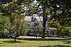
Highfields |
|
September 23, 1994
(#94001096) |
End of Lindbergh Rd., East Amwell Township
40°25′26″N 74°46′04″W / 40.423889°N 74.767778°W / 40.423889; -74.767778 (Highfields) |
East Amwell |
|
| 31 |
Hollow Brook Road Bridge over tributary of the Lamington River |
|
December 12, 2002
(#02001510) |
Hollow Brook Rd. approx. 700 feet (210 m) west of Homestead Rd.
40°43′02″N 74°44′12″W / 40.717222°N 74.736667°W / 40.717222; -74.736667 (Hollow Brook Road Bridge over tributary of the Lamington River) |
Tewksbury |
|
| 32 |
Imlaydale Historic District |
|
March 27, 1991
(#91000306) |
Imlaydale Rd. and surrounding land between NJ 31 and the Musconetcong R., Washington and Lebanon Townships
40°42′50″N 74°58′05″W / 40.713889°N 74.968056°W / 40.713889; -74.968056 (Imlaydale Historic District) |
Hampton |
|
| 33 |
The Kalmia Club |
|
April 16, 2012
(#12000208) |
39 York St.
40°22′06″N 74°56′40″W / 40.368242°N 74.944507°W / 40.368242; -74.944507 (The Kalmia Club) |
Lambertville |
Clubhouses of New Jersey Women's Clubs Multiple Property Submission |
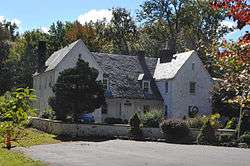
| 34 |
Kline Farmhouse |
|
July 11, 1984
(#84002712) |
NJ 517
40°40′40″N 74°45′06″W / 40.677778°N 74.751667°W / 40.677778; -74.751667 (Kline Farmhouse) |
Oldwick |
|
| 35 |
Lambertville Historic District |
|
June 30, 1983
(#83001602) |
NJ 29 and NJ 179
40°21′58″N 74°56′34″W / 40.366111°N 74.942778°W / 40.366111; -74.942778 (Lambertville Historic District) |
Lambertville |
|
| 36 |
Lambertville House |
|
September 6, 1978
(#78001768) |
32 Bridge St.
40°21′57″N 74°56′44″W / 40.365833°N 74.945556°W / 40.365833; -74.945556 (Lambertville House) |
Lambertville |
|
| 37 |
Lansdown |
|
November 2, 1979
(#79001497) |
Northeast of Pittstown on SR 2
40°36′22″N 74°54′24″W / 40.606111°N 74.906667°W / 40.606111; -74.906667 (Lansdown) |
Pittstown |
|
| 38 |
Lebanon Historic District |
|
August 26, 2009
(#09000652) |
Main Street, Cherry Street, Brunswick Avenue, Maple Street, High Street
40°38′26″N 74°50′05″W / 40.640556°N 74.834722°W / 40.640556; -74.834722 (Lebanon Historic District) |
Lebanon |
|
| 39 |
Little York Historic District |
|
August 4, 1988
(#88001207) |
CR 614 and Sweet Hollow Rd.
40°36′47″N 75°04′35″W / 40.613056°N 75.076389°W / 40.613056; -75.076389 (Little York Historic District) |
Holland Township |
|
| 40 |
Locktown Baptist Church |
|
February 15, 1974
(#74001166) |
West of Stockton on Locktown-Stugeonville Rds.
40°29′05″N 74°58′21″W / 40.484722°N 74.9725°W / 40.484722; -74.9725 (Locktown Baptist Church) |
Stockton |
|
| 41 |
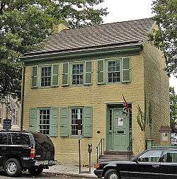
James W. Marshall House |
|
December 18, 1970
(#70000386) |
60 Bridge St.
40°21′58″N 74°56′39″W / 40.366111°N 74.944167°W / 40.366111; -74.944167 (James W. Marshall House) |
Lambertville |
|
| 42 |
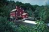
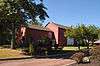
David McKinney Mill |
|
January 8, 1974
(#74001162) |
56 Main Street
40°38′10″N 74°54′48″W / 40.636111°N 74.913333°W / 40.636111; -74.913333 (David McKinney Mill) |
Clinton |
known as the Red Mill |
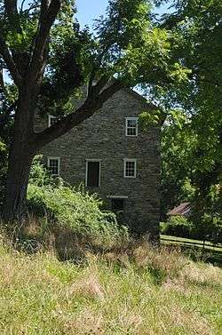
| 43 |
Mechlins Corner Tavern |
|
November 1, 1974
(#74001164) |
Northwest of Pittstown
40°36′38″N 74°59′18″W / 40.610556°N 74.988333°W / 40.610556; -74.988333 (Mechlins Corner Tavern) |
Pittstown |
|
| 44 |
Miller Farmstead |
|
September 11, 1989
(#88002118) |
NJ 57
40°47′19″N 74°53′41″W / 40.788611°N 74.894722°W / 40.788611; -74.894722 (Miller Farmstead) |
Lebanon Township |
Historic farm complex and stone arch bridge. Extends into Warren County. |
| 45 |
Mount Airy Historic District |
|
November 13, 1989
(#89001943) |
Roughly bounded by NJ 179, Rt. 605, Rt. 603, and Rt. 601
40°23′57″N 74°54′17″W / 40.399167°N 74.904722°W / 40.399167; -74.904722 (Mount Airy Historic District) |
Lambertville |
|
| 46 |
Mount Pleasant Historic District |
|
November 16, 1987
(#87002012) |
CR 519 & Rick Rd.
40°34′54″N 75°03′09″W / 40.581667°N 75.0525°W / 40.581667; -75.0525 (Mount Pleasant Historic District) |
Mount Pleasant |
|
| 47 |
Mount Salem Methodist Episcopal Church |
|
May 19, 1988
(#88000592) |
CR 579
40°36′19″N 74°59′00″W / 40.605278°N 74.983333°W / 40.605278; -74.983333 (Mount Salem Methodist Episcopal Church) |
Alexandria Township |
|
| 48 |
Mountainville Historic District |
|
December 7, 1993
(#93001360) |
Guinea Hollow Rd., Saw Mill Rd., Main St., Rockaway Creek Rd. and Philhower Rd., Tewksbury Township
40°41′29″N 74°48′33″W / 40.691389°N 74.809167°W / 40.691389; -74.809167 (Mountainville Historic District) |
Tewksbury Township |
|
| 49 |
M. C. Mulligan & Sons Quarry |
|
August 30, 1994
(#94001010) |
56 Main St.
40°38′11″N 74°54′50″W / 40.636389°N 74.913889°W / 40.636389; -74.913889 (M. C. Mulligan & Sons Quarry) |
Clinton |
|
| 50 |
Music Hall |
|
May 7, 1982
(#82003278) |
23 W. Main St.
40°38′01″N 74°54′50″W / 40.633611°N 74.913889°W / 40.633611; -74.913889 (Music Hall) |
Clinton |
|
| 51 |
New Hampton Historic District |
|
April 6, 1998
(#98000257) |
Roughly along Musconetcong River Rd, and Rymon Rd.
40°43′05″N 74°57′49″W / 40.718056°N 74.963611°W / 40.718056; -74.963611 (New Hampton Historic District) |
Lebanon |
|
| 52 |
New Hampton Pony Pratt Truss Bridge |
|
July 26, 1977
(#77000877) |
North of Hampton over Musconetcong River
40°43′13″N 74°57′50″W / 40.720278°N 74.963889°W / 40.720278; -74.963889 (New Hampton Pony Pratt Truss Bridge) |
Hampton |
|
| 53 |
New Market-Linvale-Snydertown Historic District |
|
February 12, 1998
(#98000097) |
Roughly along NJ 31, Linvale, Snydertown, and Woodsville Rds.
40°23′46″N 74°50′05″W / 40.396111°N 74.834722°W / 40.396111; -74.834722 (New Market-Linvale-Snydertown Historic District) |
East and West Amwell Townships |
|
| 54 |
Old Grandin Library |
|
November 1, 1974
(#74001163) |
12 E. Main St.
40°38′13″N 74°54′34″W / 40.636944°N 74.909444°W / 40.636944; -74.909444 (Old Grandin Library) |
Clinton |
|
| 55 |
Old Stone Presbyterian Church |
|
January 25, 2018
(#100002053) |
Corner of Oak Summit Road and County Route 519
40°32′34″N 75°00′20″W / 40.542778°N 75.005556°W / 40.542778; -75.005556 (Old Stone Presbyterian Church) |
Kingwood Township |
Known as the Old Stone Church |
| 56 |
Oldwick Historic District |
|
November 14, 1988
(#88002153) |
Roughly along County Route 517, Church, King, James, Joliet and William Streets
40°40′22″N 74°44′57″W / 40.672778°N 74.749167°W / 40.672778; -74.749167 (Oldwick Historic District) |
Oldwick |
|
| 57 |
Palatine Road Bridge over a minor tributary of the Lamington River |
|
December 12, 2002
(#02001508) |
Palatine Rd., junction with Homestead and Cold Spring Roads.
40°41′58″N 74°44′48″W / 40.699444°N 74.746667°W / 40.699444; -74.746667 (Palatine Road Bridge over a minor tributary of the Lamington River) |
Tewksbury |
|
| 58 |
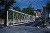
Peck's Ferry Bridge |
|
November 12, 1999
(#99001313) |
Locktown-Flemington Rd. (Delaware Township)
40°29′03″N 74°56′38″W / 40.484167°N 74.943889°W / 40.484167; -74.943889 (Peck's Ferry Bridge) |
Locktown |
|
| 59 |
Perryville Tavern |
|
July 15, 1977
(#77000874) |
West of Clinton at I-78 and CR 42
40°37′59″N 74°58′14″W / 40.633056°N 74.970556°W / 40.633056; -74.970556 (Perryville Tavern) |
Clinton |
|
| 60 |
Pittstown Historic District |
|
October 11, 1990
(#90001483) |
Pittstown Rd. and adjacent portions of Race St. and Quakertown Rds., Franklin and Alexandra Townships
40°34′43″N 74°57′42″W / 40.578611°N 74.961667°W / 40.578611; -74.961667 (Pittstown Historic District) |
Pittstown |
|
| 61 |
Pleasant Valley Historic District |
|
June 14, 1991
(#91000676) |
Centered on junction of Pleasant Valley Rd. with Woodens Ln. and Hunter Rd., Hopewell and West Amwell Twps.
40°20′18″N 74°53′44″W / 40.338333°N 74.895556°W / 40.338333; -74.895556 (Pleasant Valley Historic District) |
Lambertville |
|
| 62 |
Potterstown Rural Historic District |
|
July 2, 1992
(#92000806) |
Along Potterstown and Hall's Mill Rds. and I-78, Readington and Clinton Townships
40°38′47″N 74°47′05″W / 40.646389°N 74.784722°W / 40.646389; -74.784722 (Potterstown Rural Historic District) |
Potterstown |
|
| 63 |
Pottersville Village Historic District |
|
September 18, 1990
(#90001475) |
Properties fronting on Black River, Pottersville, McCann Mill and Hacklebarney Rds. and Fairmount Rd. E and Hill St.
40°42′52″N 74°43′21″W / 40.714444°N 74.7225°W / 40.714444; -74.7225 (Pottersville Village Historic District) |
Pottersville |
|
| 64 |
Prallsville District |
|
June 27, 1979
(#79001498) |
NJ 29
40°24′43″N 74°59′08″W / 40.411944°N 74.985556°W / 40.411944; -74.985556 (Prallsville District) |
Prallsville |
|
| 65 |
Pursley's Ferry Historic District |
|
October 8, 1980
(#80002495) |
River and Church Rds.
40°34′36″N 75°11′28″W / 40.576667°N 75.191111°W / 40.576667; -75.191111 (Pursley's Ferry Historic District) |
Holland |
|
| 66 |
Quaker Meeting |
|
August 23, 1990
(#90001242) |
Roughly bounded by Quakertown, Cherryville Rds., Quaker Ln., and Locust Grove Rd. (Franklin Township)
40°33′53″N 74°56′41″W / 40.564722°N 74.944722°W / 40.564722; -74.944722 (Quaker Meeting) |
Quakertown |
|
| 67 |
Raritan-Readington South Branch Historic District |
|
January 26, 1990
(#89002410) |
Running roughly east of the Raritan River from NJ 31 to US 202
40°31′39″N 74°49′52″W / 40.5275°N 74.831111°W / 40.5275; -74.831111 (Raritan-Readington South Branch Historic District) |
Readington Township & Raritan Township |
|
| 68 |
Raven Rock Historic District |
|
November 10, 2015
(#15000774) |
NJ 29 and Quarry Road
40°24′40″N 75°02′02″W / 40.411111°N 75.033889°W / 40.411111; -75.033889 (Raven Rock Historic District) |
Delaware Township |
|
| 69 |
Raven Rock Road Bridge |
|
October 4, 2016
(#16000691) |
Rosemont-Raven Rock Rd.
40°24′59″N 75°01′03″W / 40.416254°N 75.017552°W / 40.416254; -75.017552 (Raven Rock Road Bridge) |
Delaware Township |
|
| 70 |
John Reading Farmstead |
|
November 21, 1978
(#78001767) |
Northeast of Flemington at 523 River Rd.
40°31′28″N 74°50′18″W / 40.524444°N 74.838333°W / 40.524444; -74.838333 (John Reading Farmstead) |
Readington Township |
|
| 71 |
Readingsburg Historic District |
|
March 3, 2000
(#00000176) |
Cokesbury and Stone Mill Rds., CR 639
40°40′54″N 74°52′45″W / 40.681667°N 74.879167°W / 40.681667; -74.879167 (Readingsburg Historic District) |
Clinton |
|
| 72 |
Readington Village Historic District |
|
June 24, 1991
(#91000827) |
Readington, Hillcrest, Centerville and Brookview Roads
40°34′06″N 74°44′13″W / 40.568333°N 74.736944°W / 40.568333; -74.736944 (Readington Village Historic District) |
Readington |
Includes Readington Reformed Church |
| 73 |
Reaville Historic District |
|
May 2, 2002
(#02000433) |
Old York, Amwell, Barley Sheaf, Kuhl, Manners Rds.
40°28′41″N 74°49′19″W / 40.478056°N 74.821944°W / 40.478056; -74.821944 (Reaville Historic District) |
East Amwell Township |
|
| 74 |
Riegel Ridge Community Center |
|
June 7, 1996
(#96000656) |
County Route 519, approximately 1.5 miles (2.4 km) north of the New Jersey-Pennsylvania state line, Holland Township
40°36′34″N 75°07′00″W / 40.609444°N 75.116667°W / 40.609444; -75.116667 (Riegel Ridge Community Center) |
Milford |
|
| 75 |
Ringoes Historic District |
|
December 20, 1999
(#99001544) |
Old York, John Ringo, Wertsville and Boss Rds., and Larison Ln.
40°25′56″N 74°52′00″W / 40.432222°N 74.866667°W / 40.432222; -74.866667 (Ringoes Historic District) |
East Amwell Township |
|
| 76 |
Rockhill Agricultural Historic District |
|
April 5, 1984
(#84002717) |
North of Pittstown on SR 513
40°35′59″N 74°57′12″W / 40.599722°N 74.953333°W / 40.599722; -74.953333 (Rockhill Agricultural Historic District) |
Pittstown |
|
| 77 |
Rosemont Rural Agricultural District |
|
June 18, 2010
(#10000354) |
County Routes 519 and 604; Sanford Rd.; Covered Bridge Rd.
40°26′09″N 74°58′35″W / 40.435739°N 74.976306°W / 40.435739; -74.976306 (Rosemont Rural Agricultural District) |
Delaware Township |
|
| 78 |
Sand Brook Historic District |
|
July 17, 2013
(#13000497) |
Cty. Rd. 523, Sand Brook-Headquarters & Britton Rds.
40°28′07″N 74°55′01″W / 40.468556°N 74.916846°W / 40.468556; -74.916846 (Sand Brook Historic District) |
Sand Brook |
|
| 79 |
Sergeantsville Historic District |
|
December 2, 2009
(#09000972) |
County Routes 523 and 604, Lambert Rd., Delaware Dr.
40°26′45″N 74°56′39″W / 40.44597°N 74.94405°W / 40.44597; -74.94405 (Sergeantsville Historic District) |
Delaware Twp. |
|
| 80 |
St. Thomas Episcopal Church |
|
July 21, 1977
(#77000878) |
Southwest of Pittstown on Sky Manor Rd.
40°33′38″N 74°59′22″W / 40.560556°N 74.989444°W / 40.560556; -74.989444 (St. Thomas Episcopal Church) |
Pittstown |
|
| 81 |
Stanton Historic Rural District |
|
August 10, 1990
(#90001225) |
Jct. of Stanton and Mountain Rds., between Round and Cushetunk Mtns.
40°34′34″N 74°50′03″W / 40.576111°N 74.834167°W / 40.576111; -74.834167 (Stanton Historic Rural District) |
Stanton
(Readington Township) |
|
| 82 |
Stone Sign Post Road Bridge over Plum Brook |
|
October 4, 2016
(#16000692) |
Stone Sign Post Rd.
40°29′26″N 74°56′19″W / 40.490499°N 74.938683°W / 40.490499; -74.938683 (Stone Sign Post Road Bridge over Plum Brook) |
Delaware Township |
|
| 83 |
Strimple's Mill Road Bridge over Lockatong Creek |
|
October 4, 2016
(#16000693) |
Strimple's Mill Rd.
40°26′14″N 75°00′43″W / 40.437115°N 75.011846°W / 40.437115; -75.011846 (Strimple's Mill Road Bridge over Lockatong Creek) |
Delaware Township |
|
| 84 |
Taylor's Mill Historic District |
|
June 11, 1992
(#92000636) |
Jct. of Taylor's Mill and Rockaway Roads
40°39′48″N 74°46′06″W / 40.663333°N 74.768333°W / 40.663333; -74.768333 (Taylor's Mill Historic District) |
Readington Township |
|
| 85 |
Turner-Chew-Carhart Farm |
|
August 11, 1977
(#77000875) |
Northwest of Clinton on Syckles Corner Rd.
40°39′12″N 74°57′27″W / 40.653333°N 74.9575°W / 40.653333; -74.9575 (Turner-Chew-Carhart Farm) |
Clinton |
|
| 86 |
John Van Syckle House |
|
April 2, 2012
(#10000814) |
195 Rummel Rd.
40°35′52″N 75°04′30″W / 40.597751°N 75.075107°W / 40.597751; -75.075107 (John Van Syckle House) |
Holland Township |
|
| 87 |
Van Syckel Corner District |
|
November 8, 1979
(#79001495) |
Van Syckels Corner and Norton Rds
40°38′58″N 74°58′38″W / 40.649444°N 74.977222°W / 40.649444; -74.977222 (Van Syckel Corner District) |
Clinton |
|
| 88 |
Christoffel Vought Farmstead |
|
January 16, 2008
(#07001403) |
East of Grey Rock Rd., 600 feet (180 m) north of the junction with NJ 31. (Clinton Township)
40°38′36″N 74°53′54″W / 40.643278°N 74.89845°W / 40.643278; -74.89845 (Christoffel Vought Farmstead) |
Clinton |
|
| 89 |
Wertsville Historic District |
|
October 5, 2000
(#00001150) |
Wertsville and Lindbergh Rds.
40°26′54″N 74°47′46″W / 40.448333°N 74.796111°W / 40.448333; -74.796111 (Wertsville Historic District) |
East Amwell Township |
|
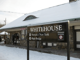
| 90 |
Whitehouse Station |
|
June 22, 1984
(#84002726) |
Main Street, Whitehouse Station
(Readington Township)
40°36′55″N 74°46′16″W / 40.615278°N 74.771111°W / 40.615278; -74.771111 (Whitehouse Station) |
Whitehouse Station
(Readington Township) |
|
| 91 |
Whitehouse-Mechanicsville Historic District |
|
March 17, 2015
(#15000093) |
Old New Jersey Route 28, Mill, Lamington and School Roads
40°37′17″N 74°45′34″W / 40.621389°N 74.759444°W / 40.621389; -74.759444 (Whitehouse-Mechanicsville Historic District) |
Readington Township |
|
.JPG)
%2C_Flemington_vicinity%2C_Hunterdon_County_(New_Jersey).jpg)