Mount Pleasant, Hunterdon County, New Jersey
| Mount Pleasant, New Jersey | |
|---|---|
| Unincorporated community | |
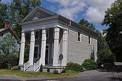 Historic general store in Mount Pleasant | |
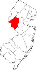
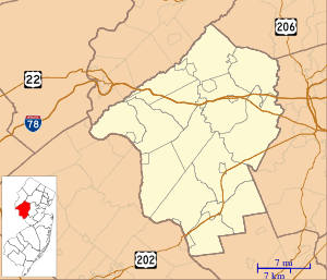 Mount Pleasant, New Jersey Mount Pleasant's location in Hunterdon County (Inset: Hunterdon County in New Jersey)  Mount Pleasant, New Jersey Mount Pleasant, New Jersey (New Jersey)  Mount Pleasant, New Jersey Mount Pleasant, New Jersey (the US) | |
| Coordinates: 40°34′48″N 75°3′0″W / 40.58000°N 75.05000°WCoordinates: 40°34′48″N 75°3′0″W / 40.58000°N 75.05000°W | |
| Country |
|
| State |
|
| County | Hunterdon |
| Township | Alexandria |
| Elevation[1] | 89 m (292 ft) |
| Time zone | UTC-5 (Eastern (EST)) |
| • Summer (DST) | UTC-4 (EDT) |
| GNIS feature ID | 878576[1] |
|
Mount Pleasant Historic District | |
| NRHP reference # | 87002012[2] |
|---|---|
| Added to NRHP | November 16, 1987 |
Mount Pleasant is an unincorporated community located within Alexandria Township, in Hunterdon County, New Jersey, United States.[1][3][4]
References
- 1 2 3 Feature Detail Report for: Mount Pleasant, Geographic Names Information System. Accessed January 1, 2015.
- ↑ National Park Service (2009-03-13). "National Register Information System". National Register of Historic Places. National Park Service.
- ↑ Locality Search, State of New Jersey. Accessed January 1, 2015.
- ↑ Areas covering the point (-75.05,40.58), MapIt. Accessed January 1, 2015.
| Topics | 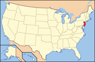 | ||
|---|---|---|---|
| Lists by county | |||
| Lists by city |
| ||
| Other lists | |||
| |||
This article is issued from
Wikipedia.
The text is licensed under Creative Commons - Attribution - Sharealike.
Additional terms may apply for the media files.