| [3] |
Name on the Register[4] |
Image |
Date listed[5] |
Location |
City or town |
Description |
|---|
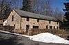
| 1 |
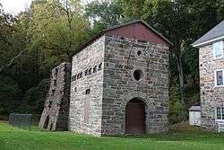
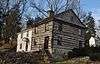
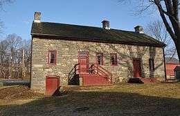
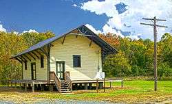
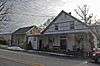
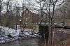
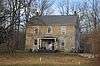
Allamuchy Freight House |
|
September 23, 2002
(#02001056) |
Rte. 612, 800 feet south of intersection with Long Bridge Road.
40°55′55″N 74°49′13″W / 40.932012°N 74.82021°W / 40.932012; -74.82021 (Allamuchy Freight House) |
Allamuchy |
|
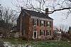
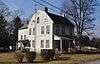
| 2 |
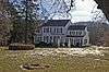
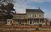
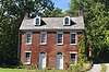
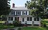
Jacob C. Allen House |
|
August 24, 2005
(#05000911) |
206 W. Moore St.
40°51′16″N 74°49′47″W / 40.854444°N 74.829722°W / 40.854444; -74.829722 (Jacob C. Allen House) |
Hackettstown |
|
| 3 |
Asbury Historic District |
|
March 19, 1993
(#93000132) |
Roughly, NJ 643 from Maple Ave. to NJ 623 and adjacent parts of Maple, NJ 623 and Kitchen and School Sts.
40°41′53″N 75°00′50″W / 40.698056°N 75.013889°W / 40.698056; -75.013889 (Asbury Historic District) |
Asbury |
|
| 4 |
Beattystown |
|
September 28, 1990
(#90001449) |
Junction of NJ 57 and Kings Highway
40°48′49″N 74°50′34″W / 40.813611°N 74.842778°W / 40.813611; -74.842778 (Beattystown) |
Beattystown |
|
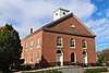
| 5 |
Belvidere Historic District |
|
October 3, 1980
(#80002525) |
Market and Race streets; Greenwich and Mansfield avenues; and the Pequest River
40°49′45″N 75°04′37″W / 40.829167°N 75.076944°W / 40.829167; -75.076944 (Belvidere Historic District) |
Belvidere |
Includes Warren County Courthouse |
| 6 |
Blair Academy |
|
January 24, 1992
(#89001944) |
NJ Route 94
40°59′06″N 74°57′50″W / 40.985000°N 74.963889°W / 40.985000; -74.963889 (Blair Academy) |
Blairstown |
Historically known as Blair Presbyterial Academy |
| 7 |
Blairstown Historic District |
|
February 16, 2007
(#07000046) |
Main St., East Ave., Douglas St., Water St., Blair Place
40°59′00″N 74°57′35″W / 40.983284°N 74.95976°W / 40.983284; -74.95976 (Blairstown Historic District) |
Blairstown |
|
| 8 |
Bowerstown Historic District |
|
May 10, 1996
(#96000537) |
Roughly bounded by Bowerstown, Plane Hill, Lanning and Mine Hill Rds., Washington Township
40°46′22″N 74°59′48″W / 40.772778°N 74.996667°W / 40.772778; -74.996667 (Bowerstown Historic District) |
Belvidere |
|
| 9 |
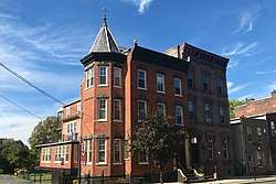
Centenary Collegiate Institute |
|
June 13, 1997
(#97000564) |
400 Jefferson St.
40°50′57″N 74°50′01″W / 40.849167°N 74.833611°W / 40.849167; -74.833611 (Centenary Collegiate Institute) |
Hackettstown |
|
| 10 |
Delaware Historic District |
|
March 20, 2003
(#03000128) |
Ann, Clinton, Charles, and Valley STs., Delaware Rd., NJ 46 and Ferry Ln.
40°53′44″N 75°03′51″W / 40.895556°N 75.064167°W / 40.895556; -75.064167 (Delaware Historic District) |
Knowlton Township |
|
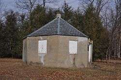
| 11 |
Fairview Schoolhouse |
|
August 12, 1977
(#77000916) |
E of Columbia on Dean Rd.
40°55′16″N 75°00′54″W / 40.921111°N 75.015°W / 40.921111; -75.015 (Fairview Schoolhouse) |
Columbia |
|
| 12 |
Finesville-Seigletown Historic District |
|
November 10, 2010
(#10000892) |
County Route 627; Mountain, Musconetcong, Mt. Joy and Bellis Rds.
40°36′26″N 75°10′17″W / 40.607222°N 75.171389°W / 40.607222; -75.171389 (Finesville-Seigletown Historic District) |
Pohatcong Township |
New listing; refnum 10000892 |
| 13 |
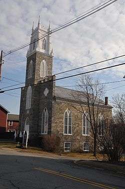
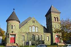
First Methodist Episcopal Church |
|
July 17, 2017
(#100001322) |
116 E. Washington Ave.
40°45′34″N 74°58′36″W / 40.759362°N 74.976767°W / 40.759362; -74.976767 (First Methodist Episcopal Church) |
Washington |
Known as United Methodist Church |
| 14 |
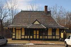
Great Meadows Railroad Station |
|
March 23, 1989
(#89000229) |
Cemetery Rd.
40°53′01″N 74°54′29″W / 40.883611°N 74.908056°W / 40.883611; -74.908056 (Great Meadows Railroad Station) |
Great Meadows |
|
| 15 |
Hixson–Mixsell House |
|
May 12, 2014
(#14000204) |
157 County Route 519
40°38′52″N 75°08′54″W / 40.647778°N 75.148333°W / 40.647778; -75.148333 (Hixson–Mixsell House) |
Pohatcong Township |
Also known as Springtown Stagecoach Inn |
| 16 |
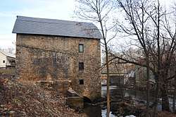
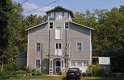
Hixson-Skinner Mill Complex |
|
December 2, 1982
(#82001047) |
Still Valley Rd.
40°39′41″N 75°08′11″W / 40.661389°N 75.136389°W / 40.661389; -75.136389 (Hixson-Skinner Mill Complex) |
Phillipsburg |
|
| 17 |
Hope District |
|
July 20, 1973
(#73001138) |
Roughly bounded by Beaver Brook, Washington St., and Brookaloo Swamp
40°54′42″N 74°58′13″W / 40.911667°N 74.970278°W / 40.911667; -74.970278 (Hope District) |
Hope |
|
| 18 |
George Hunt House |
|
September 12, 1979
(#79001531) |
SW of Alpha at 135 Warren Glen Rd.
40°35′54″N 75°10′57″W / 40.598333°N 75.1825°W / 40.598333; -75.1825 (George Hunt House) |
Alpha |
|
| 19 |
Imlaydale Historic District |
|
March 27, 1991
(#91000306) |
Imlaydale Rd. and surrounding land between NJ 31 and the Musconetcong R., Washington and Lebanon Townships
40°42′50″N 74°58′05″W / 40.713889°N 74.968056°W / 40.713889; -74.968056 (Imlaydale Historic District) |
Hampton |
includes part of Hunterdon County |
| 20 |
Johnsonburg Historic District |
|
October 15, 1992
(#92001386) |
NJ 519 and 661 and adjacent parts of Mott and Allamuchy Rds., Frelinghuysen Township
40°57′59″N 74°52′36″W / 40.966389°N 74.876667°W / 40.966389; -74.876667 (Johnsonburg Historic District) |
Johnsonburg |
|
| 21 |
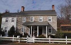
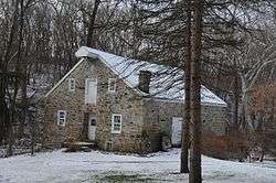
Kennedy House and Mill |
|
May 16, 1996
(#96000552) |
306 NJ 173, Greenwich Township
40°39′41″N 75°06′56″W / 40.661389°N 75.115556°W / 40.661389; -75.115556 (Kennedy House and Mill) |
Stewartsville |
|
| 22 |
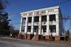
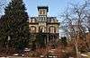
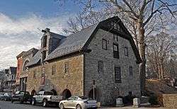
Lander–Stewart Mansion and Stites Building |
|
June 26, 2008
(#08000561) |
102–104 South Main Street
40°41′23″N 75°12′04″W / 40.689722°N 75.201111°W / 40.689722; -75.201111 (Lander–Stewart Mansion and Stites Building) |
Phillipsburg |
|
| 23 |
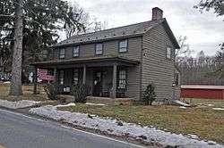
Miller Farmstead |
|
September 11, 1989
(#88002118) |
NJ 57
40°47′19″N 74°53′41″W / 40.788611°N 74.894722°W / 40.788611; -74.894722 (Miller Farmstead) |
Anderson |
|
| 24 |
Morris Canal |
|
October 1, 1974
(#74002228) |
Irregular line beginning at Phillipsburg and ending at Jersey City
40°41′08″N 75°09′49″W / 40.685556°N 75.163611°W / 40.685556; -75.163611 (Morris Canal) |
Not Applicable |
Delaware River Portal, the western terminus, is in Phillispburg |
| 25 |
Mount Bethel Methodist Church |
|
February 29, 1980
(#80002526) |
W of Hackettstown at intersection of Mount Bethel Rd. and Snyder Rd.
40°49′32″N 74°54′07″W / 40.825556°N 74.901944°W / 40.825556; -74.901944 (Mount Bethel Methodist Church) |
Mansfield |
|
| 26 |
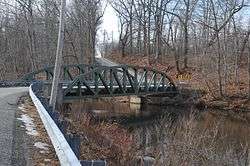
New Hampton Pony Pratt Truss Bridge |
|
July 26, 1977
(#77000877) |
N of Hampton over Musconetcong River
40°43′13″N 74°57′50″W / 40.720278°N 74.963889°W / 40.720278; -74.963889 (New Hampton Pony Pratt Truss Bridge) |
Changewater |
|
| 27 |
Old Mine Road Historic District |
|
December 3, 1980
(#80000410) |
NJ 521, Delaware, Old Mine, and River Rds.
41°09′15″N 74°55′04″W / 41.154167°N 74.917778°W / 41.154167; -74.917778 (Old Mine Road Historic District) |
Wallpack Center |
|
| 28 |
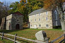
Oxford Furnace |
|
July 6, 1977
(#77000919) |
Belvidere and Washington Aves.
40°48′14″N 74°59′52″W / 40.803889°N 74.997778°W / 40.803889; -74.997778 (Oxford Furnace) |
Oxford |
|
| 29 |
Oxford Industrial Historic District |
|
August 27, 1992
(#91001471) |
NJ Route 31; Belvidere, Buckley, and Washington avenues; Jonestown and Mine Hill roads; Academy and Church streets, and vicinity
40°47′55″N 74°59′42″W / 40.798611°N 74.995°W / 40.798611; -74.995 (Oxford Industrial Historic District) |
Oxford Township |
Includes Oxford Furnace and Shippen Manor |
| 30 |
Perry-Petty Farmstead |
|
April 9, 1999
(#99000392) |
882 Jackson Valley Rd.
40°48′07″N 74°56′24″W / 40.801944°N 74.94°W / 40.801944; -74.94 (Perry-Petty Farmstead) |
Mansfield Township |
|
| 31 |
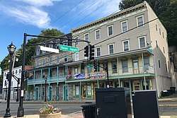
Phillipsburg Commercial Historic District |
|
October 8, 2008
(#08000973) |
29-169 S. Main St., 60-178 S. Main St., 3 Hudson St., 9 and 12-30 Morris St./Main St., 7-11, 17, and 21-27 Union Sq.
40°41′29″N 75°12′08″W / 40.691389°N 75.202222°W / 40.691389; -75.202222 (Phillipsburg Commercial Historic District) |
Phillipsburg |
Includes Lander–Stewart Mansion and Stites Building |
| 32 |
Pleasant Valley Historic District |
|
February 17, 1994
(#94000013) |
Area surrounding Mill Pond Rd., Washington Township
40°44′59″N 75°00′17″W / 40.749722°N 75.004722°W / 40.749722; -75.004722 (Pleasant Valley Historic District) |
Pleasant Valley |
|
| 33 |
Port Colden Historic District |
|
January 21, 1999
(#98001639) |
Roughly along Port Colden Rd., Lock St., NJ 57, and Morris Canal Terrace
40°45′59″N 74°57′17″W / 40.766389°N 74.954722°W / 40.766389; -74.954722 (Port Colden Historic District) |
Washington Township |
|
| 34 |
Port Murray Historic District |
|
June 7, 1996
(#96000658) |
Roughly, Port Murray Rd. from Cherry Tree Bend Rd. to Hoffman Rd., Mansfield Township
40°47′26″N 74°55′01″W / 40.790556°N 74.916944°W / 40.790556; -74.916944 (Port Murray Historic District) |
Mansfield Township |
|
| 35 |
Ramsaysburg Homestead |
|
October 27, 2004
(#04001194) |
NJ 46
40°52′45″N 75°03′20″W / 40.879167°N 75.055556°W / 40.879167; -75.055556 (Ramsaysburg Homestead) |
Knowlton |
|
| 36 |
John Richey House |
|
March 20, 2002
(#02000216) |
6 Schetzer Ln.
40°43′06″N 75°00′14″W / 40.718333°N 75.003889°W / 40.718333; -75.003889 (John Richey House) |
Franklin |
|
| 37 |
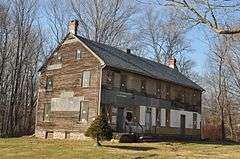
John Roseberry Homestead |
|
April 3, 1973
(#73001139) |
540 Warren St.
40°41′19″N 75°10′54″W / 40.688611°N 75.181667°W / 40.688611; -75.181667 (John Roseberry Homestead) |
Phillipsburg |
|
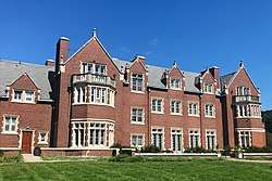
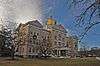
| 38 |
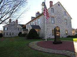
Rutherfurd Hall |
|
April 24, 2013
(#11000592) |
County Route 517 and Interstate Route 80
40°54′52″N 74°48′48″W / 40.914444°N 74.813333°W / 40.914444; -74.813333 (Rutherfurd Hall) |
Allamuchy Township |
|
| 39 |
St. James Lutheran Church and Cemetery |
|
October 24, 2016
(#16000737) |
1213 U.S. Route 22
40°40′49″N 75°08′45″W / 40.680373°N 75.145768°W / 40.680373; -75.145768 (St. James Lutheran Church and Cemetery) |
Pohatcong Township |
Cemetery is in Greenwich Township |
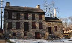
| 40 |
Seigle Homestead |
|
November 7, 1977
(#77000918) |
N of Finesville
40°36′39″N 75°09′59″W / 40.610833°N 75.166389°W / 40.610833; -75.166389 (Seigle Homestead) |
Finesville |
|
| 41 |
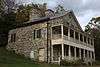
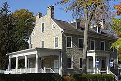
Shippen Manor |
|
December 20, 1984
(#84000517) |
Belvidere Rd.
40°48′19″N 74°59′51″W / 40.805278°N 74.9975°W / 40.805278; -74.9975 (Shippen Manor) |
Oxford |
|
| 42 |
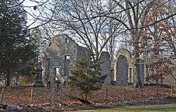
Spring Valley Christian Church Site |
|
September 18, 1997
(#97001147) |
Spring Valley Rd., 0.5 mi (0.80 km). E of Hardwick Center
41°00′20″N 74°56′23″W / 41.005556°N 74.939722°W / 41.005556; -74.939722 (Spring Valley Christian Church Site) |
Hardwick Township |
|
| 43 |
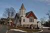
St. Luke's Episcopal Church |
|
March 16, 2007
(#07000151) |
346 High St.
40°54′37″N 74°58′09″W / 40.910278°N 74.969167°W / 40.910278; -74.969167 (St. Luke's Episcopal Church) |
Hope |
|
| 44 |
Van Nest–Hoff–Vannatta Farmstead |
|
December 28, 2005
(#05001484) |
Cty Rd. 519
40°45′47″N 75°07′49″W / 40.763056°N 75.130278°W / 40.763056; -75.130278 (Van Nest–Hoff–Vannatta Farmstead) |
Harmony |
|
| 45 |
Vass Farmstead |
|
September 17, 1999
(#99001170) |
109 Stillwater Rd.
41°00′15″N 74°55′01″W / 41.004167°N 74.916944°W / 41.004167; -74.916944 (Vass Farmstead) |
Hardwick |
|
| 46 |
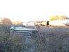
Warrington Stone Bridge |
|
December 16, 1977
(#77000917) |
NE of Columbia off NJ 94
40°55′59″N 75°04′30″W / 40.933056°N 75.075°W / 40.933056; -75.075 (Warrington Stone Bridge) |
Columbia |
Old bridge replaced |
| 47 |
Washington Railroad Station |
|
July 3, 1979
(#79001532) |
Railroad Ave.
40°45′30″N 74°58′06″W / 40.758333°N 74.968333°W / 40.758333; -74.968333 (Washington Railroad Station) |
Washington |
|
.jpg)
.JPG)