National Register of Historic Places listings in Sussex County, New Jersey
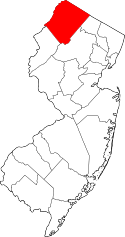
Location of Sussex County in New Jersey
List of the National Register of Historic Places listings in Sussex County, New Jersey
| Atlantic - Bergen - Burlington - Camden - Cape May - Cumberland - Essex - Gloucester - Hudson - Hunterdon - Mercer - Middlesex - Monmouth - Morris - Ocean - Passaic - Salem - Somerset - Sussex - Union - Warren |
This is intended to be a complete list of properties and districts listed on the National Register of Historic Places in Sussex County, New Jersey. The locations of National Register properties and districts (at least for all showing latitude and longitude coordinates below) may be seen in an online map by clicking on "Map of all coordinates".[1]
- This National Park Service list is complete through NPS recent listings posted October 11, 2018.[2]
| [3] | Name on the Register[4] | Image | Date listed[5] | Location | City or town | Description |
|---|---|---|---|---|---|---|
| 1 | Backwards Tunnel | 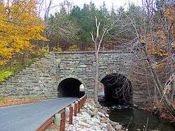 |
December 28, 2005 (#05001483) |
Cork Hill Rd., 310 ft. N of Passaic Ave. intersection 41°05′16″N 74°36′06″W / 41.087778°N 74.601667°W |
Ogdensburg | Built by the Midland Railroad in 1871. So called because bore for road is wider than that for Wallkill River. |
| 2 | Bethany Chapel | 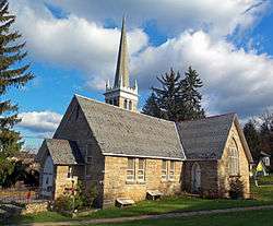 |
February 29, 1980 (#80002517) |
103 Hamburg Tpke. 41°08′50″N 74°34′26″W / 41.147222°N 74.573889°W |
Hamburg | 1869 stone church |
| 3 | Black Creek Site-28SX297 |  |
November 27, 2002 (#02000626) |
Address Restricted |
Vernon Township | |
| 4 | Crescent Theatre | 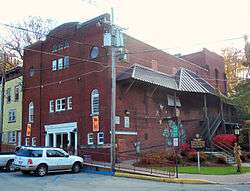 |
September 7, 2005 (#05000965) |
74 Main St. 41°12′33″N 74°36′28″W / 41.209167°N 74.607778°W |
Sussex | 1917 theater was local community center and one of the first in the region to show sound films in 1929. Now home to Tri-State Theater Co. |
| 5 | Erickson Lakeside Cabin | November 3, 2017 (#100001778) |
103 Lakeside Dr., Lake Wallkill 41°14′12″N 74°32′15″W / 41.236530°N 74.537511°W |
Vernon Township | ||
| 6 | Evans-Waters Cottage | 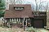 |
November 15, 2016 (#16000777) |
11 Grandview Rd., Lake Wallkill 41°14′23″N 74°32′16″W / 41.239766°N 74.537747°W |
Vernon Township | |
| 7 | First Presbyterian Church of Wantage | 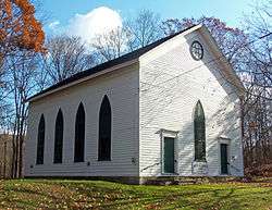 |
September 23, 1982 (#82003305) |
N of Sussex on NJ 23 41°14′28″N 74°37′22″W / 41.241111°N 74.622778°W |
Sussex | 1829 church housed one of the first congregations in Wantage, established in 1787. Later changed from Reformed to Presbyterian. |
| 8 | Foster-Armstrong House |  |
July 23, 1979 (#79000235) |
N of Branchville on River Rd. 41°18′33″N 74°47′21″W / 41.309167°N 74.789167°W |
Branchville | |
| 9 | Cornelius Gunn House | .JPG) |
July 23, 1979 (#79000238) |
SW of Wallpack Center on Ridge Rd. 41°09′07″N 74°54′03″W / 41.151944°N 74.900833°W |
Walpack Township | |
| 10 | Harmony Hill United Methodist Church | _4.jpg) |
September 19, 1977 (#77000913) |
N of Stillwater on Fairview Lake Rd. 41°02′33″N 74°52′54″W / 41.0425°N 74.881667°W |
Stillwater | |
| 11 | High Breeze Farm | 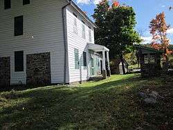 |
July 27, 1989 (#89000993) |
Barrett Rd. off NJ 94 41°13′06″N 74°25′03″W / 41.218333°N 74.4175°W |
Highland Lakes | |
| 12 | High Point Park Historic District | 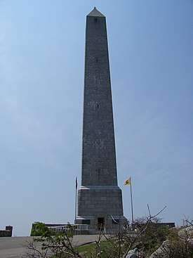 |
April 23, 1996 (#96000404) |
Roughly bounded by the NJ-NY state line and Deckertown Tnpk. between NJ 23 and NJ 653, Wantage and Montague Townships 41°17′16″N 74°41′40″W / 41.287778°N 74.694444°W |
Branchville | |
| 13 | Hill Memorial | 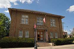 |
July 18, 1985 (#85001565) |
82 Main St. 41°03′24″N 74°45′17″W / 41.056667°N 74.754722°W |
Newton | Now houses the Sussex County Historical Society |
| 14 | Lafayette Village Historic District | 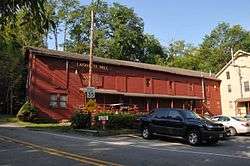 |
December 31, 2013 (#13001024) |
NJ 15, Morris Farm Rd. & Meadows Rd. 41°05′53″N 74°41′18″W / 41.0979805°N 74.6883775°W |
Lafayette Township | |
| 15 | Lawrence Mansion | 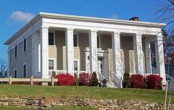 |
November 2, 1979 (#79001522) |
W of Hamburg on NJ 94 41°09′09″N 74°35′14″W / 41.1525°N 74.587222°W |
Hamburg | 1841 Greek Revival mansion now used as commercial property |
| 16 | Richard Layton House | .JPG) |
July 23, 1979 (#79000237) |
SW of Wallpack Center on Ridge Rd. 41°08′53″N 74°54′14″W / 41.148056°N 74.903889°W |
Walpack Township | |
| 17 | Log Cabin and Farm | 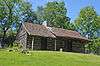 |
August 24, 1977 (#77000910) |
N of Branchville on Mattison Ave. 41°11′40″N 74°44′33″W / 41.194444°N 74.7425°W |
Branchville | Log cabin relocated within the county in 1989[6] |
| 18 | Meadowburn Farm | 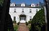 |
August 9, 1993 (#93000748) |
Address Restricted |
Vernon | |
| 19 | Henry W. Merriam House | 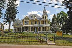 |
December 18, 1970 (#70000396) |
131 Main St. 41°03′10″N 74°45′20″W / 41.052778°N 74.755556°W |
Newton | |
| 20 | Millville Historic and Archaeological District | January 30, 1984 (#84002807) |
Address Restricted |
Montague Township | ||
| 21 | Minisink Archeological Site | 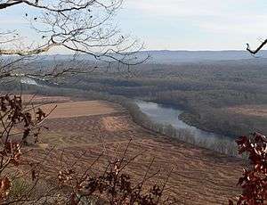 |
April 19, 1993 (#93000608) |
in the vicinity of Minisink Island[7] 41°17′26″N 74°49′44″W / 41.2906°N 74.829°W |
Montague Township | |
| 22 | Morris Canal | 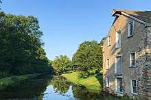 |
October 1, 1974 (#74002228) |
Irregular line beginning at Phillipsburg and ending at Jersey City 40°41′08″N 75°09′49″W / 40.685556°N 75.163611°W |
Not Applicable | Extends through Essex County, New Jersey |
| 23 | Newton Town Plot Historic District | 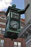 |
November 12, 1992 (#92001521) |
Roughly, Church St., Park Pl. and Spring St. from Main St. to High St. and Main and High from Church to Spring 41°03′26″N 74°45′13″W / 41.057222°N 74.753611°W |
Newton | 64 properties (56 contributing) on 17.2 acres of varying architectural styles and historical contexts. The district boundaries are determined by the "Town Plot" surveyed by Jonathan Hampton in 1762. |
| 24 | Old Mine Road Historic District | 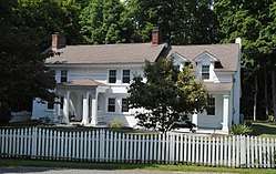 |
December 3, 1980 (#80000410) |
NJ 521, Delaware, Old Mine, and River Rds. 41°09′15″N 74°55′04″W / 41.154167°N 74.917778°W |
Walpack Township | |
| 25 | Old Monroe School House | 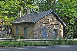 |
August 12, 1977 (#77000911) |
NJ 94 41°06′57″N 74°37′58″W / 41.115833°N 74.632778°W |
Monroe | |
| 26 | Peters Valley Historic District | 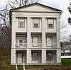 |
February 29, 1980 (#80000437) |
Sandyston-Haney's Mill, Walpack, and Kuhn Rds. 41°11′46″N 74°51′12″W / 41.196111°N 74.853333°W |
Walpack Township | |
| 27 | Plaster Mill | 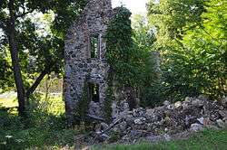 |
August 3, 1977 (#77000912) |
Off Main St. and Kelly Pl. 40°54′06″N 74°42′30″W / 40.901667°N 74.708333°W |
Stanhope | |
| 28 | Casper and Abraham Shafer Grist Mill Complex | _from_SE_1.jpg) |
December 10, 2009 (#09000653) |
928 Main St. 41°01′59″N 74°52′29″W / 41.032961°N 74.874725°W |
Stillwater | |
| 29 | Shoemaker-Houck Farm | .JPG) |
July 23, 1979 (#79000234) |
S of Wallpack Center on Heney's Mill-Wallpack Center Rd. 41°08′35″N 74°52′55″W / 41.143056°N 74.881944°W |
Walpack Township | |
| 30 | Andrew Snable House | 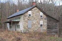 |
July 23, 1979 (#79000236) |
NE of Wallpack Center on Sandyston-Haney's Mill Rd. 41°10′11″N 74°52′15″W / 41.169722°N 74.870833°W |
Walpack Township | |
| 31 | Sterling Hill Mine | 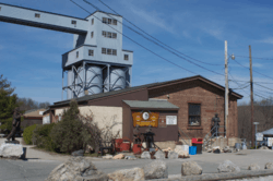 |
September 3, 1991 (#91001365) |
30 Plant St. 41°04′59″N 74°36′24″W / 41.083056°N 74.606667°W |
Ogdensburg | |
| 32 | Stockholm United Methodist Church | 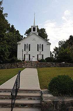 |
March 26, 1976 (#76001189) |
CR 515 41°05′21″N 74°30′43″W / 41.089167°N 74.511944°W |
Stockholm | |
| 33 | Sussex County Courthouse | 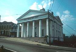 |
July 23, 1979 (#79001523) |
High and Spring Sts. 41°03′32″N 74°45′14″W / 41.058889°N 74.753889°W |
Newton | |
| 34 | Elias Van Bunschooten House | 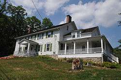 |
November 1, 1974 (#74001191) |
NW of Sussex on NJ 23 41°15′51″N 74°38′11″W / 41.264167°N 74.636389°W |
Sussex | |
| 35 | Wallpack Center Historic District | 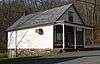 |
July 17, 1980 (#80000354) |
Wallpack Center Rd. 41°09′33″N 74°52′51″W / 41.159167°N 74.880833°W |
Walpack Township | |
| 36 | Waterloo Village | 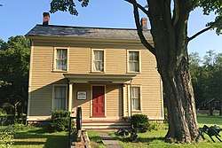 |
September 13, 1977 (#77000909) |
1 mi. S of Andover at Musconetcong River and CR 604; also Musconetcong R. & Cty. Rd. 604 40°54′56″N 74°45′22″W / 40.915556°N 74.756111°W |
Andover | Second set of addresses represents a boundary increase April 28, 2015. |
| 37 | White Deer Plaza and Boardwalk District | 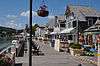 |
July 11, 1988 (#88001012) |
White Deer Plaza, Winona Pkwy., and W. Shore Trail 41°01′56″N 74°38′28″W / 41.032222°N 74.641111°W |
Sparta |
References
| Wikimedia Commons has media related to National Register of Historic Places in Sussex County, New Jersey. |
- ↑ The latitude and longitude information provided in this table was derived originally from the National Register Information System, which has been found to be fairly accurate for about 99% of listings. For about 1% of NRIS original coordinates, experience has shown that one or both coordinates are typos or otherwise extremely far off; some corrections may have been made. A more subtle problem causes many locations to be off by up to 150 yards, depending on location in the country: most NRIS coordinates were derived from tracing out latitude and longitudes from USGS topographical quadrant maps created under the North American Datum of 1927, which differs from the current, highly accurate WGS84 GPS system used by most on-line maps. Chicago is about right, but NRIS longitudes in Washington are higher by about 4.5 seconds, and are lower by about 2.0 seconds in Maine. Latitudes differ by about 1.0 second in Florida. Some locations in this table may have been corrected to current GPS standards.
- ↑ "National Register of Historic Places: Weekly List Actions". National Park Service, United States Department of the Interior. Retrieved on October 11, 2018.
- ↑ Numbers represent an ordering by significant words. Various colorings, defined here, differentiate National Historic Landmarks and historic districts from other NRHP buildings, structures, sites or objects.
- ↑ National Park Service (2008-04-24). "National Register Information System". National Register of Historic Places. National Park Service.
- ↑ The eight-digit number below each date is the number assigned to each location in the National Register Information System database, which can be viewed by clicking the number.
- ↑ "Archived copy" (PDF). Archived from the original (PDF) on 2015-05-08. Retrieved 2010-04-30.
- ↑ Location derived from its NRHP nomination form; the NRIS lists the site as "Address Restricted"
| Topics | 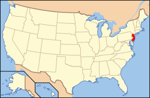 | ||
|---|---|---|---|
| Lists by county | |||
| Lists by city |
| ||
| Other lists | |||
| |||
Municipalities and communities of Sussex County, New Jersey, United States | ||
|---|---|---|
| Boroughs | | |
| Town | ||
| Townships | ||
| CDPs | ||
| Other unincorporated communities | ||
This article is issued from
Wikipedia.
The text is licensed under Creative Commons - Attribution - Sharealike.
Additional terms may apply for the media files.