Cloverhill, New Jersey
| Cloverhill, New Jersey | |
|---|---|
| Unincorporated community | |
 | |
 Cloverhill, New Jersey 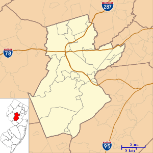 Cloverhill, New Jersey  Cloverhill, New Jersey  Cloverhill, New Jersey | |
| Coordinates: 40°29′17″N 74°46′56″W / 40.48806°N 74.78222°WCoordinates: 40°29′17″N 74°46′56″W / 40.48806°N 74.78222°W | |
| Country |
|
| State |
|
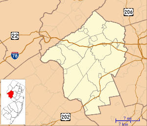
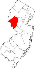
| County | Hunterdon and Somerset |
| Township | East Amwell, Raritan and Hillsborough |
| Elevation[1] | 187 ft (57 m) |
| GNIS feature ID | 875522[1] |
|
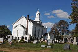
Clover Hill Historic District | |
| Nearest city | Flemington, New Jersey, Montgomery, New Jersey |
|---|---|
| Coordinates | 40°29′14″N 74°47′1″W / 40.48722°N 74.78361°W |
| Area | 25.6 acres (10.4 ha) |
| Built | 1834 |
| Architectural style | Late Victorian, Greek Revival, Gothic Revival |
| NRHP reference # | 80002492[2] |
| Added to NRHP | September 29, 1980 |
Cloverhill or Clover Hill is an unincorporated community located at the intersection of the boundaries of East Amwell and Raritan townships in Hunterdon County and Hillsborough Township in Somerset County, in New Jersey, United States.[3] It was added to the National Register of Historic Places in 1980.
References
- 1 2 "Cloverhill". Geographic Names Information System. United States Geological Survey.
- ↑ National Park Service (2010-07-09). "National Register Information System". National Register of Historic Places. National Park Service.
- ↑ Locality Search, State of New Jersey. Accessed January 30, 2015.
Municipalities and communities of Somerset County, New Jersey, United States | ||
|---|---|---|
| Boroughs | 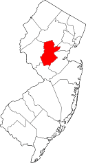 | |
| Townships | ||
| CDPs | ||
| Other unincorporated communities | ||
| Topics | 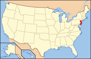 | ||
|---|---|---|---|
| Lists by county | |||
| Lists by city |
| ||
| Other lists | |||
| |||
This article is issued from
Wikipedia.
The text is licensed under Creative Commons - Attribution - Sharealike.
Additional terms may apply for the media files.