Furmans Corner, New Jersey
| Furmans Corner, New Jersey | |
|---|---|
| Unincorporated community | |
 | |
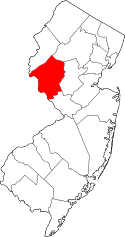
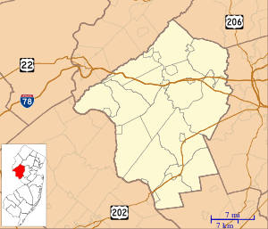 Furmans Corner, New Jersey Location of Furmans Corner in Hunterdon County Inset: Location of county within the state of New Jersey  Furmans Corner, New Jersey Furmans Corner, New Jersey (New Jersey)  Furmans Corner, New Jersey Furmans Corner, New Jersey (the US) | |
| Coordinates: 40°27′35″N 74°47′12″W / 40.45972°N 74.78667°WCoordinates: 40°27′35″N 74°47′12″W / 40.45972°N 74.78667°W | |
| Country |
|
| State |
|
| County | Hunterdon |
| Township | East Amwell |
| Elevation[1] | 138 ft (42 m) |
| GNIS feature ID | 876539[1] |
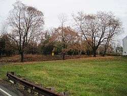
Furmans Corner is an unincorporated community located within East Amwell Township in Hunterdon County, New Jersey, United States. The area is very sparsely-populated with only a few homes located along the two roads in the area, Wertsville Road (County Route 602) and North Hill Road. The remainder of the area consists of the Union Cemetery of Wertsville and farmland.[2]
References
- 1 2 "Furmans Corner". Geographic Names Information System. United States Geological Survey.
- ↑ Google (January 30, 2015). "Furmans Corner, New Jersey" (Map). Google Maps. Google. Retrieved January 30, 2015.
This article is issued from
Wikipedia.
The text is licensed under Creative Commons - Attribution - Sharealike.
Additional terms may apply for the media files.