Ratnagiri Airport
| Ratnagiri Airport | |||||||||||
|---|---|---|---|---|---|---|---|---|---|---|---|
| Summary | |||||||||||
| Airport type | Public | ||||||||||
| Operator | Maharashtra Industrial Development Corporation | ||||||||||
| Serves | Ratnagiri, Konkan division, Maharashtra, India | ||||||||||
| Elevation AMSL | 93 m / 305 ft | ||||||||||
| Coordinates | 17°00′49″N 073°19′40″E / 17.01361°N 73.32778°ECoordinates: 17°00′49″N 073°19′40″E / 17.01361°N 73.32778°E | ||||||||||
| Maps | |||||||||||
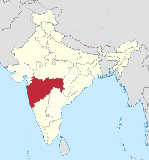 Maharashtra in India | |||||||||||
 RTC Location of the airport in Maharashtra | |||||||||||
| Runways | |||||||||||
| |||||||||||
Ratnagiri Airport (IATA: RTC, ICAO: VARG) is a public airport located in Mirjole, Ratnagiri district, in the Konkan division of the state of Maharashtra, India.
History
The airport was built in 1973 by the Public Works Department, Government of India.Its Contract was awarded to and satisfactorily completed by M/s H. K. Chauhan one of the most reputed contractors from Ratnagiri[4] It was transferred to the Maharashtra Industrial Development Corporation(MIDC) for upgradation, expansion and maintenance in 1997.[5] During the 2008 winter session of the state legislature, the Maharashtra State Cabinet decided to hand over the airport to the Indian Coast Guard for setting up an air station. It proposed to hand over 41 hectares of airport land and another 19 hectares of MIDC land to the defence ministry .[6]
Coast Guard Air Station
The Indian Coast Guard have taken over the airstrip at Ratnagiri and will develop it into its first full-fledged air station in Maharashtra. The Air station will play a crucial role in maritime surveillance and search & rescue operations.[7]
Airlines and destinations
No scheduled commercial air service at this time. Earlier it was connected to Mumbai by Vayudoot. Ratnagiri Airport is being upgraded with Coast Guard Air Station, Passenger Terminal, Night Landing Facilities and Air Traffic Control Tower. Commercial air services are scheduled to begin by early 2018 under the Regional Connectivity Scheme of Airports Authority of India (AAI), after lengthening of current runway from 1300 m. to 1800 m.[8]
References
- ↑ Airport information for VARG at World Aero Data. Data current as of October 2006.
- ↑ Airport information for VARG at Great Circle Mapper.
- ↑ Airport information for Ratnagiri Airport at Search (for) Travel website.
- ↑ "Airstrips in Maharashtra". Maharashtra Public Works Department. Retrieved 3 February 2012.
- ↑ "M.I.D.C. Website". Archived from the original on 28 March 2012. Retrieved 3 February 2012.
- ↑ "Coast Guard gets new airbase". Mumbai Mirror. 3 January 2009. Retrieved 3 Feb 2012.
- ↑ "Ratnagiri to have coast guard air station". ExpressBuzz. 29 March 2011. Retrieved 3 Feb 2012.
- ↑ Business Today - 23.08.2016 - Airport Authority of India