Gwalior Airport
| Gwalior Airport Rajmata Vijaya Raje Scindia Air Terminal | |||||||||||
|---|---|---|---|---|---|---|---|---|---|---|---|
 | |||||||||||
| Summary | |||||||||||
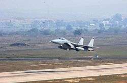
| Airport type | Military/Public | ||||||||||
| Owner | Indian Air Force | ||||||||||
| Operator | Indian Air Force/Airports Authority of India | ||||||||||
| Serves | Gwalior | ||||||||||
| Location | Gwalior, Madhya Pradesh, India | ||||||||||
| Time zone | Indian Standard Time (+5:30) | ||||||||||
| Elevation AMSL | 617 ft / 188 m | ||||||||||
| Coordinates | 26°17′36″N 078°13′40″E / 26.29333°N 78.22778°ECoordinates: 26°17′36″N 078°13′40″E / 26.29333°N 78.22778°E | ||||||||||
| Map | |||||||||||
 GWL  GWL | |||||||||||
| Runways | |||||||||||
| |||||||||||
The Gwalior Airport, officially Rajmata Vijaya Raje Scindia Air Terminal,[1] (IATA: GWL, ICAO: VIGR) is a civil enclave airport at the Maharajpur Air Force Station 10 km north-east of Gwalior, Madhya Pradesh, India. It is one of the four airports in Madhya Pradesh.
Airlines and destinations
| Airlines | Destinations |
|---|---|
| Air Odisha | Delhi, Lucknow, Kanpur |
| Alliance Air | Delhi, Indore, Bhopal[2] |
Structure
The airport is spread over 760.7 acres and the terminal can handle 350 passengers per hour. The 100-by-150-metre (330 ft × 490 ft) apron can handle two Airbus A320 and one small aircraft simultaneously.[3] The Gwalior Air Base is the only operational air force base with two operational parallel runways. The second runway was built in February 2009 and became operational in October 2010.
References
- ↑ "Gwalior: General information". Airports Authority of India. Retrieved 18 February 2017.
- ↑ "Gwalior Airport routes". Flightradar24. Retrieved 11 September 2017.
- ↑ AAI website, retrieved 10 January 2012
External links
![]()
This article is issued from
Wikipedia.
The text is licensed under Creative Commons - Attribution - Sharealike.
Additional terms may apply for the media files.