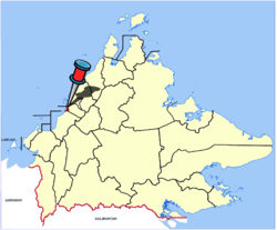
Putatan District
| Putatan District Daerah Putatan | |
|---|---|
| District | |
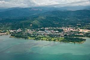 Putatan aerial view. | |
 | |
| Coordinates: 5°55′00″N 116°07′00″E / 5.91667°N 116.11667°ECoordinates: 5°55′00″N 116°07′00″E / 5.91667°N 116.11667°E | |
| Country |
|
| State |
|
| Division | West Coast |
| Capital | Putatan |
| Government | |
| • District Officer | Ag. Abdul Ghani Haji Pg. Yusoff |
| Area | |
| • Total | 29,7 km2 (115 sq mi) |
| Population (2010) | |
| • Total | 54,733 |
| Website |
ww2 |
The Putatan District (Malay: Daerah Putatan) is an administrative district in the Malaysian state of Sabah, part of the West Coast Division which includes the districts of Kota Belud, Kota Kinabalu, Papar, Penampang, Putatan, Ranau and Tuaran. The capital of the district is in Putatan Town.
Etymology
The district name originated from "putat", a flowering mangrove tree that was once abundant in the area.[1]
History
On 2 August 2010, the Putatan District Council began to be established as a separate district from Penampang.[2] From 2011, the council was fully granted independence status in all official matters related to the area under its jurisdiction.[3]
Demographics
According to the last census in 2010, the population of the district is estimated to be around 54,733,[4] mainly Bruneian Malay and Bajau people as well with a significant number of Kadazan-Dusun and Chinese.
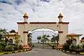
Gallery
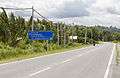 Lok Kawi-Pengalat Road.
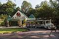 Lok Kawi Wildlife Park.
 One Place Mall.
 Sabah State Al-Biruni Observatory, an observatory to observe the moon and to determine the exact date and time for the beginning of the fasting month of Ramadan.
See also
References
- ↑ Ruben Sario (9 October 2017). "Putatan: Bustling coastal town south of Kota Kinabalu". The Star. Archived from the original on 9 November 2017. Retrieved 9 November 2017.
- ↑ "Pengenalan Pejabat" (in Malay). Putatan District Council. Archived from the original on 9 November 2017. Retrieved 9 November 2017.
- ↑ Jenne Lajiun (18 November 2011). "Putatan District Council granted 'independence'". The Borneo Post. Archived from the original on 9 November 2017. Retrieved 9 November 2017.
- ↑ "Population by ethnic group, Local Authority area and state, Malaysia" (PDF). Department of Statistics, Malaysia. 2010. Archived from the original (PDF) on 27 February 2012. Retrieved 5 November 2017.
Further reading
- Treacher, W. H (1891). "British Borneo: sketches of Brunai, Sarawak, Labuan, and North Borneo". University of California Libraries. Singapore, Govt. print. dept. p. 190.
- Rutter, Owen (1922). "British North Borneo - An Account of its History, Resources and Native Tribes". Cornell University Libraries. Constable & Company Ltd, London. p. 157.
- Tregonning, K. G. (1965). A History Of Modern Sabah (North Borneo 1881–1963). University of Malaya Press.
External links
![]()
- (in Malay) Putatan District Council
| |
Not Available (★Kangar) | |
| |
| |
☆Kuala Lumpur, Labuan and Putrajaya are Federal Territories (Malaysia) and did not have districts. italics for districts created after 2010 census. | |