Kota Bharu District
| Kota Bharu District | ||
|---|---|---|
|
| ||
| Jajahan Kota Bharu | ||
| Other transcription(s) | ||
| • Jawi | كوت بهارو | |
| ||
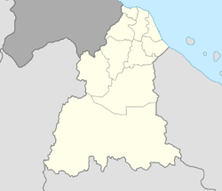 Kota Bharu District Location of Kota Bharu District in Kelantan  Kota Bharu District Kota Bharu District (Malaysia) | ||
| Coordinates: 6°5′N 102°16′E / 6.083°N 102.267°ECoordinates: 6°5′N 102°16′E / 6.083°N 102.267°E | ||
| Country |
| |
| State |
| |
| Establishment | 1986[1] | |
| Seat | Kota Bharu | |
| Local area government(s) |
Islamic City of Kota Bharu Municipal Council (Kota Bharu North) Islamic Municipal of Ketereh District Council (Kota Bharu South) | |
| Government | ||
| • District officer | Ahmad Robert Abdul Rahim [2] | |
| Area[3] | ||
| • Total | 409 km2 (158 sq mi) | |
| Population (2010)[4] | ||
| • Total | 482,222 | |
| • Density | 1,200/km2 (3,100/sq mi) | |
| Time zone | UTC+8 (MST) | |
| • Summer (DST) | UTC+8 (Not observed) | |
| Postcode | 15xxx | |
| Calling code | +6-09 | |
| Vehicle registration plates | D | |

The Kota Bharu District is a district in northern Kelantan, Malaysia. As of 2010, the district's population is estimated to be 482,222. It contains the state capital, Kota Bharu, as well as Pengkalan Chepa and Ketereh.
Kota Bharu district is surrounded by six other districts, namely Bachok District, Pasir Puteh District, Machang District, Tanah Merah District, Pasir Mas District and Tumpat District clockwise.
Municipal areas
Kota Bharu region contains two municipal areas within its borders:
- Kota Bharu Islamic City Municipal Council (Majlis Perbandaran Kota Bharu, Bandaraya Islam, MPKB-BRI), which manages downtown Kota Bharu, Pengkalan Chepa and Kubang Kerian; and
- Ketereh District Council, which administers the southern part of Kota Bharu District, including the Salor salient, Ketereh and Kok Lanas.
Population
As of 2010, Kota Bharu has a population of 482,222 people.[4]
Ranking Population of Kota Bharu District (Jajahan)
| Rank | Sub-districts (Daerah) | Population 2010 |
|---|---|---|
| 1 | Panji | 73,315 |
| 2 | Kubang Kerian | 57,259 |
| 3 | Ketereh | 41,835 |
| 4 | Bandar Kota Bharu (downtown) |
44,757 |
| 5 | Kemumin | 41,392 |
| 6 | Badang (Mouth of the Kelantan River) |
35,957 |
| 7 | Kota | 24,364 |
| 8 | Sering | 24,309 |
| 9 | Peringat | 24,137 |
| 10 | Banggu | 23,049 |
| 11 | Kadok | 19,554 |
| 12 | Limbat | 18,796 |
| 13 | Pendek | 17,254 |
| 14 | Salor | 11,255 |
| 15 | Dewan Beta | 11,205 |
Politics
Kota Bharu is represented in the Parliament of Malaysia. For electoral purposes, the district is divided into four constituencies in the Kota Bharu electoral region. Each constituency elects one Member of Parliament (MP) by the first-past-the-post system of election.
Federal Parliament and State Assembly Seats
List of Kota Bharu district representatives in the Federal Parliament (Dewan Rakyat)
|
Parliament |
Constituency |
Member of Parliament |
Party |
|---|---|---|---|
|
P20 |
Pengkalan Chepa | Dr Izani bin Husin | PAS (Pan-Malaysian Islamic Party) |
|
P21 |
Kota Bharu | Datuk Takiyuddin Hassan | PAS |
|
P24 |
Kubang Kerian | Ahmad Baihaki bin Atiqullah | PAS |
|
P26 |
Ketereh | Tan Sri Annuar Musa | BN (National Front) |
List of Kota Bharu district representatives in the State Legislative Assembly (Dewan Undangan Negeri)
|
Parliament |
State |
Constituency |
State Assemblyman |
Party |
|---|---|---|---|---|
|
P20 |
N5 | Kijang | Wan Ubaidah Omar | PAS (Pan-Malaysian Islamic Party) |
|
P20 |
N6 | Chempaka | Ahmad Fathan Mahmod | PAS |
|
P20 |
N7 | Panchor | Datuk Mohd Amar Abdullah | PAS |
|
P21 |
N8 | Tanjong Mas | Rohaini Ibrahim | PAS |
|
P21 |
N9 | Kota Lama | Tan Teng Loon @ Anuar Tan Abdullah, Datuk | PAS |
|
P21 |
N10 | Bunut Payong | Dr Ramli bin Mamat | PAS |
|
P24 |
N17 | Salor | Datuk Haji Husam Musa | Amanah |
|
P24 |
N18 | Pasir Tumboh | Abd Rahman bin Yunus | PAS |
|
P24 |
N19 | Demit | Mumtaz binti Md Nawi | PAS |
|
P26 |
N23 | Melor | Dr Md. Yusnan bin Yusof | PAS |
|
P26 |
N24 | Kadok | Azami bin Haji Mohd Nor | PAS |
|
P26 |
N25 | Kok Lanas | Datuk Md. Alwi bin Che Ahmad | BN (National Front) |
References
- ↑ User, Super. "Laman Web Rasmi Pejabat Tanah Dan Jajahan Jeli - Sejarah Jajahan". www.ptjj.kelantan.gov.my.
- ↑ User, Super. "Laman Web Rasmi Pejabat Tanah Dan Jajahan Kota Bharu - Perutusan Ketua Jajahan". www.ptjkb.kelantan.gov.my.
- ↑ User, Super. "Laman Web Rasmi Pejabat Tanah Dan Jajahan Kota Bharu - Latar Belakang PTJKB". www.ptjkb.kelantan.gov.my.
- 1 2 "Population Distribution and Basic Demographic Characteristics, 2010" (PDF). Department of Statistics, Malaysia. Archived from the original (PDF) on 22 May 2014. Retrieved 19 April 2012.
Capital: Kota Bharu | |||||||
| Topics |
| ||||||
| Society |
| ||||||
| Administrative divisions |
| ||||||
| |||||||