Tampin District
| Tampin District | |
|---|---|
|
| |
| Daerah Tampin | |
| Other transcription(s) | |
| • Jawi | تمڤين |
| • Chinese | 淡边县 |
| • Tamil | தம்பின் |
 Location of Tampin District in Negeri Sembilan | |
 Tampin District Location of Tampin District in Malaysia | |
| Coordinates: 2°30′N 102°25′E / 2.500°N 102.417°ECoordinates: 2°30′N 102°25′E / 2.500°N 102.417°E | |
| Country |
|
| State |
|
| Established as District | 1 July 1980 |
| Seat | Tampin |
| Local area government(s) | Tampin District Council |
| Government | |
| • District officer | Mohamed Roduan Ujang[1] |
| • Tunku Besar Tampin | Tunku Syed Razman al-Qadri |
| Area[2] | |
| • Total | 878.69 km2 (339.26 sq mi) |
| Population (2010)[3] | |
| • Total | 82,545 |
| • Density | 94/km2 (240/sq mi) |
| Time zone | UTC+8 (MST) |
| • Summer (DST) | UTC+8 (Not observed) |
| Postcode | 73xxx |
| Calling code | +6-06 |
| Vehicle registration plates | N |
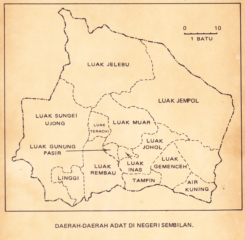
The Tampin District is a district in Negeri Sembilan, Malaysia. The district covers 878.69 square kilometres (339.26 sq mi) and is further divided into four adat socio-political provinces: Tampin town, Air Kuning, Gemencheh and Gemas.[4]
Administrative divisions
Tampin District is divided into 7 mukims, which are:[5]
- Ayer Kuning
- Gemas
- Gemencheh
- Keru
- Repah
- Tampin Tengah
- Tebong
References
- ↑ http://pdttampin.ns.gov.my/pdtt/my/organization/carta-organisasi
- ↑ User, Super. "Pejabat Daerah Dan Tanah Tampin - Latarbelakang". pdttampin.ns.gov.my.
- ↑ "Population Distribution and Basic Demographic Characteristics, 2010" (PDF). Department of Statistics, Malaysia. Archived from the original (PDF) on 22 May 2014. Retrieved 19 April 2012.
- ↑ "Daerah Adat Negeri Sembilan". Retrieved 15 January 2016.
- ↑ http://apps.water.gov.my/jpskomuniti/dokumen/TAMPIN_PROFIL_JANUARI_2011.pdf
External links
| Wikimedia Commons has media related to Tampin. |
Capital: Seremban | |||||||||||
| Topics |
| ||||||||||
| Society |
| ||||||||||
| Administrative divisions |
| ||||||||||
| |||||||||||
This article is issued from
Wikipedia.
The text is licensed under Creative Commons - Attribution - Sharealike.
Additional terms may apply for the media files.