Kota Belud District
| Kota Belud District Daerah Kota Belud | |
|---|---|
| District | |
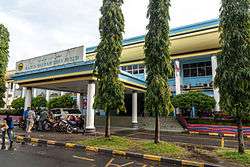 Kota Belud District Council office. | |
 | |
| Coordinates: 6°21′00″N 116°26′00″E / 6.35000°N 116.43333°ECoordinates: 6°21′00″N 116°26′00″E / 6.35000°N 116.43333°E | |
| Country |
|
| State |
|
| Division | West Coast |
| Capital | Kota Belud |
| Government | |
| • District Officer | Mohd Najib Muntok |
| Area | |
| • Total | 1,386 km2 (535 sq mi) |
| Population (2010) | |
| • Total | 91,272 |
| Website |
www |
The Kota Belud District (Malay: Daerah Kota Belud) is an administrative district in the Malaysian state of Sabah, part of the West Coast Division which includes the districts of Kota Belud, Kota Kinabalu, Papar, Penampang, Putatan, Ranau and Tuaran. The capital of the district is in Kota Belud Town.
Etymology
Kota Belud gained its name from the combination of two words in Bajau language. Kota means "fort" while Belud means a "hill" which consequently giving the meaning of "fort in a hill".[1]
History
In the past before the existence of a government body, there was often hostility between the races of different villages in the area. In order to defending themselves, they had to find a place to survive their opposition attacks. Hence, the Bajaus have chosen a hill as their fortress which subsequently known as "Kota Belud".[1]
Demographics
According to the last census in 2010, the population of Kota Belud district is estimated to be around 91,27,[2] mainly Bajau, Illanun people and Dusun. As in other districts of Sabah, there are a significant number of illegal immigrants from the nearby southern Philippines, mainly from the Sulu Archipelago and Mindanao, many of whom are not included in the population statistics.
Notable Person
Politicians
- Mohammad Said Keruak - The seventh Head of State of Sabah and the Fourth Chief Minister of Sabah
- Salleh Said Keruak - The Ninth Chief Minister of Sabah, the former Speaker of the Sabah State Legislative Assembly, the former Senator and the Malaysian Minister of Communication and Multimedia.
- Pandikar Amin Mulia - The Eight Speaker of the Dewan Rakyat, the lower house of Parliament of Malaysia
- Abdul Rahman Dahlan - Malaysian Minister
Sportsman
- Dass Gregory Kalopis - the former Malaysian Football Player
- Matlan Marjan - the former Malaysian Football Player
- Zainizam Marjan - the former Malaysian Football Player
Gallery
 Kota Belud Mosque.
 St. William Catholic Church.
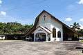 Taginambur Borneo Evangelical Church.
 James Brooke Range.
See also
References
- 1 2 "Latar Belakang Daerah" (in Malay). Kota Belud District Office. Archived from the original on 10 November 2017. Retrieved 10 November 2017.
- ↑ "Population by ethnic group, Local Authority area and state, Malaysia" (PDF). Department of Statistics, Malaysia. 2010. Archived from the original (PDF) on 27 February 2012. Retrieved 5 November 2017.
Further reading
- Treacher, W. H (1891). "British Borneo: sketches of Brunai, Sarawak, Labuan, and North Borneo". University of California Libraries. Singapore, Govt. print. dept. p. 190.
- Rutter, Owen (1922). "British North Borneo - An Account of its History, Resources and Native Tribes". Cornell University Libraries. Constable & Company Ltd, London. p. 157.
- Tregonning, K. G. (1965). A History Of Modern Sabah (North Borneo 1881–1963). University of Malaya Press.
External links
![]()
- (in Malay) Kota Belud District Office
| |
Not Available (★Kangar) | |
| |
| |
☆Kuala Lumpur, Labuan and Putrajaya are Federal Territories (Malaysia) and did not have districts. italics for districts created after 2010 census. | |